MyTopo
Classic USGS Woodlawn Tennessee 7.5'x7.5' Topo Map
Couldn't load pickup availability
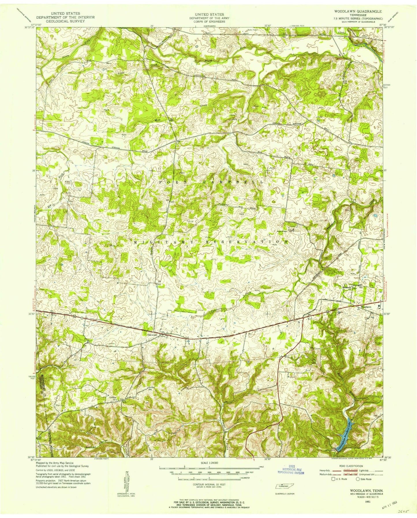
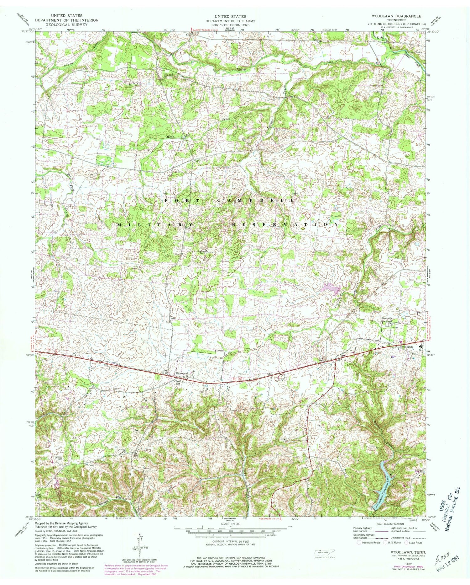
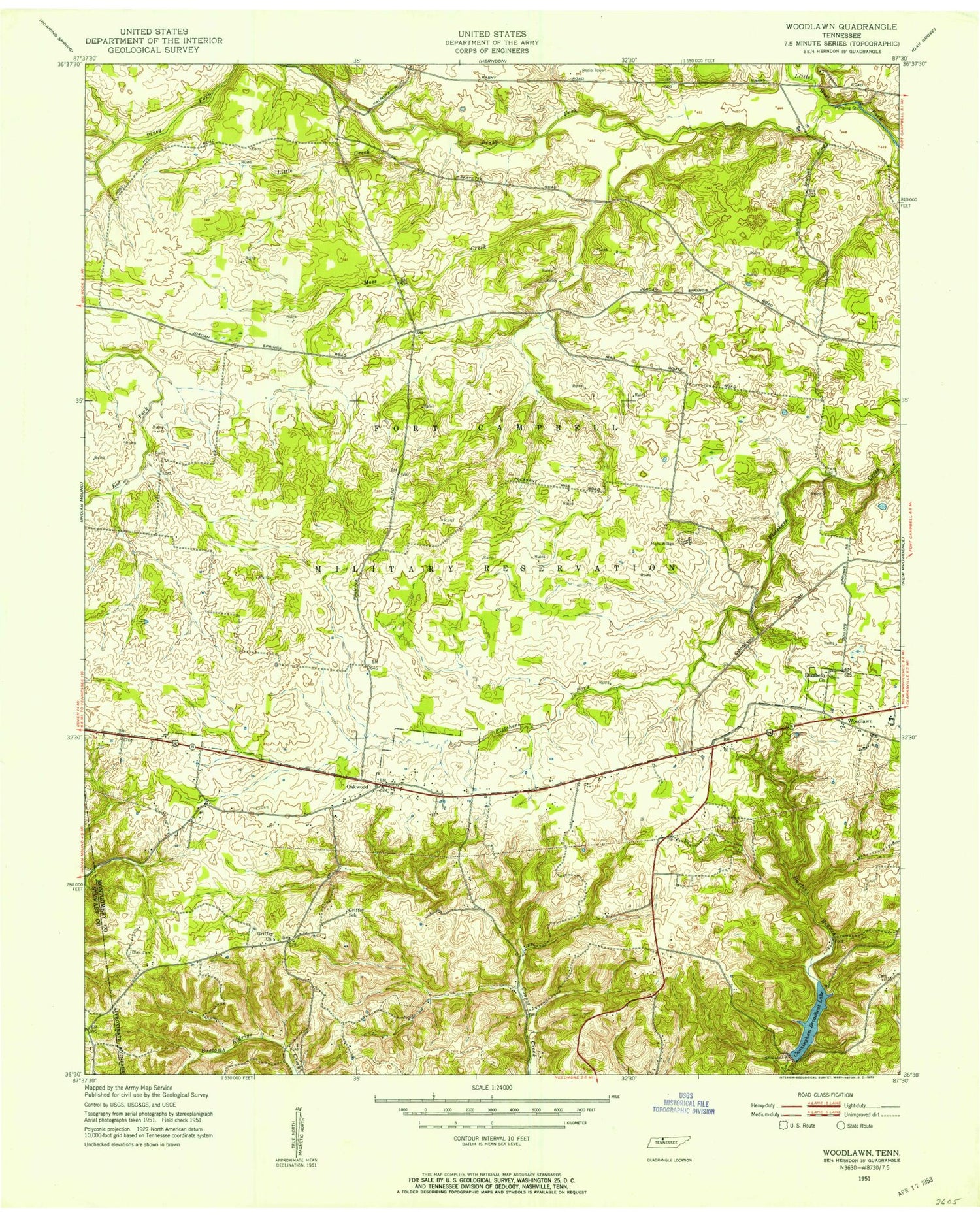
Historical USGS topographic quad map of Woodlawn in the state of Tennessee. Map scale may vary for some years, but is generally around 1:24,000. Print size is approximately 24" x 27"
This quadrangle is in the following counties: Montgomery, Stewart.
The map contains contour lines, roads, rivers, towns, and lakes. Printed on high-quality waterproof paper with UV fade-resistant inks, and shipped rolled.
Contains the following named places: Blair Cemetery, Boiling Springs, Commissioner District 10, Cunningham Broadbent Lake, Cunningham Broadbent Lake Dam, District 4, Elizabeth Church, Fort Campbell, Gate Number Eleven, Gate Number Ten, Glover Hollow, Griffey Church, Griffey School, Hickory Grove Church, Hickory Grove School, Jordan Creek, Jordan Springs, Lake Site Number Three, Lake Site Number Three Dam, Little Creek, Montgomery County Landfill, Moss Creek, Oakwood, Oakwood School, Piney Fork, Pleasant Hill School, Rose Hill, Rose Hill Church, Sanctified Church, Woodlawn, Woodlawn Elementary School, Woodlawn First Baptist Church, Woodlawn Post Office, Woodlawn Volunteer Fire and Rescue, ZIP Code: 37191