MyTopo
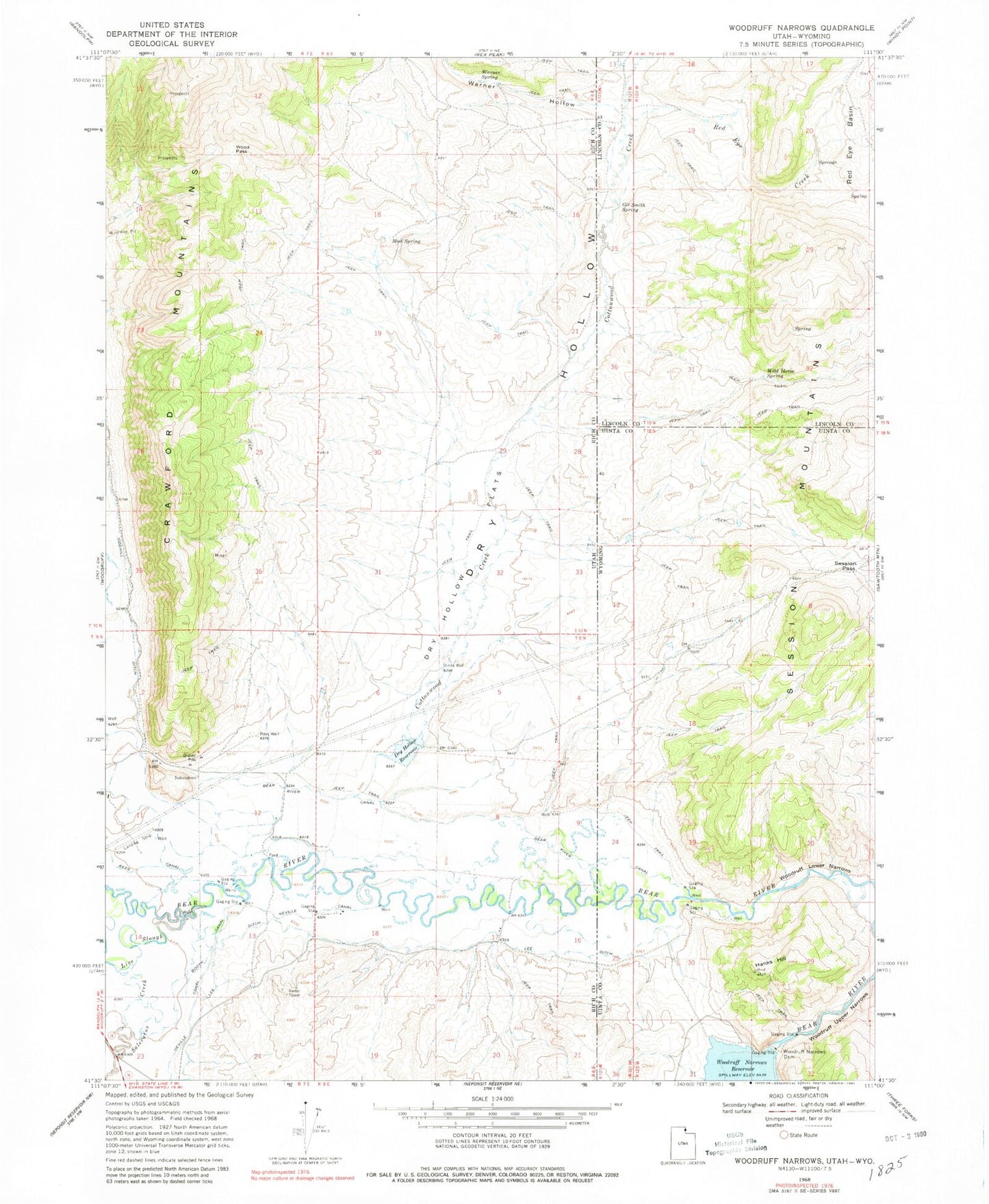
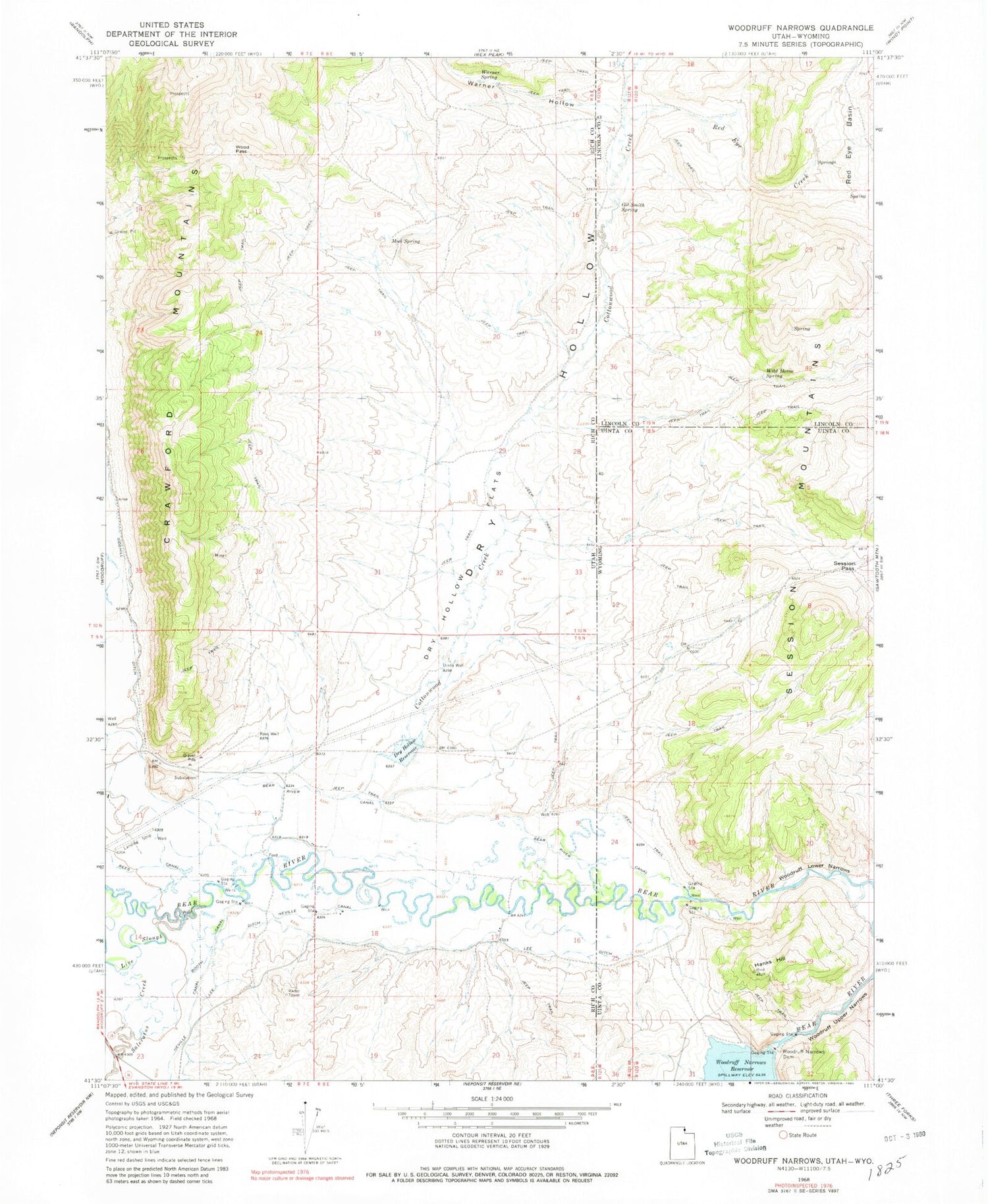
Classic USGS Woodruff Narrows Wyoming 7.5'x7.5' Topo Map
Couldn't load pickup availability
Historical USGS topographic quad map of Woodruff Narrows in the states of Wyoming, Utah. Map scale may vary for some years, but is generally around 1:24,000. Print size is approximately 24" x 27"
This quadrangle is in the following counties: Lincoln, Rich, Uinta.
The map contains contour lines, roads, rivers, towns, and lakes. Printed on high-quality waterproof paper with UV fade-resistant inks, and shipped rolled.
Contains the following named places: Bear River Canal, Booth Canal, Cottonwood Creek, Dry Hollow, Dry Hollow Flats, Dry Hollow Reservoir, Gil Smith Spring, Hanks Hill, Lee Ditch, Live Slough, Mud Spring, Neville Canal, Red Eye Basin, Red Eye Creek, Rees Canal, Rees Well, Saleratus Creek, Session Mountains, Session Pass, Sidehill Ditch, Uinta Well, Warner Hollow, Warner Spring, Wild Horse Spring, Wood Pass, Woodruff Lower Narrows, Woodruff Narrows Dam, Woodruff Upper Narrows