MyTopo
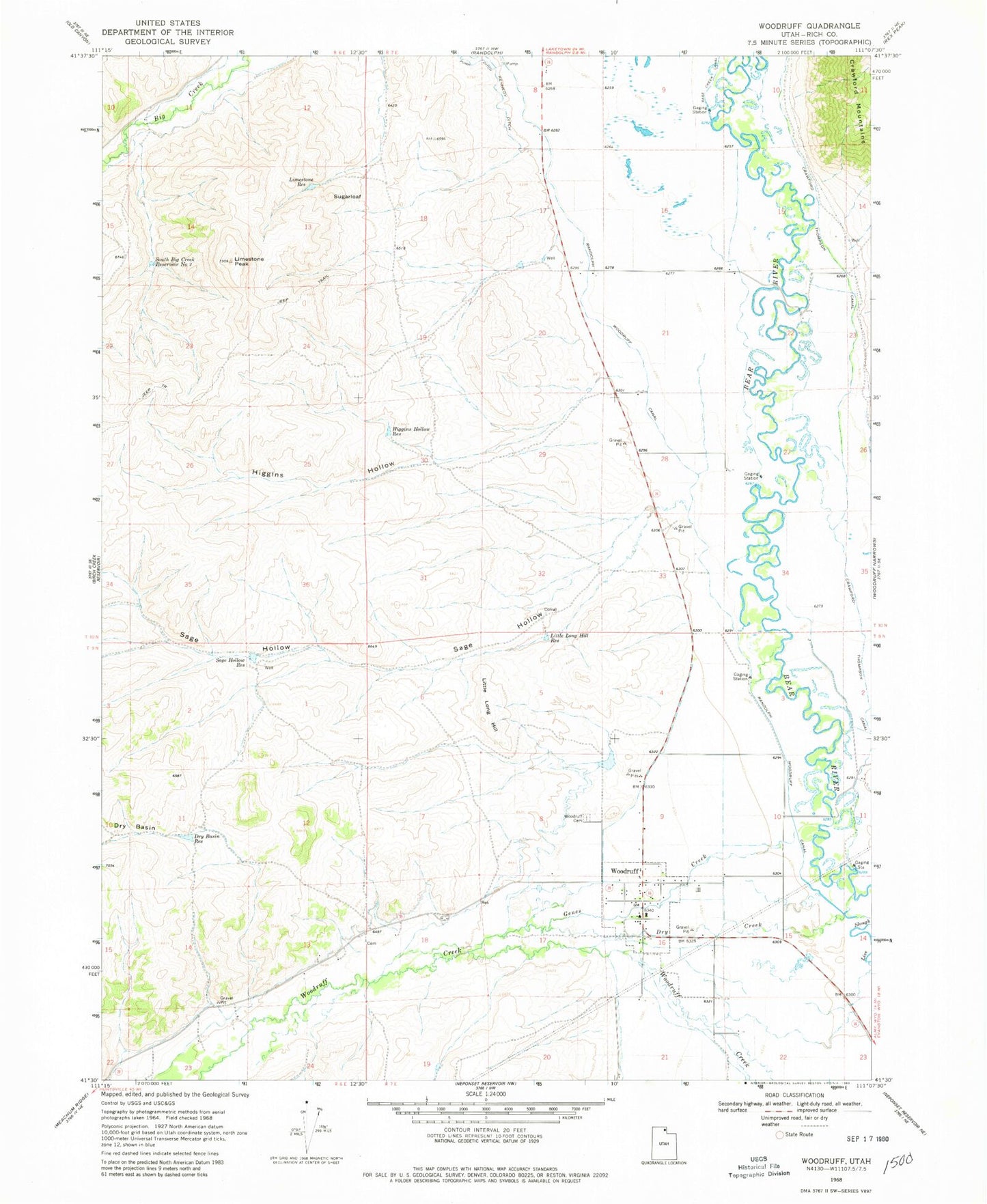
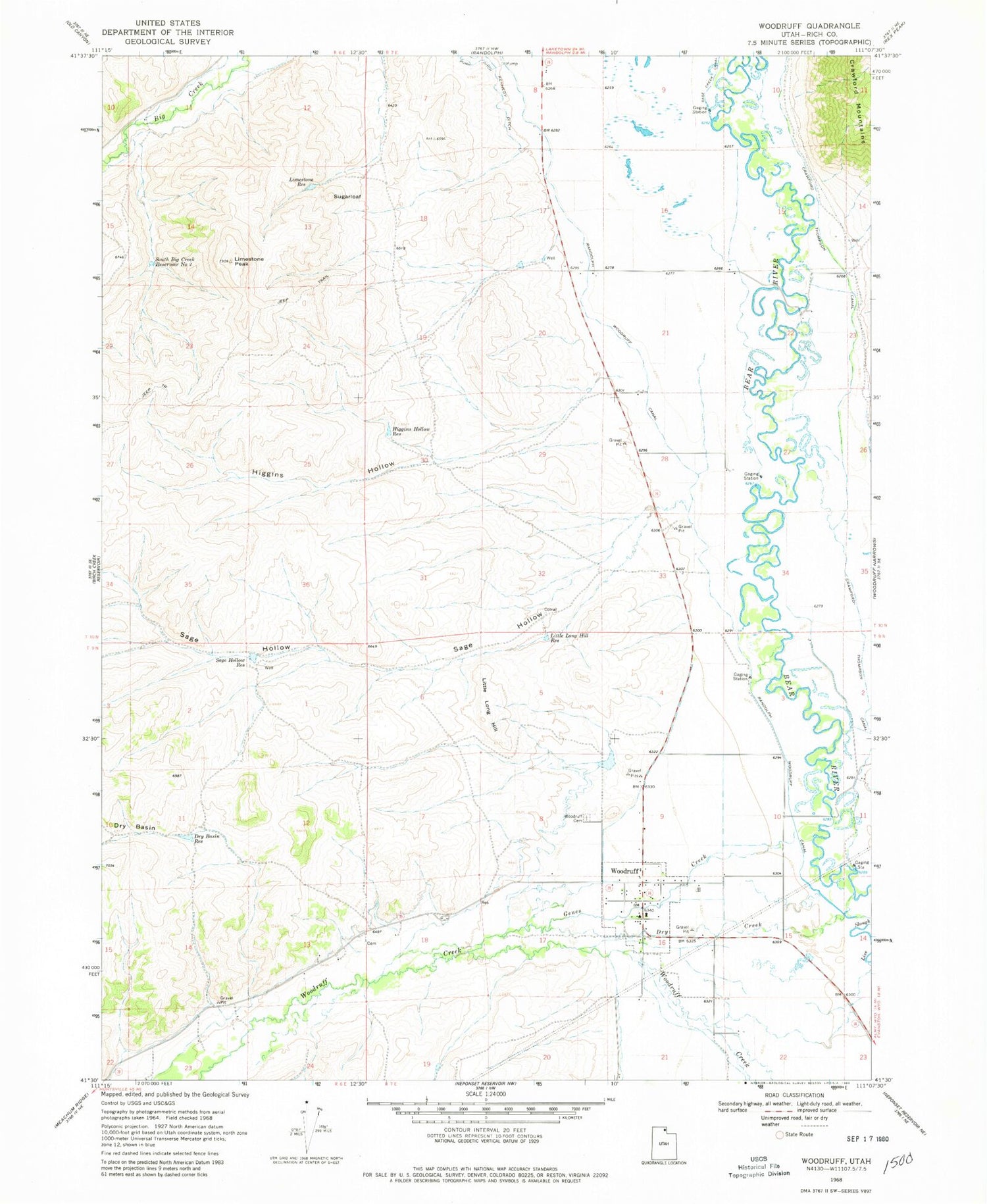
Classic USGS Woodruff Utah 7.5'x7.5' Topo Map
Couldn't load pickup availability
Historical USGS topographic quad map of Woodruff in the state of Utah. Map scale may vary for some years, but is generally around 1:24,000. Print size is approximately 24" x 27"
This quadrangle is in the following counties: Rich.
The map contains contour lines, roads, rivers, towns, and lakes. Printed on high-quality waterproof paper with UV fade-resistant inks, and shipped rolled.
Contains the following named places: Crawford Thompson Canal, Dry Basin, Dry Basin Reservoir, Dry Creek, Eastman Family Cemetery, Genes Creek, Higgins Hollow, Higgins Hollow Reservoir, Limestone Peak, Limestone Reservoir, Little Long Hill, Little Long Hill Reservoir, Randolph Woodruff Canal, Rich County Ambulance Mobile Unit - Woodruff, Sage Hollow, Sage Hollow Reservoir, South Big Creek Reservoir Number 2, Sugarloaf, The Church of Jesus Christ of Latter Day Saints, Town of Woodruff, Woodruff, Woodruff Cemetery, Woodruff Post Office, Woodruff Volunteer Fire Department