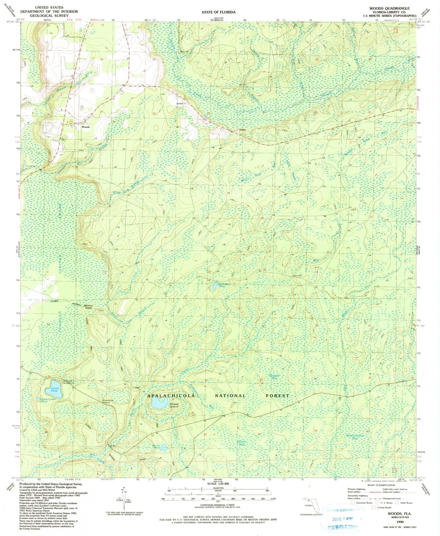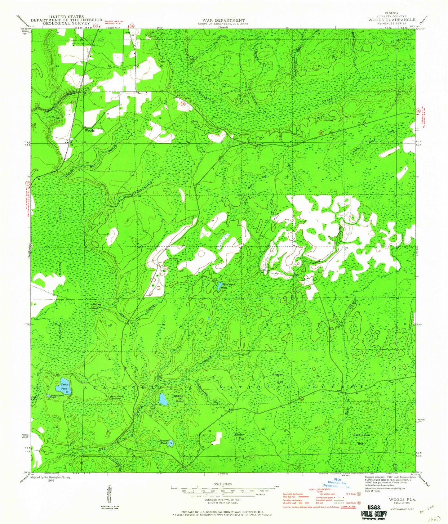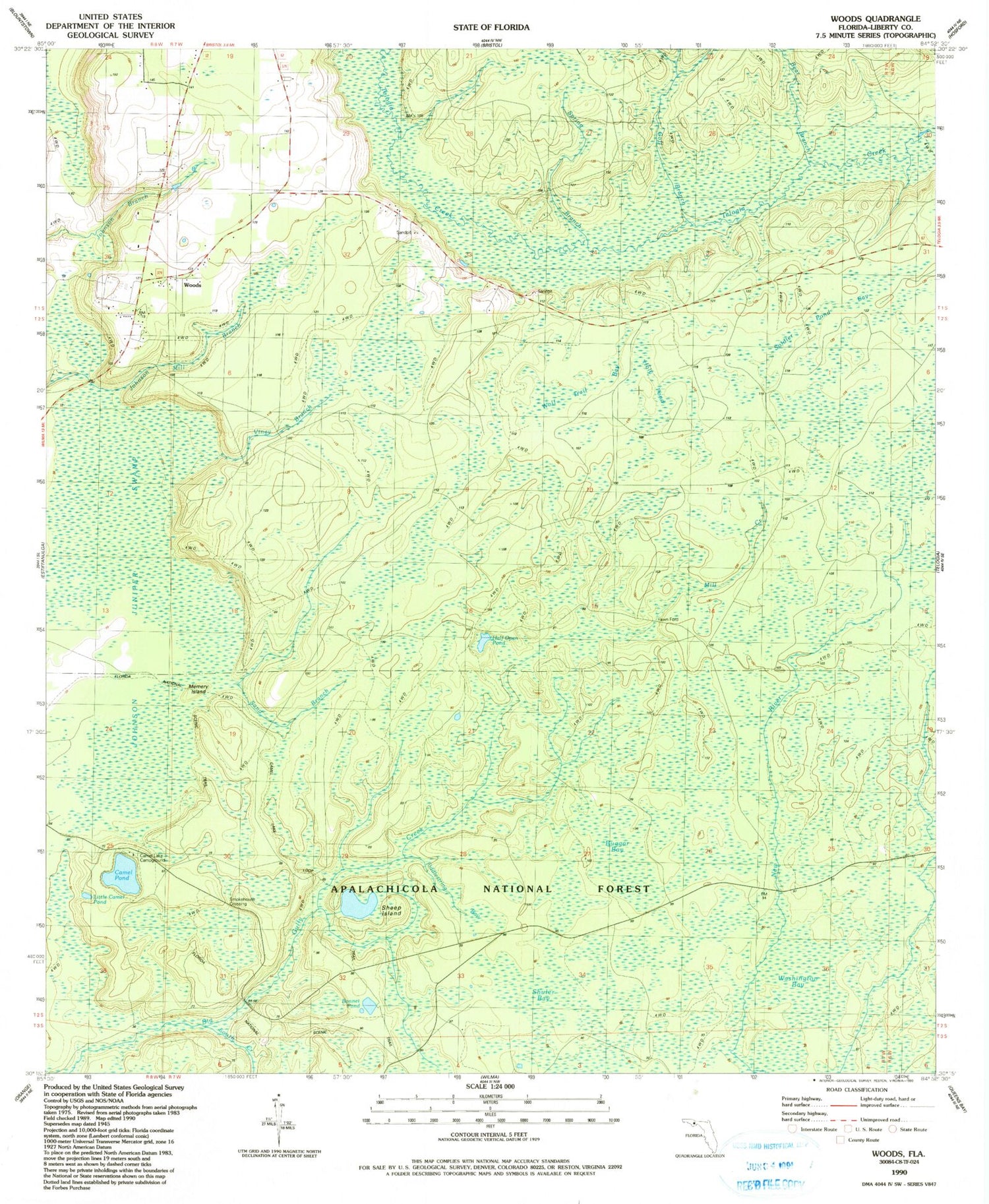

MyTopo
Classic USGS Woods Florida 7.5'x7.5' Topo Map
Couldn't load pickup availability
Historical USGS topographic quad map of Woods in the state of Florida. Map scale may vary for some years, but is generally around 1:24,000. Print size is approximately 24" x 27"
This quadrangle is in the following counties: Liberty.
The map contains contour lines, roads, rivers, towns, and lakes. Printed on high-quality waterproof paper with UV fade-resistant inks, and shipped rolled.
Contains the following named places: Bear Branch, Bonnet Pond, Buggar Bay, Camel Lake Campground, Camel Pond, Fawn Ford, Fiddlestring Bay, Goff Branch, Half Open Pond, Holy Pond, Johnson Juniper Swamp, Johnson Mill Branch, Little Camel Pond, Memery Island, Mill Creek, Sand Branch, Sheep Island, Shuler Bay, Smokehouse Crossing, Soldier Pond Bay, South Creek, Spring Branch, Trail of the Lakes, Viney Branch, Washington Bay, West Liberty Division, Wolf Trail Bay, Woods, ZIP Code: 32321