MyTopo
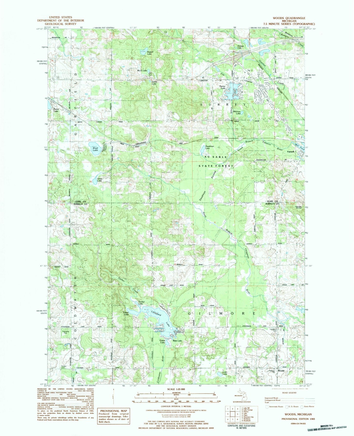
Classic USGS Woods Michigan 7.5'x7.5' Topo Map
Couldn't load pickup availability
Historical USGS topographic quad map of Woods in the state of Michigan. Map scale may vary for some years, but is generally around 1:24,000. Print size is approximately 24" x 27"
This quadrangle is in the following counties: Clare, Isabella.
The map contains contour lines, roads, rivers, towns, and lakes. Printed on high-quality waterproof paper with UV fade-resistant inks, and shipped rolled.
Contains the following named places: Bass Lake, Bluff Lake, Coldwater Township Park, Conley Cemetery, Deadman Lake, Deadman Swamp, Dishpan Lake, Dollar Lake, Elm Creek, Farwell Lookout Tower, Gilmore Cemetery, Gilmore Church, Grass Lake, Littlefield Lake, Living Hope Lutheran Church, Lost Lake, Maple Grove Church, Mill Pond, Minnow Lake, North Woods Nursing Center, Outlet Lake, Overton Creek, Russell Lake, Sucker Creek, Sucker Lake, Surrey Lake, Tower Lake, Township of Gilmore, Township of Surrey, Trinity Baptist Church, We-E Lake, Woods, ZIP Code: 48622