MyTopo
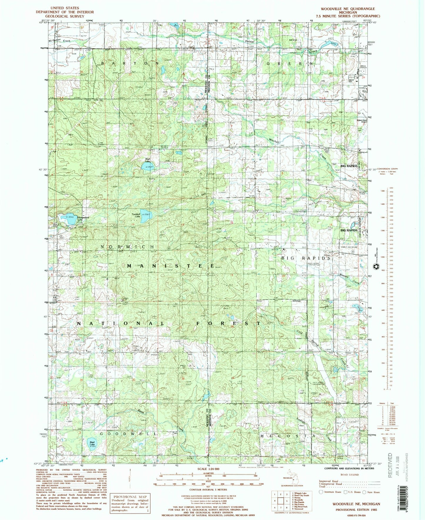
Classic USGS Woodville NE Michigan 7.5'x7.5' Topo Map
Couldn't load pickup availability
Historical USGS topographic quad map of Woodville NE in the state of Michigan. Map scale may vary for some years, but is generally around 1:24,000. Print size is approximately 24" x 27"
This quadrangle is in the following counties: Mecosta, Newaygo.
The map contains contour lines, roads, rivers, towns, and lakes. Printed on high-quality waterproof paper with UV fade-resistant inks, and shipped rolled.
Contains the following named places: Big Rapids High School, Big Rapids Rest Area, Bisel Lake, Charter Township of Big Rapids, Cobb School, Good Shepherd Lutheran Church, Green School, Hatfield Church, Havenview Mobile Home Court, Hillside Baptist Church, Hungerford Cemetery, Hungerford Lake, Hungerford Post Office, Hungerford Station, Jehovah's Witnesses, Katke Golf Course, Mount Carmel Cemetery, Mud Lake, New Directions High School, Resurrection Life Church, Roben-Hood Airport, Township of Norwich, Turnbull Lake, Van Gilder Cemetery, Vangilder School, WAAQ-FM (Big Rapids)