MyTopo
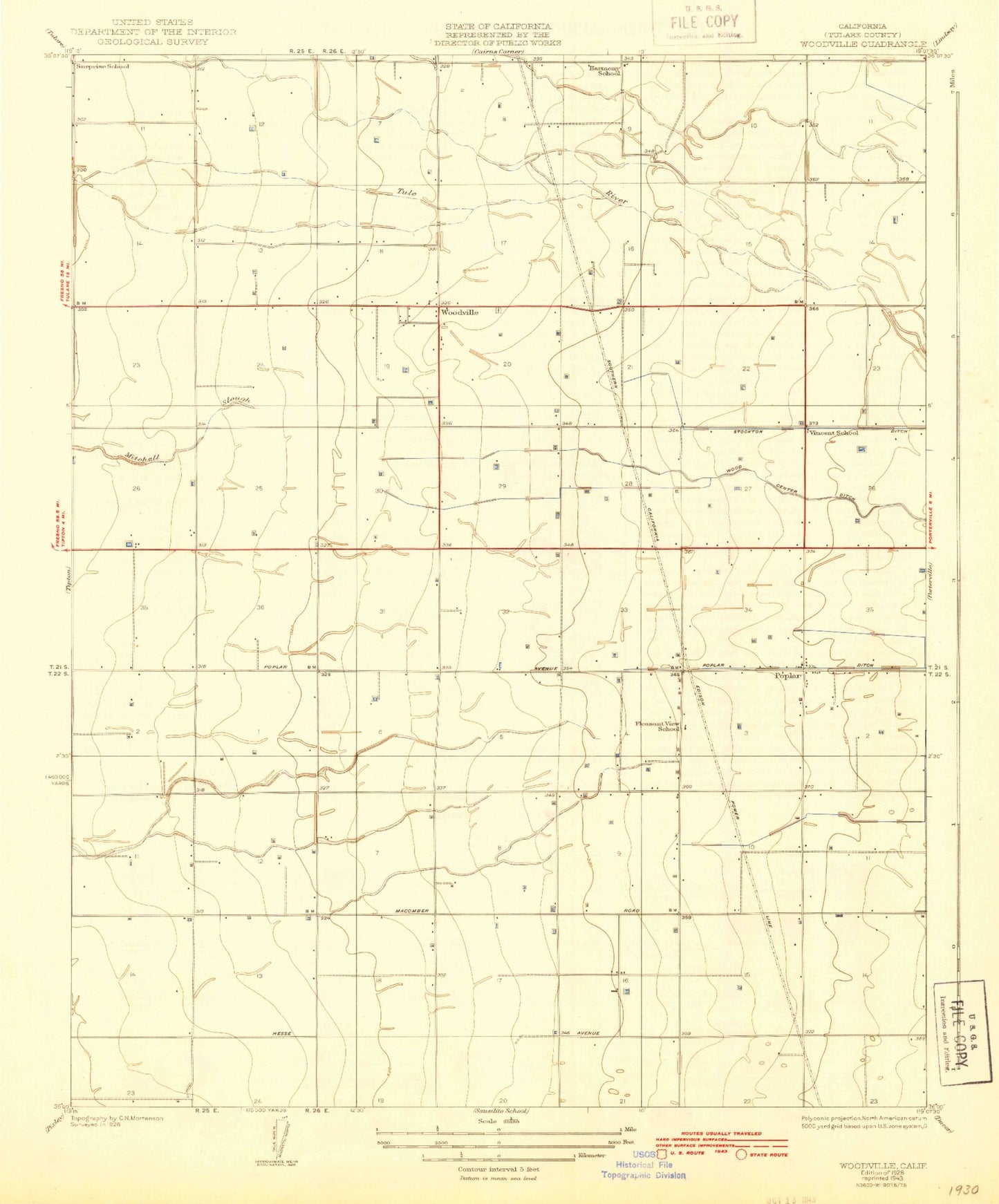
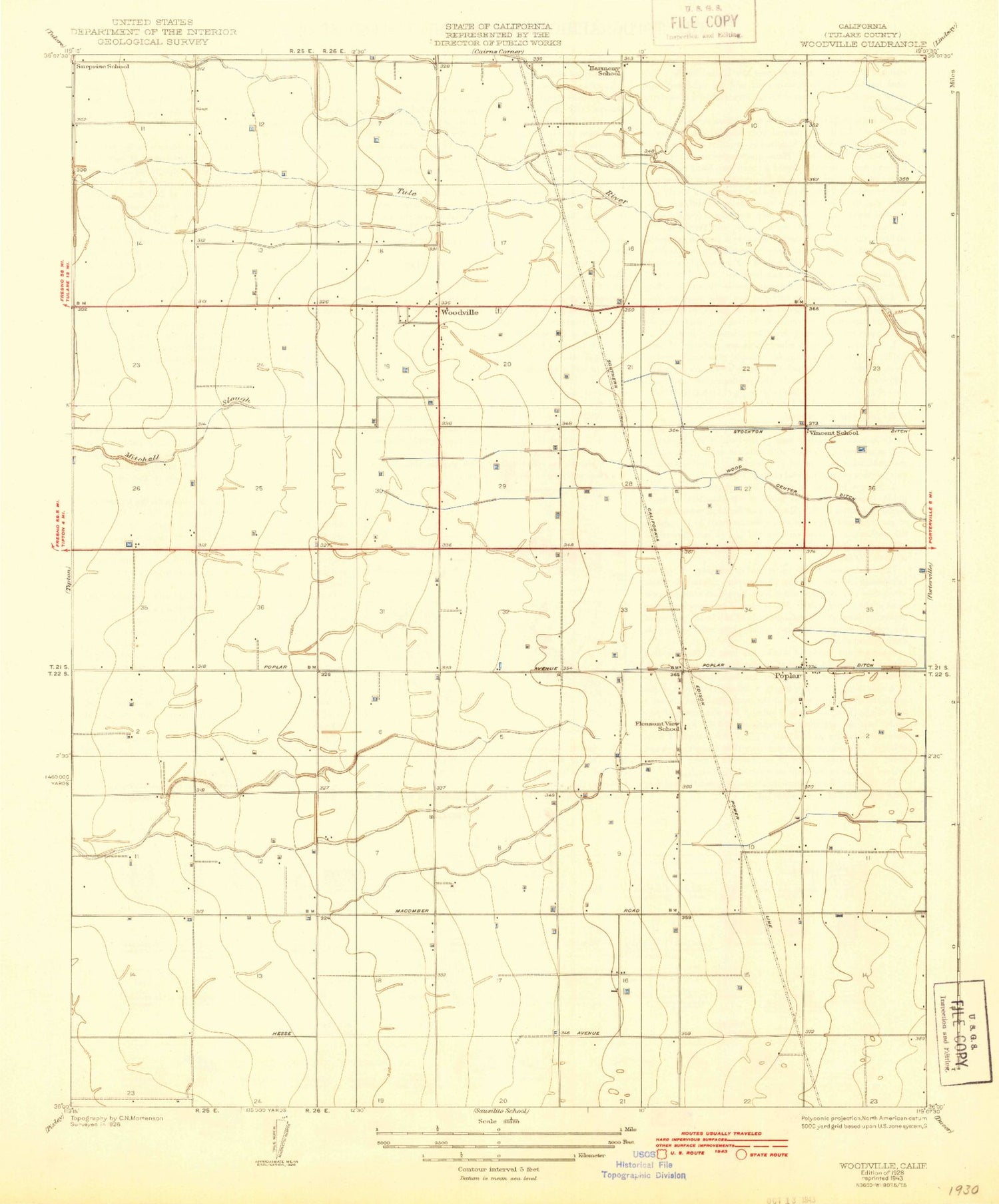
Classic USGS Woodville California 7.5'x7.5' Topo Map
Couldn't load pickup availability
Historical USGS topographic quad map of Woodville in the state of California. Map scale may vary for some years, but is generally around 1:24,000. Print size is approximately 24" x 27"
This quadrangle is in the following counties: Tulare.
The map contains contour lines, roads, rivers, towns, and lakes. Printed on high-quality waterproof paper with UV fade-resistant inks, and shipped rolled.
Contains the following named places: Apostolic Church of Jesus Christ, Church of Christ of Poplar, Cotton Center, D and V Dairy, De Jong Dairy, Deboer Dairy, Five Star Dairy Number 2, Greenleaf Farms, Harmony, Harmony Farms Dairy, Harmony School, Lairds Corner, Lou Mar Dairy, Lowes Corner, Middle Branch South Branch Tule River, Northstar Dairy, Oettle Bridge, Pleasant Grove, Pleasant View Elementary School, Poplar, Poplar Post Office, Poplar-Cotton Center Census Designated Place, Schenley Ranch, South Branch South Branch Tule River, T - Bar Dairy, Tule River Youth Center, Van Beek Brothers Dairy, Vincent, Vincent School, Woodville, Woodville Census Designated Place, Woodville Elementary School, Woodville Farm Labor Camp Census Designated Place, Woodville Farm Labor Supply Center, ZIP Code: 93258