
MyTopo
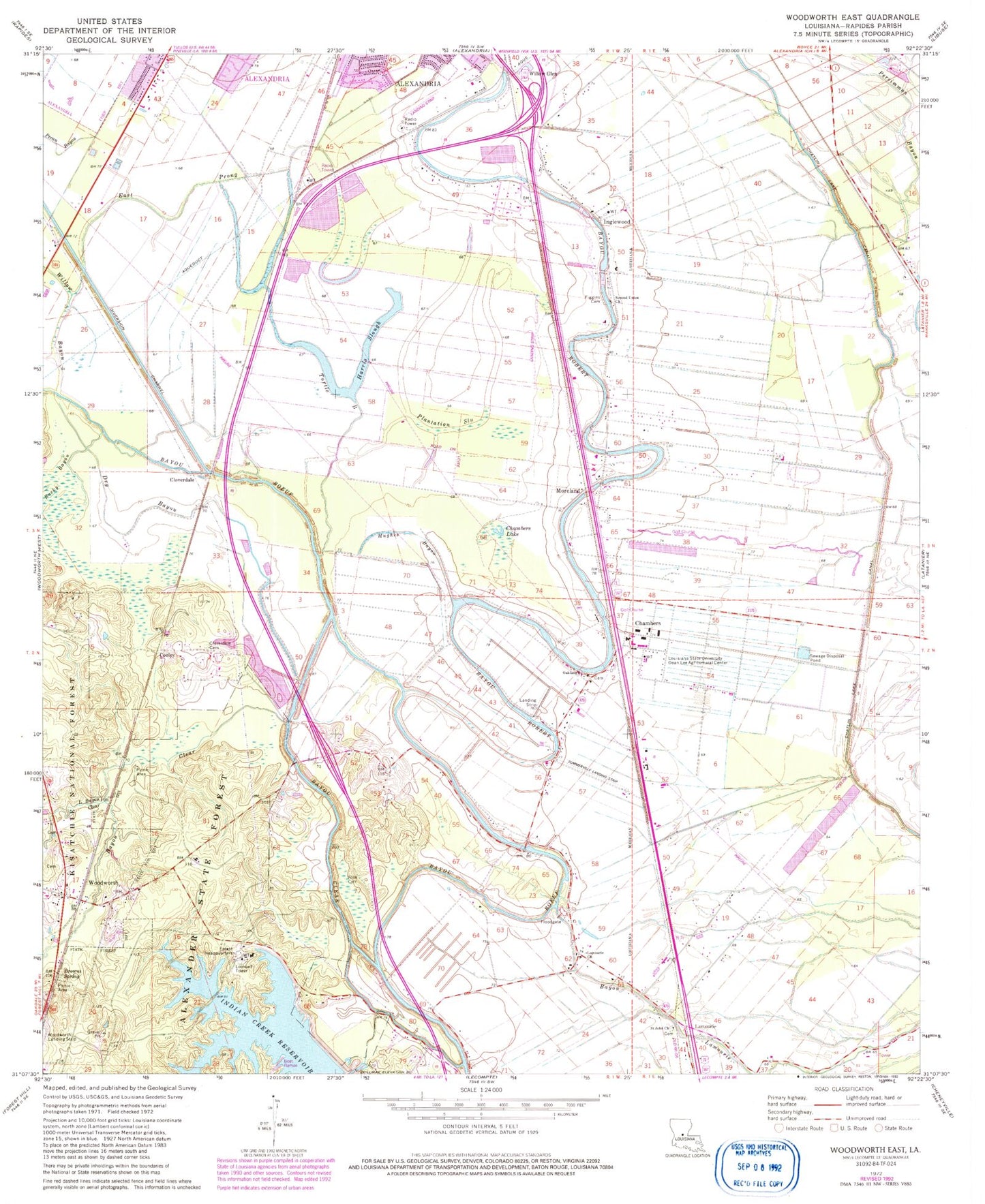
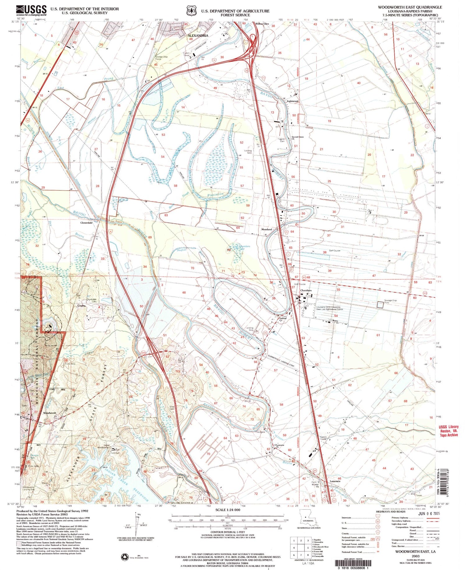
Classic USGS Woodworth East Louisiana 7.5'x7.5' Topo Map
Couldn't load pickup availability
Historical USGS topographic quad map of Woodworth East in the state of Louisiana. Map scale may vary for some years, but is generally around 1:24,000. Print size is approximately 24" x 27"
This quadrangle is in the following counties: Rapides.
The map contains contour lines, roads, rivers, towns, and lakes. Printed on high-quality waterproof paper with UV fade-resistant inks, and shipped rolled.
Contains the following named places: Back Bayou, Bayou Clear, Bayou Robert, Bench Slough, Browns Spring, Chambers, Chambers Lake, Chatlin Lake Canal, Cloverdale, Cloverdale Cemetery, Cooley, Dry Bayou, East Prong Willow Bayou, Figgins Cemetery, Hard Times Plantation, Harris Slough, Hughes Bayou, Indian Creek Dam, Inglewood, Inglewood Plantation, Inglewood Plantation Historic District, Lamourie, Lamourie Baptist Church, Lamourie High School, Lamourie Ward Two, Lecompte Volunteer Fire Department Station 2, Little Bayou Clear, Louisiana State University Alexandria, Moreland, Oakland Baptist Church, Old Wise Cemetery, Parish Governing Authority District F, Pecan Bayou, Persimmon Bayou, Plantation Slough, Rocky Bayou, Saint John Baptist Church, Saint John Cemetery, Saint John Church, Second Union Baptist Church, Summerville Airport, Turpin Spur, Turtle Bayou, Willow Bayou, Willow Glen, Woodworth, Woodworth Police Department, Woodworth Post Office