
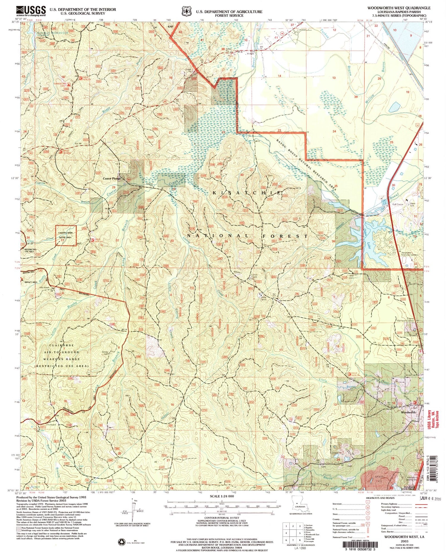
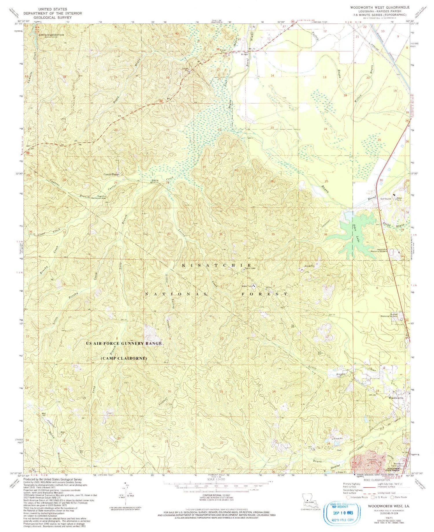
MyTopo
Classic USGS Woodworth West Louisiana 7.5'x7.5' Topo Map
Couldn't load pickup availability
Historical USGS topographic quad map of Woodworth West in the state of Louisiana. Typical map scale is 1:24,000, but may vary for certain years, if available. Print size: 24" x 27"
This quadrangle is in the following counties: Rapides.
The map contains contour lines, roads, rivers, towns, and lakes. Printed on high-quality waterproof paper with UV fade-resistant inks, and shipped rolled.
Contains the following named places: Alexander Memorial Gardens, Bayou Hospital, Boggu Bayou, Big Brushy Creek, Castor Plunge, Clear Creek, Cypress Branch, Grassy Bayou, Little Brushy Creek, Little Creek, Lost Bayou, Loving Creek, Magnolia Recreation Park, Middle Bayou, Sunrise Memorial Gardens, Twin Bridges, Wild Azalea Trail, Bayou Boeuf Natural Research Area, Evangeline Camp, Little Loving Creek, Magnolia Forest Walk, Castor Creek Scenic Area, Bayou Clear School (historical), Lost Bayou School (historical), Saint Mark Church (historical), Twin Bridges Church (historical), Woodworth Lookout Tower (historical), Castor Creek, Long Branch, Oden Lake, Woodworth Airport, Rapides Parish, Town of Woodworth, Claiborne Range, Woodworth Volunteer Fire Department


