MyTopo
Classic USGS Woody Mountain NW Montana 7.5'x7.5' Topo Map
Regular price
$16.95
Regular price
Sale price
$16.95
Unit price
per
Couldn't load pickup availability
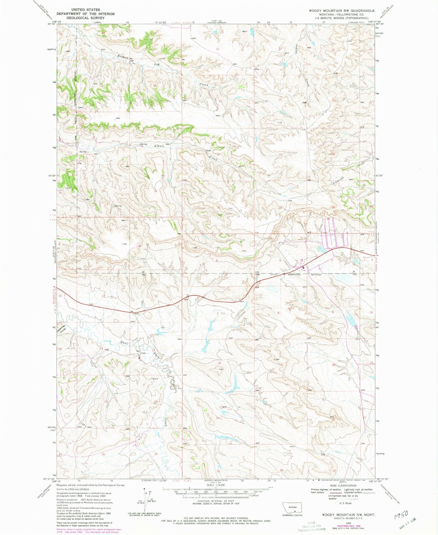
Historical USGS topographic quad map of Woody Mountain NW in the state of Montana. Map scale may vary for some years, but is generally around 1:24,000. Print size is approximately 24" x 27"
This quadrangle is in the following counties: Yellowstone.
The map contains contour lines, roads, rivers, towns, and lakes. Printed on high-quality waterproof paper with UV fade-resistant inks, and shipped rolled.
Contains the following named places: 02S28E24DCCD01 Well, 02S29E04BACC01 Well, 02S29E05DDCD01 Well, 02S29E17BC__01 Well, Crow Number 75 Dam, Crow Number 77 Dam, Crow Number 79 Dam, Crow Number 80 Dam, Doctor Lee Number 2 Dam, Jr Scott Number 18 Dam, KKUL-FM (Hardin), KOUS-TV (Hardin), Lone Tree Coulee