MyTopo
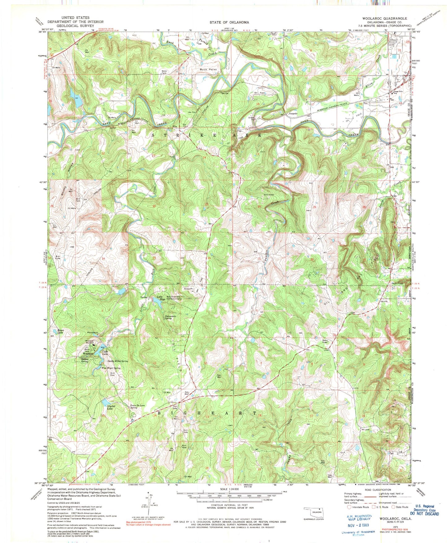
Classic USGS Woolaroc Oklahoma 7.5'x7.5' Topo Map
Couldn't load pickup availability
Historical USGS topographic quad map of Woolaroc in the state of Oklahoma. Map scale may vary for some years, but is generally around 1:24,000. Print size is approximately 24" x 27"
This quadrangle is in the following counties: Osage, Washington.
The map contains contour lines, roads, rivers, towns, and lakes. Printed on high-quality waterproof paper with UV fade-resistant inks, and shipped rolled.
Contains the following named places: Bison Lake, Buck Creek, Buck Point, Clyde Lake, Clyde Lake Dam, Crystal Lake, Crystal Lake Dam, Daddy Miller Spring, Daddy Miller Spring Dam, Daddy Miller Spring Reservoir, Fite, Lake Higo, Little Rock Creek, Nehawaski Spring, Oknoname 113078 Dam, Oknoname 113078 Reservoir, Oknoname 113080 Dam, Oknoname 113080 Reservoir, Oknoname 113086 Dam, Oknoname 113086 Reservoir, Oknoname 113087 Dam, Oknoname 113087 Reservoir, Oknoname 113088 Dam, Oknoname 113088 Reservoir, Oknoname 113089 Dam, Oknoname 113089 Reservoir, Oknoname 113090 Dam, Oknoname 113090 Reservoir, Oknoname 113200 Dam, Oknoname 113200 Reservoir, Osage Hills Elementary School, Panther Creek, Ponce De Leon Spring, Spencer Spring, Torpedo, Turkey Creek, Wah Shah She Dam, Wah-Shah-She Girl Scout Camp, Whisky Hollow, Wim Wigor Spring, Wim-Wigor-Spring Dam, Wim-Wigor-Spring Reservoir, Woolaroc, Woolaroc Museum, ZIP Code: 74003