MyTopo
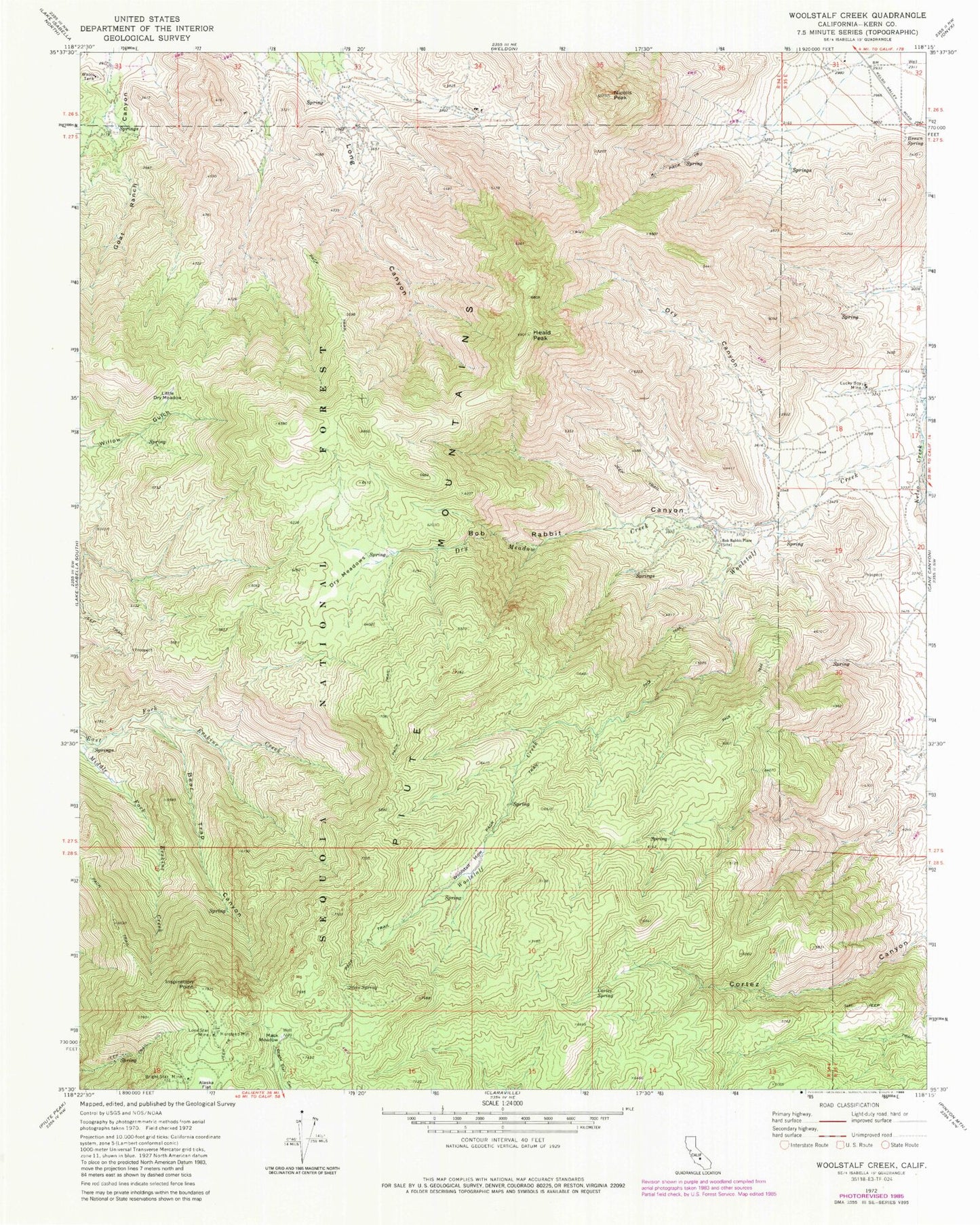
Classic USGS Woolstalf Creek California 7.5'x7.5' Topo Map
Couldn't load pickup availability
Historical USGS topographic quad map of Woolstalf Creek in the state of California. Map scale may vary for some years, but is generally around 1:24,000. Print size is approximately 24" x 27"
This quadrangle is in the following counties: Kern.
The map contains contour lines, roads, rivers, towns, and lakes. Printed on high-quality waterproof paper with UV fade-resistant inks, and shipped rolled.
Contains the following named places: Bear Trap Canyon, Bob Rabbit Canyon, Bob Rabbit Place, Bright Star Mine, Brown Spring, Cortez Spring, Digger Pine Mine, Dry Canyon, Dry Meadow Creek, Dry Meadows, Heald Peak, Inspiration Point, Little Dry Meadow, Lone Star Mine, Lucky Box Mine, Mack Meadow, Moreland Mill, Nicolls Peak, Steve Spring, Woolstalf Creek, Woolstalf Meadow, ZIP Code: 93283