MyTopo
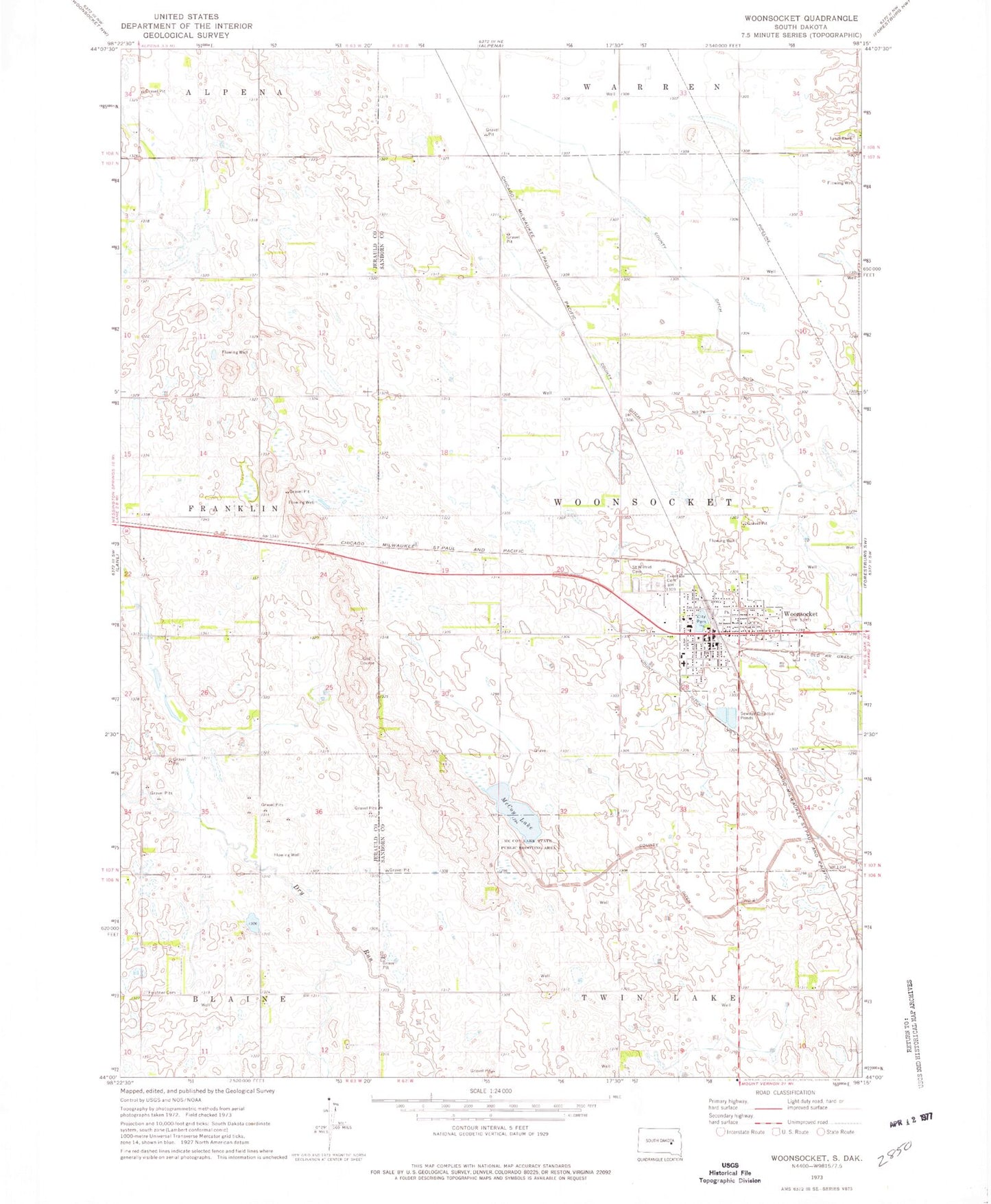
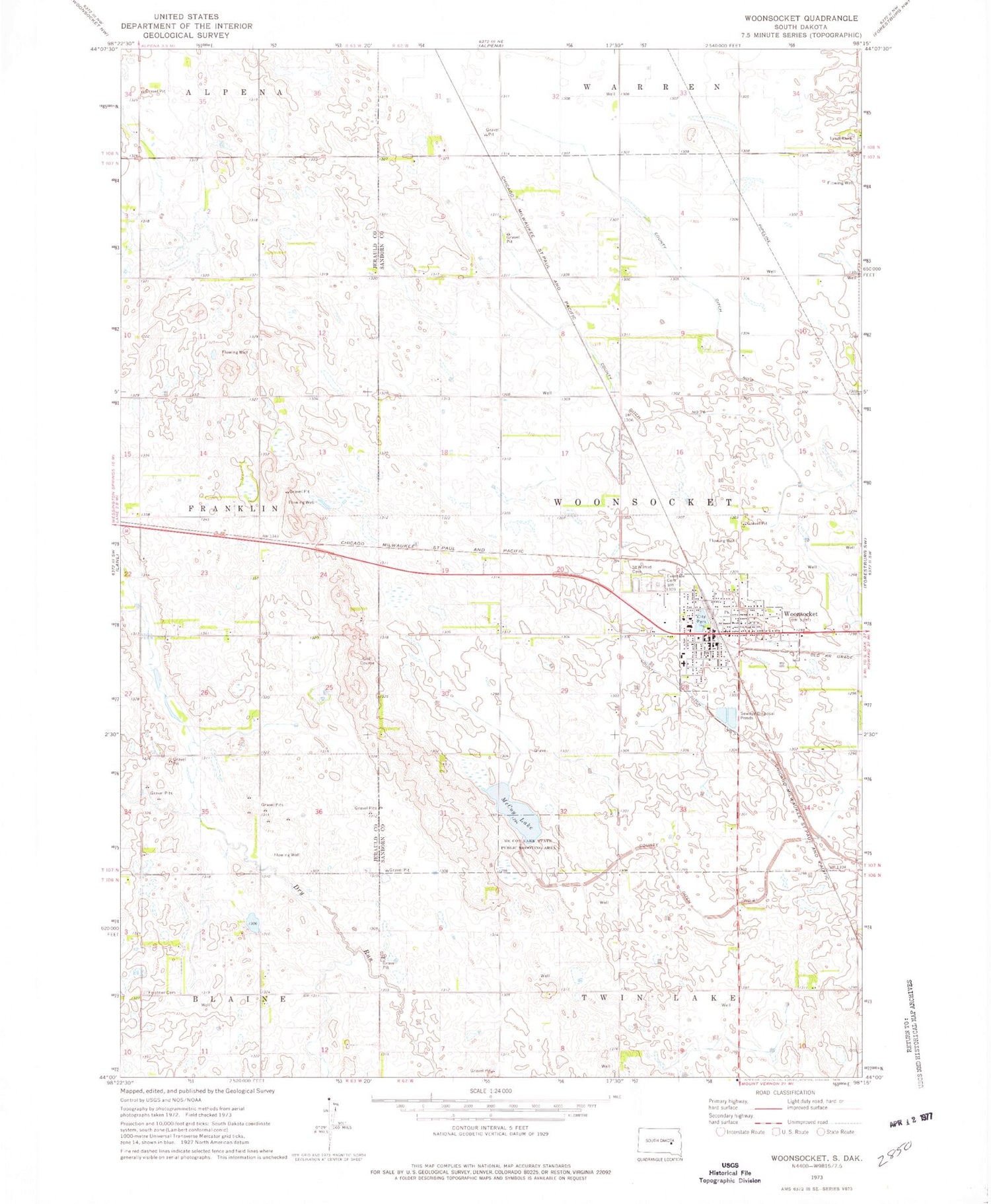
Classic USGS Woonsocket South Dakota 7.5'x7.5' Topo Map
Couldn't load pickup availability
Historical USGS topographic quad map of Woonsocket in the state of South Dakota. Map scale may vary for some years, but is generally around 1:24,000. Print size is approximately 24" x 27"
This quadrangle is in the following counties: Jerauld, Sanborn.
The map contains contour lines, roads, rivers, towns, and lakes. Printed on high-quality waterproof paper with UV fade-resistant inks, and shipped rolled.
Contains the following named places: Assembly of God Church, Callahan School Number 1, City of Woonsocket, County Ditch Number 16, County Ditch Number 21, County Ditch Number 7, County Ditch Number 8, Eventide Cemetery, Feistner Cemetery, Hessdorfer School Number 5, Lynch Ranch, McCoy Lake, McCoy Lake State Public Shooting Area, Mount Olive Evangelical Lutheran Church, Saint Wilfrid Cemetery, Sanborn County Ambulance Service, Sanborn County Courthouse, Sanborn County Sheriff's Office, Stark School Number 1, The Empire Mall, Township of Woonsocket, Wonsocket Fire Department, Woonsocket, Woonsocket City Hall, Woonsocket Elementary School, Woonsocket High School, Woonsocket Post Office, Woonsocket School/Community Library, ZIP Code: 57385