MyTopo
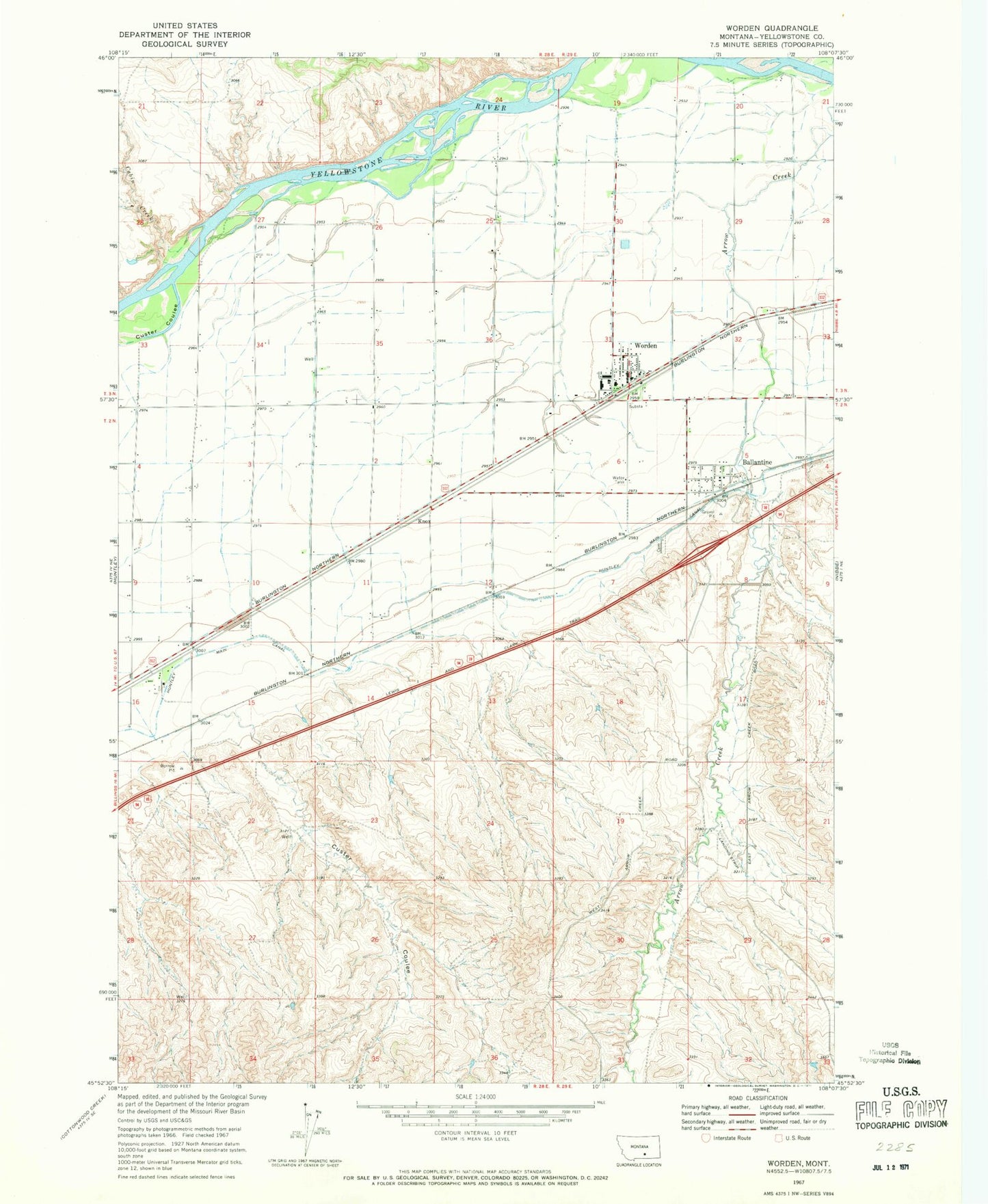
Classic USGS Worden Montana 7.5'x7.5' Topo Map
Couldn't load pickup availability
Historical USGS topographic quad map of Worden in the state of Montana. Map scale may vary for some years, but is generally around 1:24,000. Print size is approximately 24" x 27"
This quadrangle is in the following counties: Yellowstone.
The map contains contour lines, roads, rivers, towns, and lakes. Printed on high-quality waterproof paper with UV fade-resistant inks, and shipped rolled.
Contains the following named places: 02N28E01CDBA01 Well, 02N28E09DDBA01 Well, 02N28E09DDBD01 Well, 02N28E09DDCD01 Well, 02N28E22AACB01 Well, 03N28E33CADD01 Well, Ballantine, Ballantine Census Designated Place, Ballantine Post Office, Cabin Creek, Custer Coulee, Gritty Stone Fishing Access Site, Knox, Worden, Worden Ambulance, Worden Census Designated Place, Worden Post Office, Worden Volunteer Fire Department Station 1 Headquarters