
MyTopo
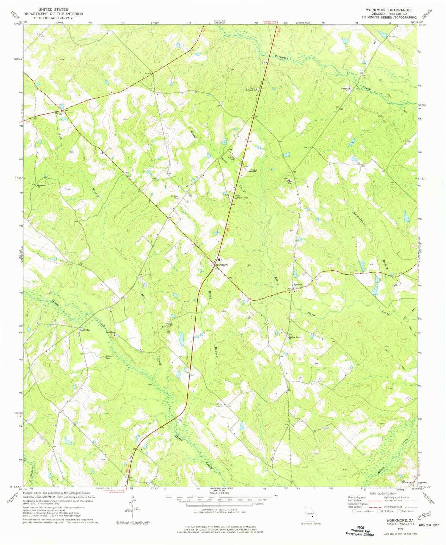
Classic USGS Workmore Georgia 7.5'x7.5' Topo Map
Couldn't load pickup availability
Historical USGS topographic quad map of Workmore in the state of Georgia. Map scale may vary for some years, but is generally around 1:24,000. Print size is approximately 24" x 27"
This quadrangle is in the following counties: Telfair.
The map contains contour lines, roads, rivers, towns, and lakes. Printed on high-quality waterproof paper with UV fade-resistant inks, and shipped rolled.
Contains the following named places: Bethelehem Church, Boggy Branch, Central Grove Church, Cobbville, Frances Chapel, Graham Cemetery, Harmony Church, Jones Lake, Jones Lake Dam, Macedonia Church, Mceachin Lake, Mceachin Lake Dam, McLean Cemetery, Midway Church, Mill Branch, Neily, Rockwell Church, Smokehouse Branch, Telfair County, Telfair Lookout Tower, Turnpike Church, Turnpike Church Cemetery, Walkers Pond, Walkers Pond Dam, Webb Cemetery, Workmore, Workmore High School


