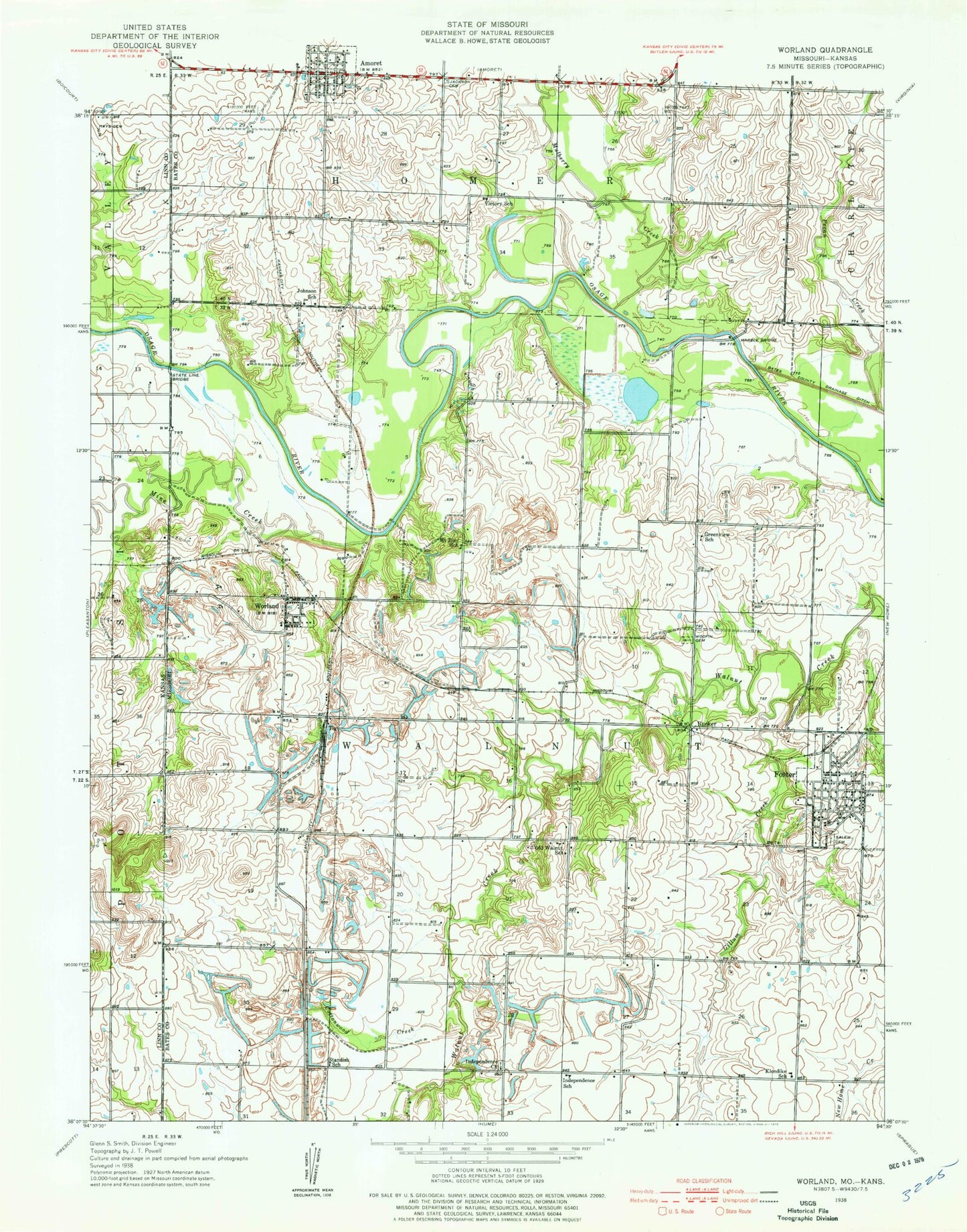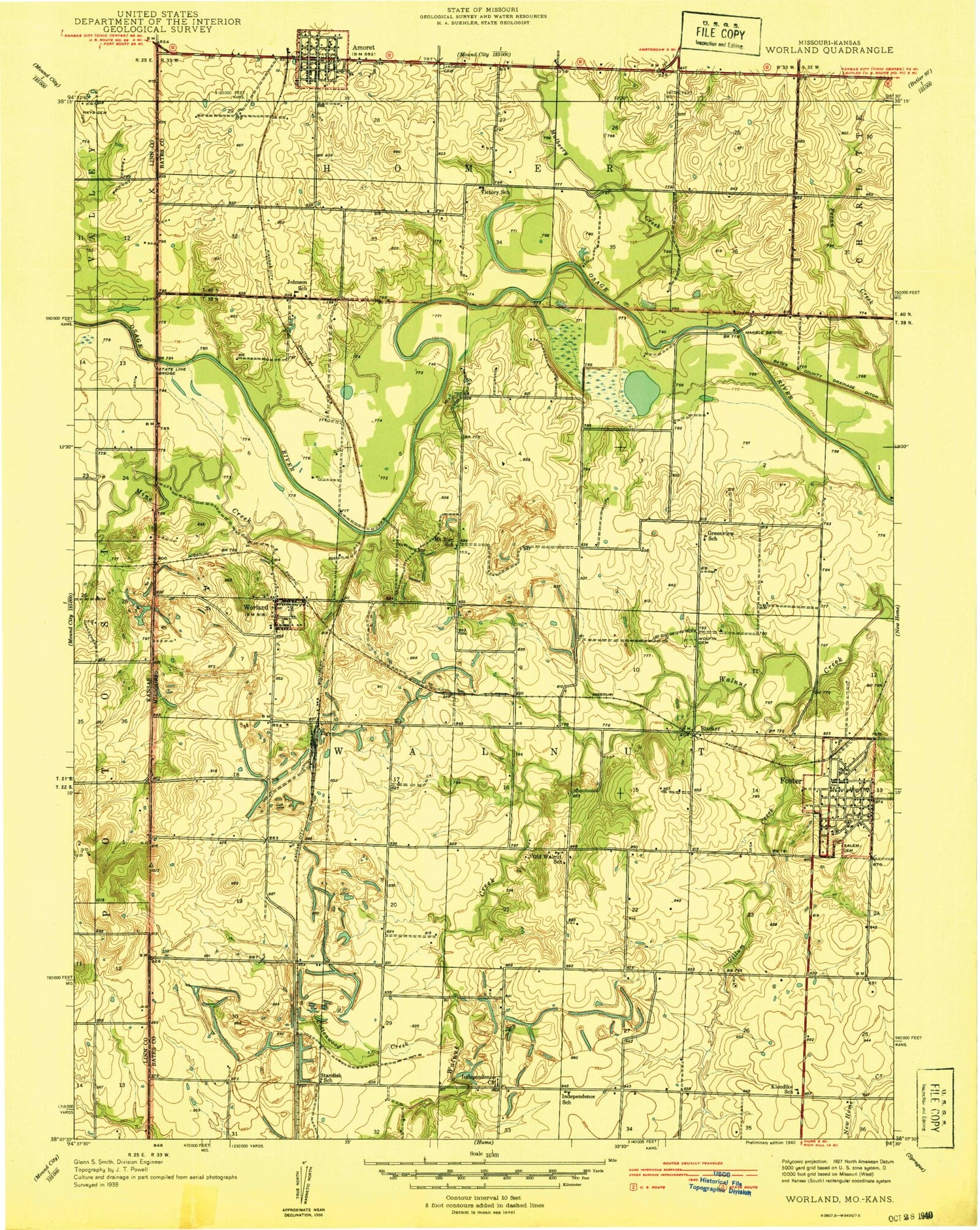

MyTopo
Classic USGS Worland Missouri 7.5'x7.5' Topo Map
Couldn't load pickup availability
Historical USGS topographic quad map of Worland in the states of Missouri, Kansas. Map scale may vary for some years, but is generally around 1:24,000. Print size is approximately 24" x 27"
This quadrangle is in the following counties: Bates, Linn.
The map contains contour lines, roads, rivers, towns, and lakes. Printed on high-quality waterproof paper with UV fade-resistant inks, and shipped rolled.
Contains the following named places: Cottonwood Creek, Foster, Foster Post Office, Foster School, Foster Volunteer Fire Department, Gillum Creek, Greenview School, Harmonia, Hays Cemetery, Independence Church, Independence School, Johnson School, Klondike School, Marble Bridge, Mine Creek, Mokan, Mount Zion School, Mulberry Creek, Old Walnut School, Pecan Creek, Rucker, Salem Cemetery, Standish School, State Line Bridge, Tiger, Township of Walnut, Victory School, Village of Foster, Ward, Woodfin Cemetery, Worland, Worland School