
MyTopo
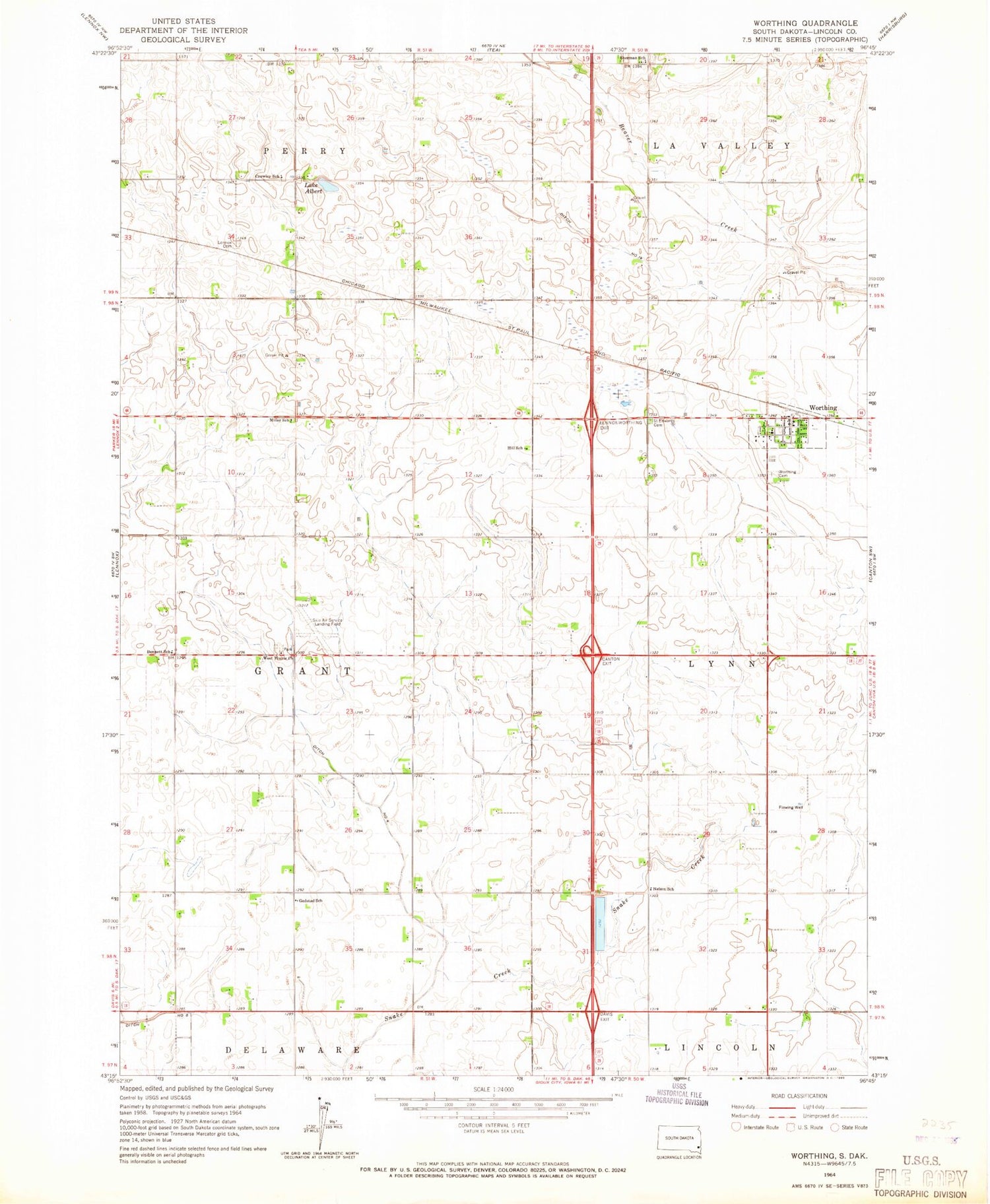
Classic USGS Worthing South Dakota 7.5'x7.5' Topo Map
Couldn't load pickup availability
Historical USGS topographic quad map of Worthing in the state of South Dakota. Map scale may vary for some years, but is generally around 1:24,000. Print size is approximately 24" x 27"
This quadrangle is in the following counties: Lincoln.
The map contains contour lines, roads, rivers, towns, and lakes. Printed on high-quality waterproof paper with UV fade-resistant inks, and shipped rolled.
Contains the following named places: Bennett School, City of Worthing, Crowley School, Ditch Number 14, Ditch Number Eight, Ditch Number Four, Faith LaValley Cemetery, Gedstad School, Hill School, Lake Albert, Maple Grove, Miller School, Mount Olivet Cemetery, Nelson School, Saint Edwards Cemetery, Sherman School, Skie Air Service Landing Field, Township of Grant, West Prairie Church, West Prairie Lutheran Cemetery, Worthing, Worthing Cemetery, Worthing City Hall, Worthing Elementary School, Worthing Fire Department, Worthing Police Department, Worthing Post Office, ZIP Codes: 57039, 57077


