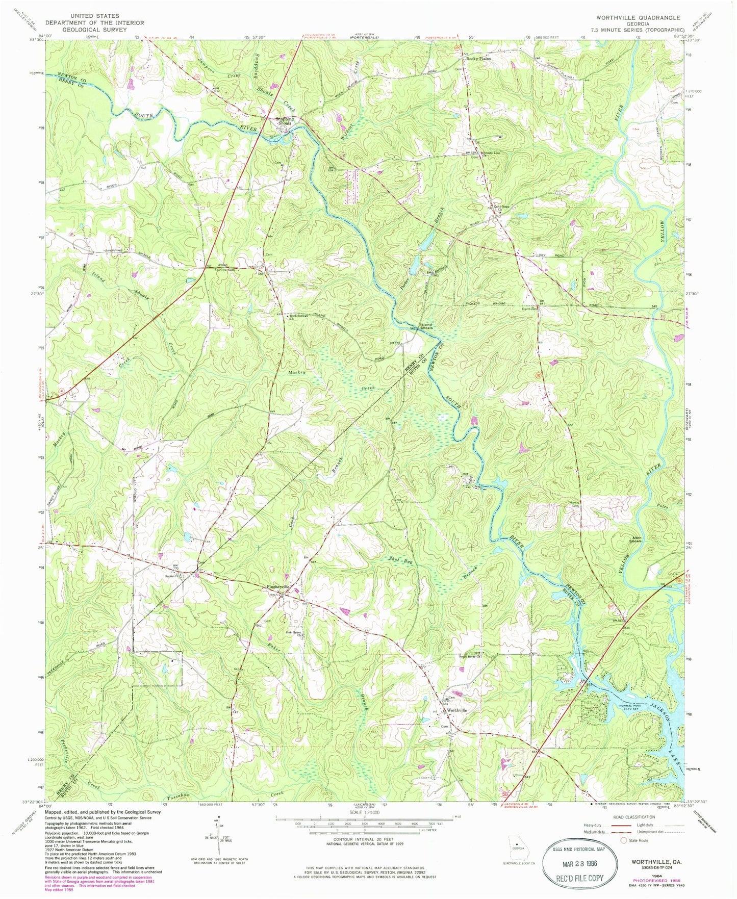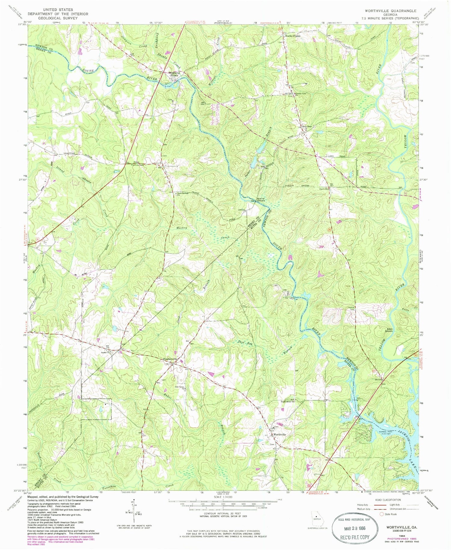
MyTopo
Classic USGS Worthville Georgia 7.5'x7.5' Topo Map
Couldn't load pickup availability
Historical USGS topographic quad map of Worthville in the state of Georgia. Map scale may vary for some years, but is generally around 1:24,000. Print size is approximately 24" x 27"
This quadrangle is in the following counties: Butts, Henry, Newton.
The map contains contour lines, roads, rivers, towns, and lakes. Printed on high-quality waterproof paper with UV fade-resistant inks, and shipped rolled.
Contains the following named places: Allen Shoals, Butts County Fire Department Station 3, Camfield Airport, Cook Branch, County Line Baptist Church Cemetery, County Line Church, Creekwood Estates, Davis Cemetery, Early Hope Church, Early Hope Church Cemetery, Fairview Associate Reformed Presbyterian Church, Fairview Cemetery, Fincherville, Hollow Oaks, Island Shoals, Island Shoals Creek, Leadmore, Mackey Creek, Maddox Bridge, Manns Bridge, Martins Store, Newton County Fire Department Station 2, Oak Grove Church, Parker Branch, Peeksville Creek, Pine Hill School, Potts Creek, Riverside Park, Riverwood, Rock Spring Baptist Church, Rock Spring Elementary School, Rock Springs School, Rocky Plains, Rocky Plains Elementary School, Sampson Creek, Sardis Baptist Church, Sardis Campground, Shot Bag Branch, Snapping Shoals, Snapping Shoals Cemetery, Snapping Shoals Church, Snapping Shoals Creek, Snapping Shoals Methodist Church, South Newton Division, South River Church, Stewart Bridge, Treadwell Lake, Treadwell Lake Dam, Union, Wildcat Creek, Woodlees Christian Academy, Woodstown, Worthville, Worthville Church, Worthville Division, Yellow River