MyTopo
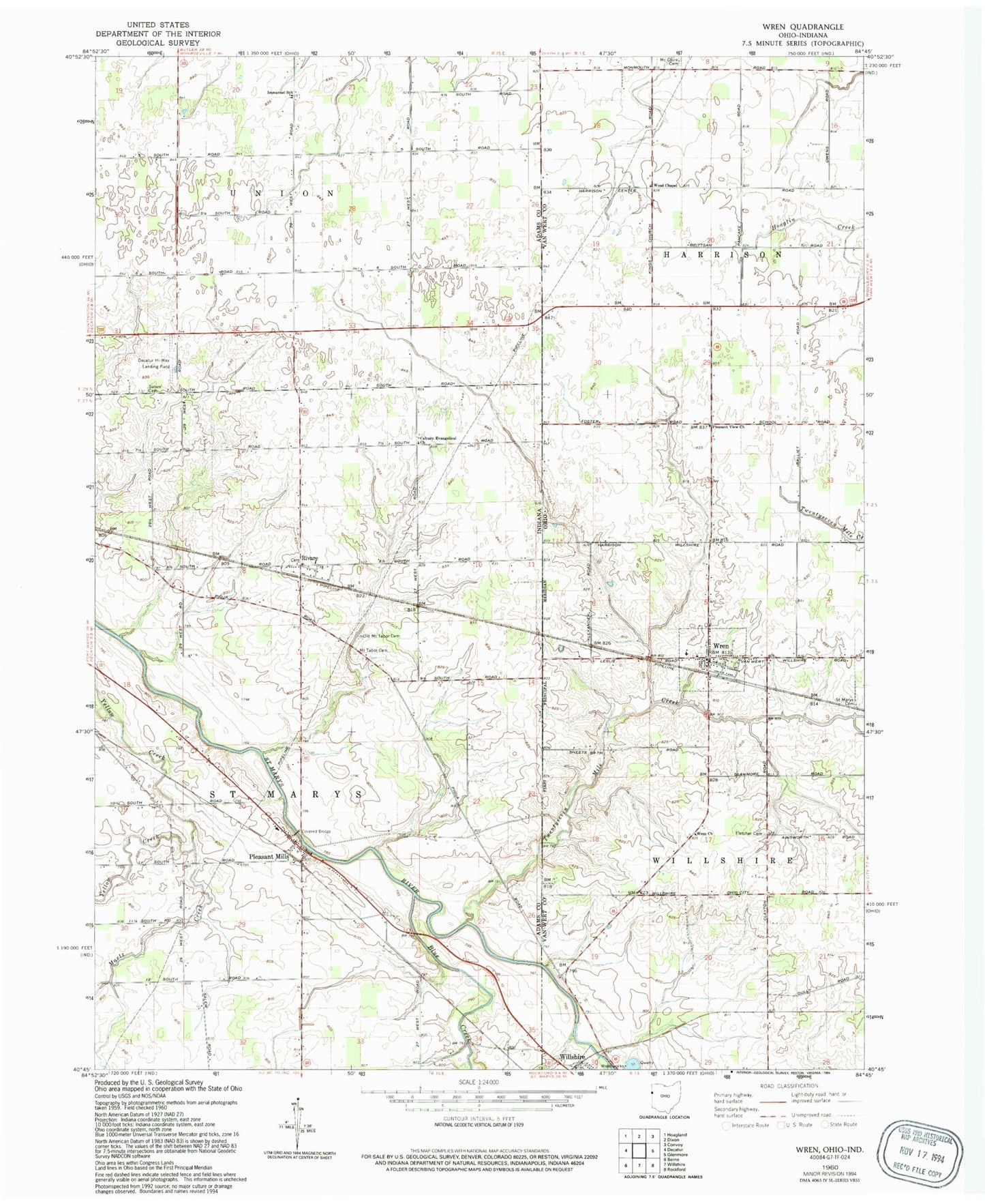
Classic USGS Wren Ohio 7.5'x7.5' Topo Map
Couldn't load pickup availability
Historical USGS topographic quad map of Wren in the states of Ohio, Indiana. Map scale may vary for some years, but is generally around 1:24,000. Print size is approximately 24" x 27"
This quadrangle is in the following counties: Adams, Van Wert.
The map contains contour lines, roads, rivers, towns, and lakes. Printed on high-quality waterproof paper with UV fade-resistant inks, and shipped rolled.
Contains the following named places: Blue Creek, Bowen Ditch, Brumback Library Wren Branch, Burkhart Farm, Callow Farms, Calvary Evangelical Church, Crestview South Elementary School, Decatur Hi-Way Airport, Fegley Farms, Fletcher Cemetery, Haljoro Farms, Harker School, Immanuel School, Martz Creek, McClure Cemetery, Mosier School, Mount Tabor Cemetery, Old Mount Tabor Cemetery, Pleasant Mills, Pleasant View Church, Rivare, Saint Marys Cemetery, Salem Cemetery, Sprunger Farm, Township of Saint Marys, Triple L Farms, Twentyseven Mile Creek, Village of Wren, Wood Chapel, Workinger Farms, Wren, Wren Cemetery, Wren Church, Wren Fire Department and Emergency Medical Services Department, Wren Post Office, ZIP Code: 45899