MyTopo
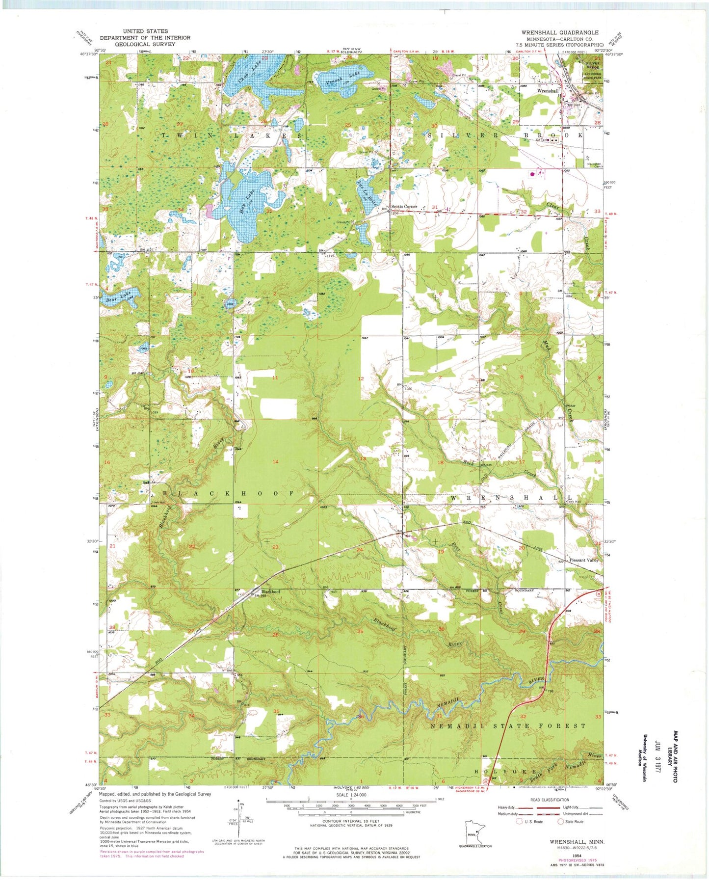
Classic USGS Wrenshall Minnesota 7.5'x7.5' Topo Map
Couldn't load pickup availability
Historical USGS topographic quad map of Wrenshall in the state of Minnesota. Map scale may vary for some years, but is generally around 1:24,000. Print size is approximately 24" x 27"
This quadrangle is in the following counties: Carlton.
The map contains contour lines, roads, rivers, towns, and lakes. Printed on high-quality waterproof paper with UV fade-resistant inks, and shipped rolled.
Contains the following named places: Bandle's Mobile Home Park, Bear Lake, Blackhoof, Blackhoof Post Office, Blackhoof River, Chub Lake, City of Wrenshall, First Presbyterian Church, Hay Lake, Lac La Belle, Moehrke Pond, Moehrke SCS Dam, Pioneer Park Mobile Home Park, Pleasant Valley, Saint John's Lutheran Cemetery, Saint John's Lutheran Church, Scotts Corner, Silverbrook Cemetery, Son of Life Community Church, Township of Blackhoof, Venoah Lake, Walter Hackensmith Fishpond Dam, Wrenshall, Wrenshall Fire Department, Wrenshall High School, Wrenshall Police Department, Wrenshall Post Office, ZIP Code: 55718