MyTopo
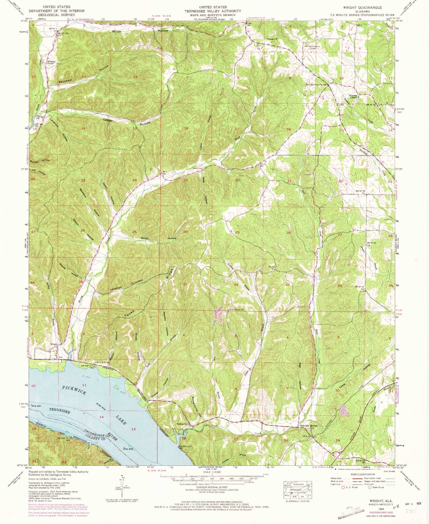
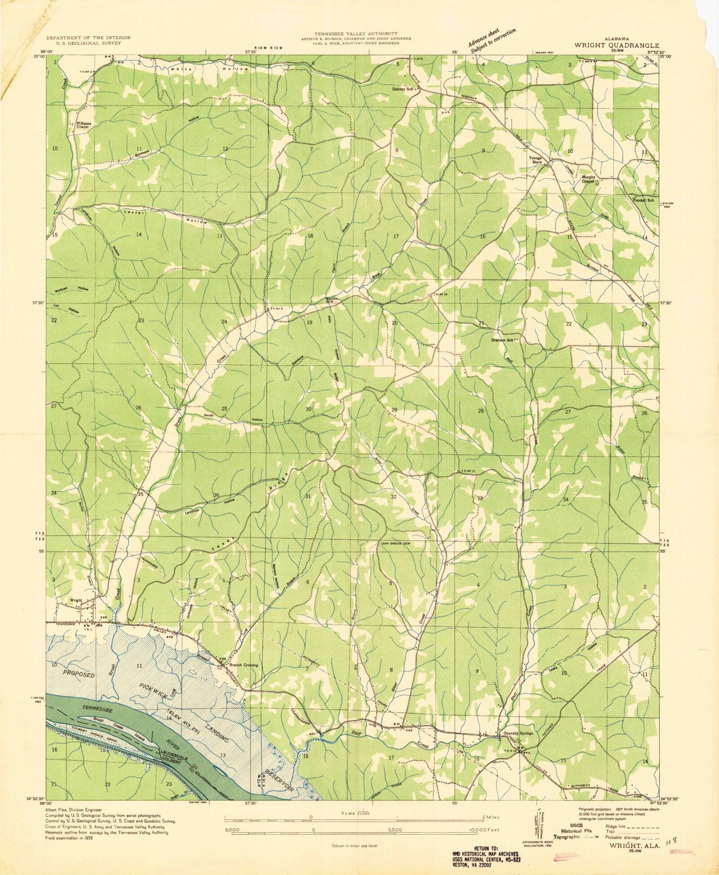
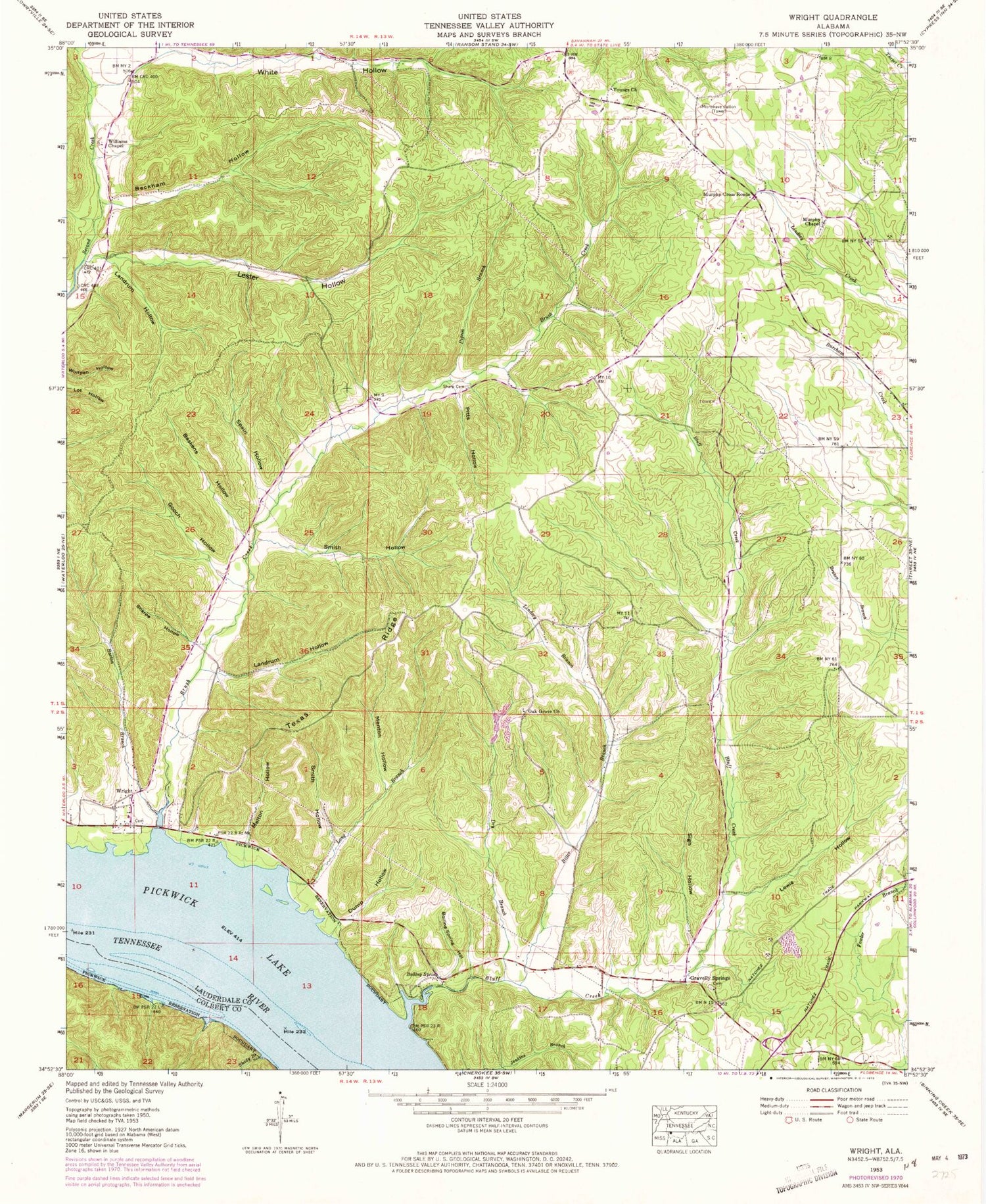
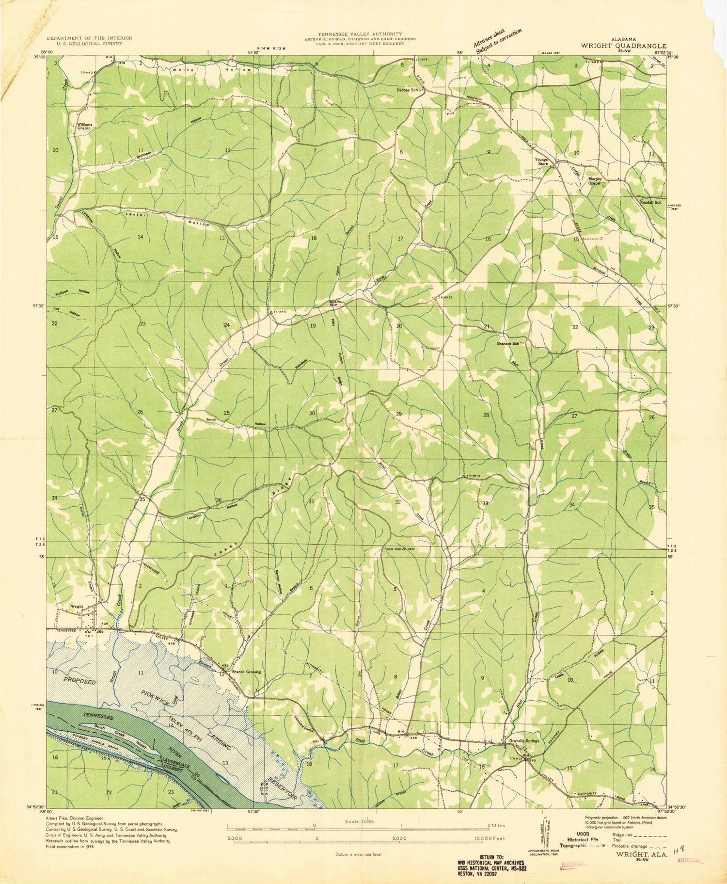
Classic USGS Wright Alabama 7.5'x7.5' Topo Map
Couldn't load pickup availability
Historical USGS topographic quad map of Wright in the state of Alabama. Map scale may vary for some years, but is generally around 1:24,000. Print size is approximately 24" x 27"
This quadrangle is in the following counties: Colbert, Lauderdale.
The map contains contour lines, roads, rivers, towns, and lakes. Printed on high-quality waterproof paper with UV fade-resistant inks, and shipped rolled.
Contains the following named places: Barton Branch, Baskens Hollow, Beckham Hollow, Bitter Branch, Bluff Creek, Bluff Creek Hill, Boiling Spring Hollow, Browns Store, Brush Creek, Brush Creek Island, Brush Creek Park, Carrolls Mill, Crusoe Island, Dabney School, Dart, Dart Post Office, Dry Branch, Dump Hollow, First United Pentecostal Church, Fowler Branch, Francis - King - Lucas Cemetery, Gooch Hollow, Graham School, Gravelly Springs, Gravelly Springs Missionary Baptist Church, Jones School, Kendall School, Kendell, Lambs Chapel Freewill Baptist Church, Landrum Hollow, Lester Hollow, Lewis Hollow, Lindsey Branch, Long Branch, Long Branch Crossing, Melton Hollow, Menton Hollow, Milford Cemetery, Millsbury Landing, Murphy Chapel, Murphy Cross Roads, Oak Grove Cemetery, Oak Grove Church, Pettipoole Hill, Pigeon Branch, Pitts Hollow, Rainbow Ridge, Sego School, Shady Branch, Sharp Cemetery, Sharps Hollow, Sigh Hollow, Smith Hollow, Spain Hollow, Texas Ridge, Troublesome Hollow Branch, Tumleys Tanyards, Waterloo Volunteer Fire and Rescue Department Station 2, Waterloo Volunteer Fire and Rescue Department Station 3, Williams Chapel United Presbyterian Church, Woods School, Wright, Wrights Landing, Youngs Church