MyTopo
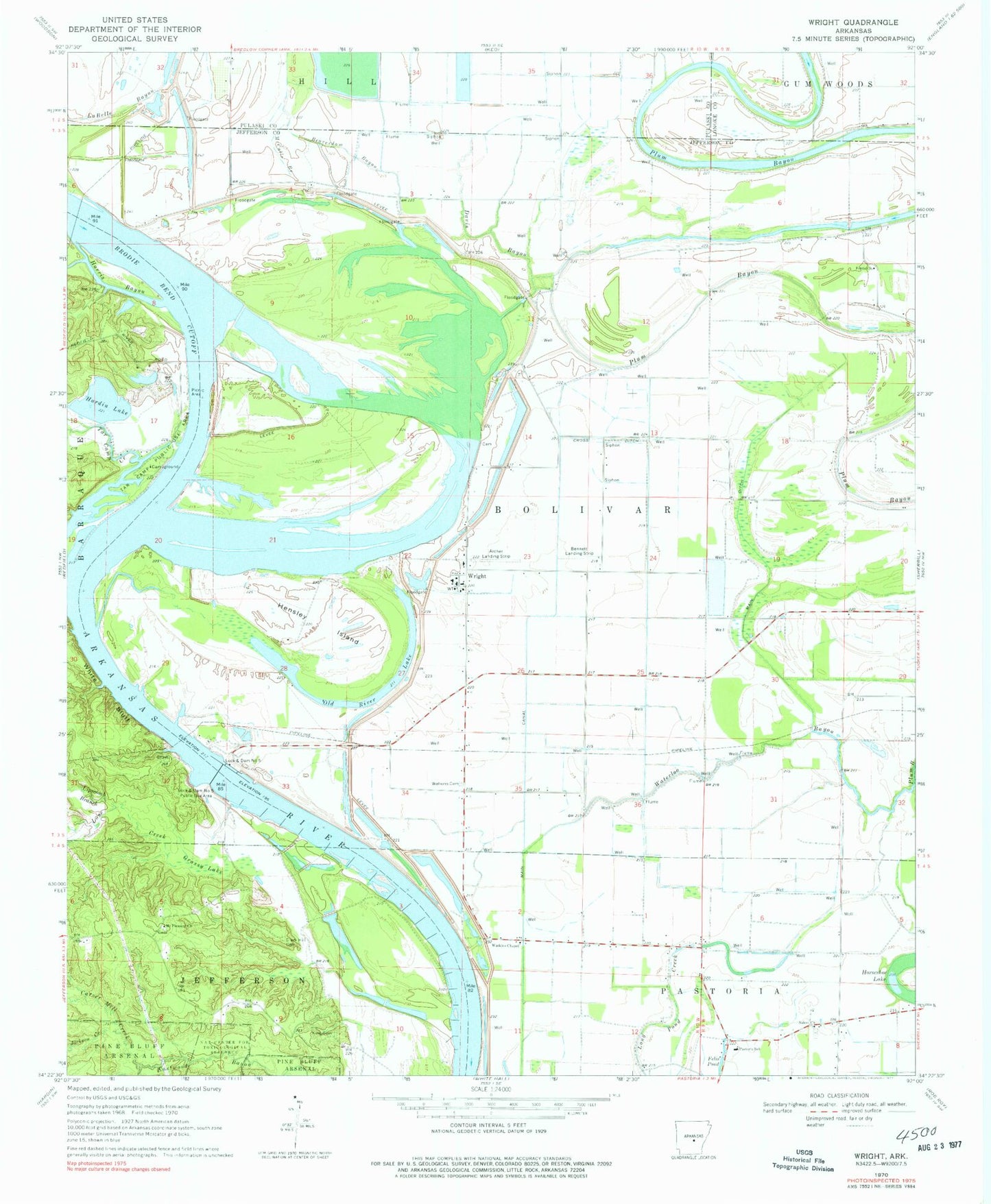
Classic USGS Wright Arkansas 7.5'x7.5' Topo Map
Couldn't load pickup availability
Historical USGS topographic quad map of Wright in the state of Arkansas. Map scale may vary for some years, but is generally around 1:24,000. Print size is approximately 24" x 27"
This quadrangle is in the following counties: Jefferson, Lonoke, Pulaski.
The map contains contour lines, roads, rivers, towns, and lakes. Printed on high-quality waterproof paper with UV fade-resistant inks, and shipped rolled.
Contains the following named places: Adamsburg Landing, Archer Landing Strip, Beaverdam Bayou, Bennett Landing Strip, Bredlow Reservoir, Bredlow Reservoir Dam, Brodie Bar, Brodie Bend, Brodie Bend Cutoff, Carver Mill Creek, Clark Hill Cemetery, Clear Water Holding Pond, Cross Ditch, Davis Bayou, Dike Number One Dam, Ditch A, Ditch B, Ditch C, Ditch D, Faver School, Felix Pond, Ferda Church, Grassy Lake, Hardin Lake, Hardin Lake Dam, Hardin Lake Dam Number Two, Hardin Lake Number Two, Harris Bayou, Hensley Island, Jackson Creek, Jessie R Core School, King Cemetery, Lateral F, Lateral H, Lateral I, Lateral J, Lipscomb Branch, Lock, Lock and Dam Number 5, Lock and Dam Number 5 Public Use Area, Love Creek, Main Canal, Main Ditch, McCalls Branch, Mocks Point, Mount Pleasant Church, New Home Cemetery, New Home Church, Old River Lake, Pastoria School, Plum Bayou, Plum Bayou Baptist Church, Plum Bayou Post Office, Pool Five, Red Bluff Ferry, Salem Cemetery, Salem Church, Silers Chute, Silers Island, Tar Camp Creek, Tar Camp Crossing, Tar Camp Public Use Area, Township of Bolivar, Waterloo Bayou, Watkins Cemetery, Watkins Chapel, White Bluff, Wild Cat Crossing, Wright, Wright - Pastoria Volunteer Fire Department, Wright Post Office


