
MyTopo
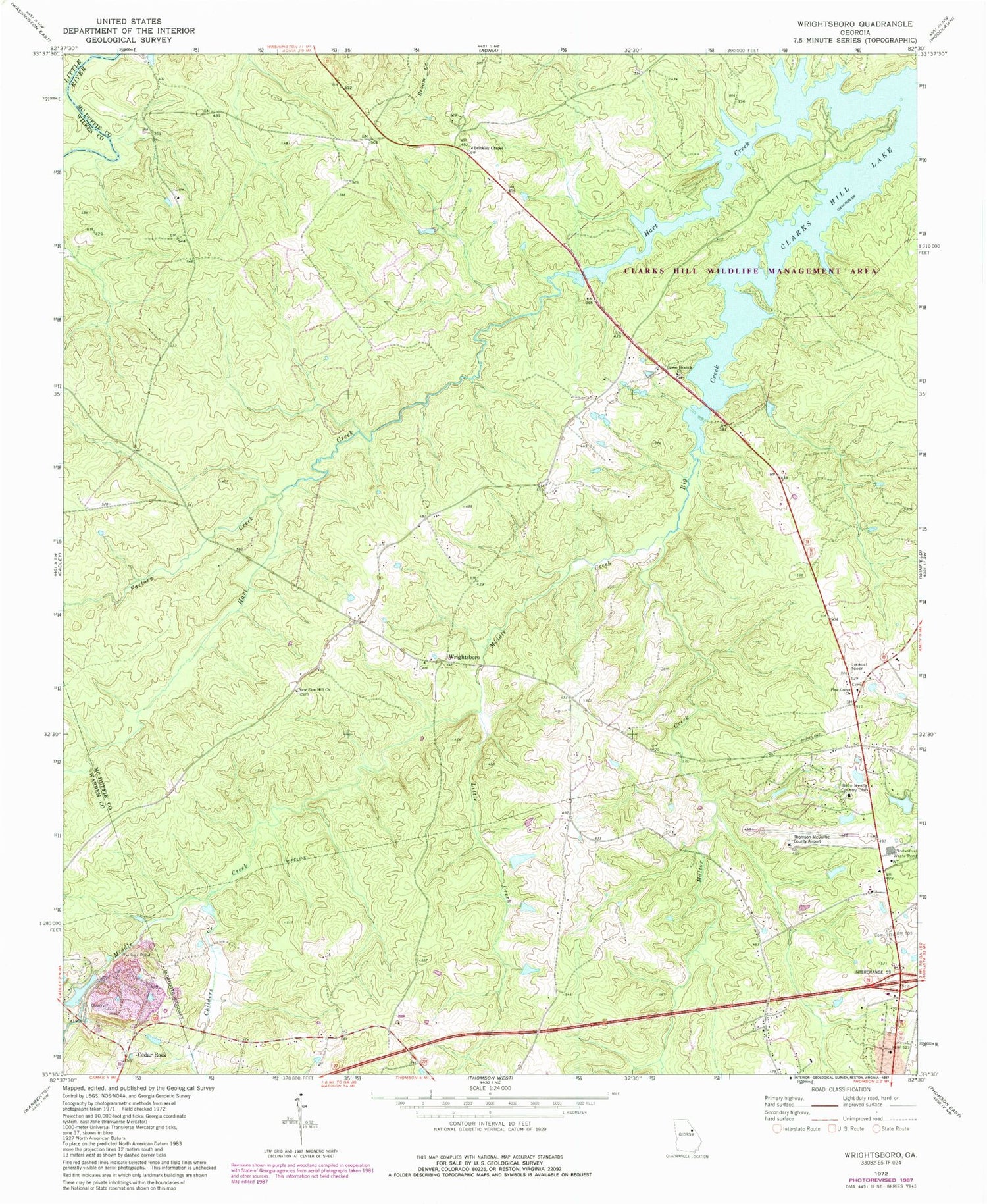
Classic USGS Wrightsboro Georgia 7.5'x7.5' Topo Map
Couldn't load pickup availability
Historical USGS topographic quad map of Wrightsboro in the state of Georgia. Map scale may vary for some years, but is generally around 1:24,000. Print size is approximately 24" x 27"
This quadrangle is in the following counties: McDuffie, Warren, Wilkes.
The map contains contour lines, roads, rivers, towns, and lakes. Printed on high-quality waterproof paper with UV fade-resistant inks, and shipped rolled.
Contains the following named places: Anthony Crossroads, Belle Meade Country Club, Brinkley Chapel, Cedar Rock, Childers Creek, Columbia Mine, Factory Creek, Georgia State Patrol Thomson, Green Branch Church, Hart Creek, Ivey Cemetery, Knox Lake, Knox Lake Dam, Liberty Hill Cemetery, Liberty Hill Church, Liberty Hill School, Little Creek, Mattox Creek, McDuffie County Fire Department Station 2, Middle Creek, Moore Cemetery, New Zion Hill Cemetery, New Zion Hill Church, Pine Grove Cemetery, Pine Grove Church, Pleasant Grove Cemetery, Pleasant Grove Church, Rees-Wade-Short Cemetery, Savannah Valley Memorial Garden, Shaws Bend, Tatham Mines, Thomson Division, Thomson-McDuffie County Airport, Three Points, Todds Branch, Wrightsboro, Wrightsboro Cemetery, Wrightsboro Methodist Church, ZIP Code: 30824


