MyTopo
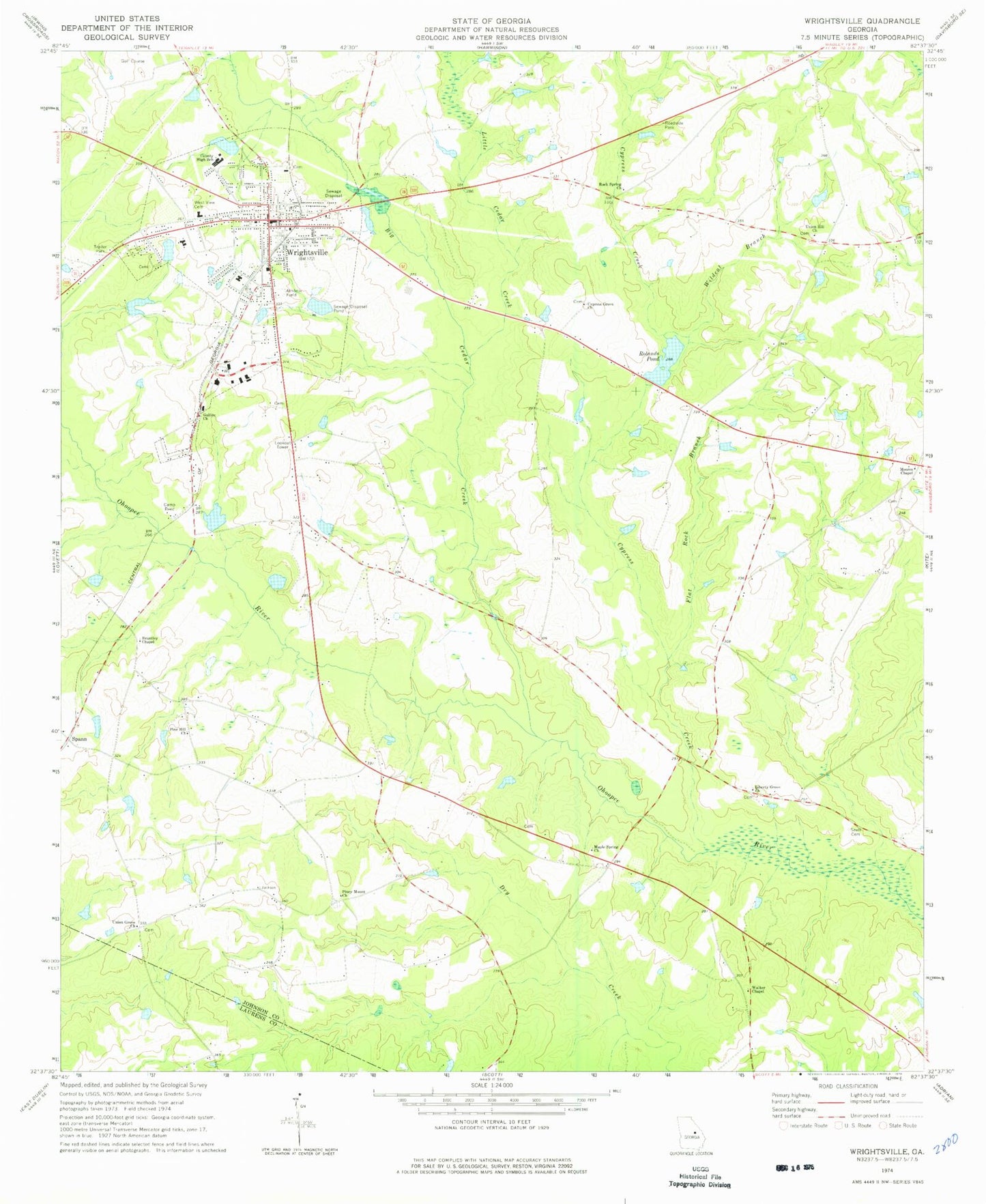
Classic USGS Wrightsville Georgia 7.5'x7.5' Topo Map
Couldn't load pickup availability
Historical USGS topographic quad map of Wrightsville in the state of Georgia. Map scale may vary for some years, but is generally around 1:24,000. Print size is approximately 24" x 27"
This quadrangle is in the following counties: Johnson, Laurens.
The map contains contour lines, roads, rivers, towns, and lakes. Printed on high-quality waterproof paper with UV fade-resistant inks, and shipped rolled.
Contains the following named places: Antioch Baptist Church, Bell Pond, Bell Pond Dam, Big Cedar Creek, Brantley Chapel, Brantley Chapel Cemetery, Browns Memorial Baptist Church, Camp Reed, City of Wrightsville, Cypress Creek, Cypress Grove Church, Dailey Grove Church, East Pond, East Pond Dam, Flat Rock Branch, Galilee Church, Johnson County, Johnson County Courthouse, Johnson County High School, Johnson County Jail, Johnson County Sheriff's Office, Johnson State Prison, Liberty Grove Church, Little Cedar Creek, Lord Pond, Lord Pond Dam, Luck Lake, Luck Lake Dam, Maple Spring Church, Moores Chapel, Neelys Chapel, Pine Hill Church, Piney Mount Church, Piney Mount Fire Department, Rock Spring Church, Rolands Pond, Shurling Dam, Shurling Lake, Snell Cemetery, Spann, Union Grove Church, Union Hill Church, Walker Chapel, West View Cemetery, Wildcat Branch, WIML-FM (Wrightsville), Wrightsville, Wrightsville Airport, Wrightsville City Hall, Wrightsville Division, Wrightsville Elementary School, Wrightsville Fire Department, Wrightsville Police Department, Wrightsville Post Office, Wrightsville Primary School, Wrightsville Sewage Disposal Pond, ZIP Code: 31096