MyTopo
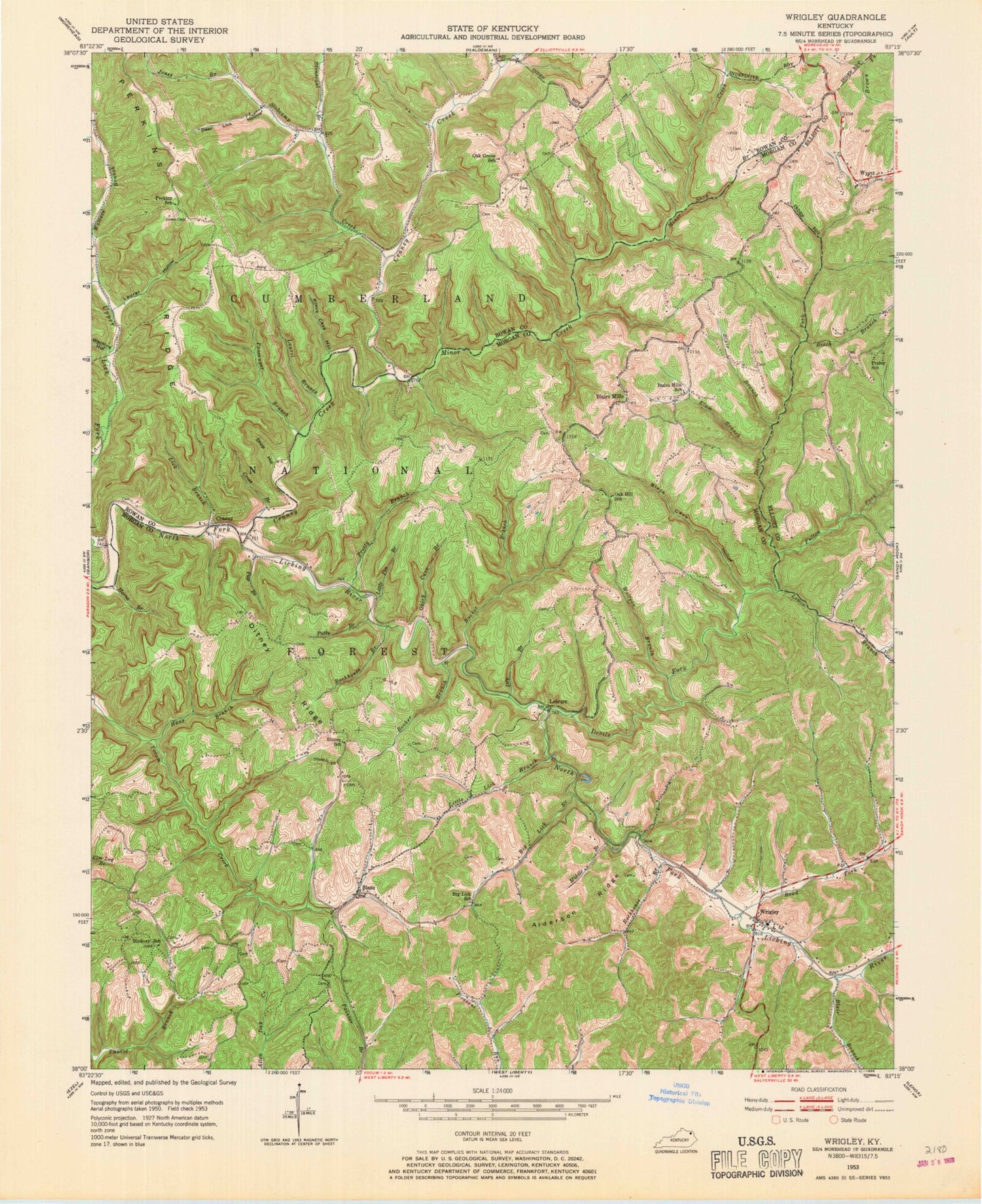
Classic USGS Wrigley Kentucky 7.5'x7.5' Topo Map
Couldn't load pickup availability
Historical USGS topographic quad map of Wrigley in the state of Kentucky. Map scale may vary for some years, but is generally around 1:24,000. Print size is approximately 24" x 27"
This quadrangle is in the following counties: Elliott, Morgan, Rowan.
The map contains contour lines, roads, rivers, towns, and lakes. Printed on high-quality waterproof paper with UV fade-resistant inks, and shipped rolled.
Contains the following named places: 519 Volunteer Fire Department - Wrigley Station, Adkins Curve, Alderson Ridge, Beech Branch, Big Lick Branch, Big Lick School, Bishop Cemetery, Black Cave Hollow, Black Cemetery, Blacklog Hollow, Blair Branch, Blairs Cemetery, Blairs Mill Church of Christ, Blairs Mill Post Office, Blairs Mill Railroad Station, Blairs Mill School, Blairs Mills, Blairs Mills Church, Blaze, Blaze Post Office, Blaze School, Booker Branch, Bucket Branch, Cassity Cemetery, Coley Branch, Craney, Craney Creek, Crisp Family Cemetery, Crisp Farm Cemetery, Cross Branch, Day Cemetery, Deer Lick Hollow, Devils Fork, Dillion Cemetery, Ditney Ridge, Ditney School, Dry Branch, Elam Branch, Fraley Ridge, Fraley School, Fulton Fork, G W Hall Cemetery, Glady Branch, Gregory Cemetery One, Hall Cemetery, Hans Branch, Harns Branch, Hickory School, Hitch Cemetery, Howard Shelter, Jennings Cemetery, John W Moore Cemetery, Jones Branch, Jones Cemetery, Jones Ridge, Kidd - White Cemetery, Kidd Cemetery One, Kidd Cemetery Two, Kidd Family Cemetery, Lambert Cemetery, Laurel Branch, Laurel Hollow, Leasure Post Office, Leisure, Lewis Branch, Lick Branch, Little Lick Branch, Little Pea Branch, Lost Point Pentecostal Church, Middle Branch, Minor Creek, Oak Hill, Oak Hill Church, Oak Hill Church of God, Oak Hill School, Okley Cave Branch, Passenger Branch, Pennington Cemetery, Perry Cemetery Two, Prather-Stamper Cemetery, Pretty Branch, Pup Branch, Purple Post Office, Putty Branch, Quesinberry Cemetery, Riddle Cemetery, Road Fork, Rockhouse Branch, Shop Branch, Shop Hollow, Slabcamp Creek, Stonecoal Branch, Thornsberry Cemetery, Upper Lick Fork, Wagner Fork, Wallace Branch, Winding Stairs, Wolfpen Branch, Wrigley, Wrigley Division, Wrigley Post Office, Wrigley Railroad Station, Wrigley School, Wyett, Wyett Church of Jesus Christ, Wyett Post Office, Yocum Post Office