MyTopo
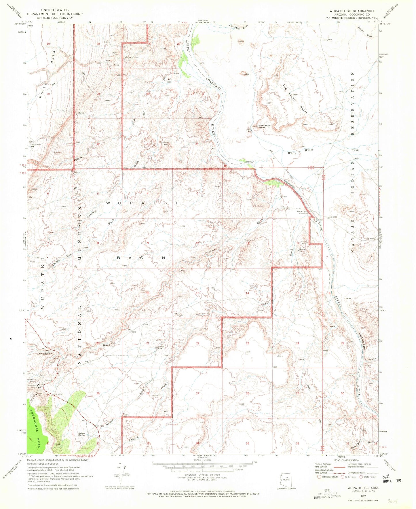
Classic USGS Wupatki SE Arizona 7.5'x7.5' Topo Map
Couldn't load pickup availability
Historical USGS topographic quad map of Wupatki SE in the state of Arizona. Map scale may vary for some years, but is generally around 1:24,000. Print size is approximately 24" x 27"
This quadrangle is in the following counties: Coconino.
The map contains contour lines, roads, rivers, towns, and lakes. Printed on high-quality waterproof paper with UV fade-resistant inks, and shipped rolled.
Contains the following named places: Antelope Wash, Aswan Tank, Black Falls, Black Falls Crossing, Black Falls Dam, Citadel Wash, Deadman Wash, Doney Mountain Wash, Heiser Spring, Heiser Wash, Inscription Point, Kanaa Valley, Kanaa Wash, Savage Well, Taah Iiti Wash, Trader Tank, Tse Lichii Point, White Water Wash, Wupatki Basin, Wupatki National Monument Visitor Center