MyTopo
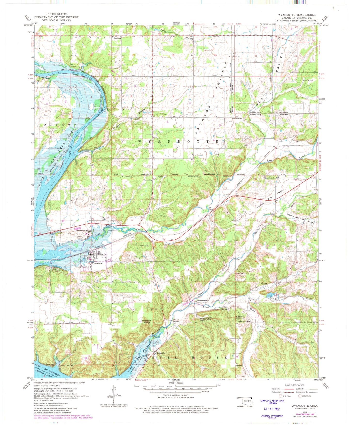
Classic USGS Wyandotte Oklahoma 7.5'x7.5' Topo Map
Couldn't load pickup availability
Historical USGS topographic quad map of Wyandotte in the state of Oklahoma. Map scale may vary for some years, but is generally around 1:24,000. Print size is approximately 24" x 27"
This quadrangle is in the following counties: Ottawa.
The map contains contour lines, roads, rivers, towns, and lakes. Printed on high-quality waterproof paper with UV fade-resistant inks, and shipped rolled.
Contains the following named places: Brown Cemetery, Brush Creek, Cedar Creek, Eastern Shawnee Oklahoma Tribal Statistical Area, Eastside, Jackson Prairie, Kellyville, Lost Creek, Mason Springs Valley, Modoc Cemetery, Modoc Church, Modoc Oklahoma Tribal Statistical Area, Modoc Valley, Owsley School, Pleasant Point School, Roark Creek, Seneca Indian School, Shawnee Branch, South Eight School, Stony Point School, Sycamore Chapel, Sycamore Cove, Sycamore Creek, Town of Wyandotte, Township of Wyandotte, Wayside Church, Wyandotte, Wyandotte Division, Wyandotte Elementary School, Wyandotte Fire Department, Wyandotte High School, Wyandotte Indian Cemetery, Wyandotte Middle School, Wyandotte Oklahoma Tribal Statistical Area, Wyandotte Post Office, Wyandotte Tribal and Municipal Police Department, Yankee Bill Prairie