MyTopo
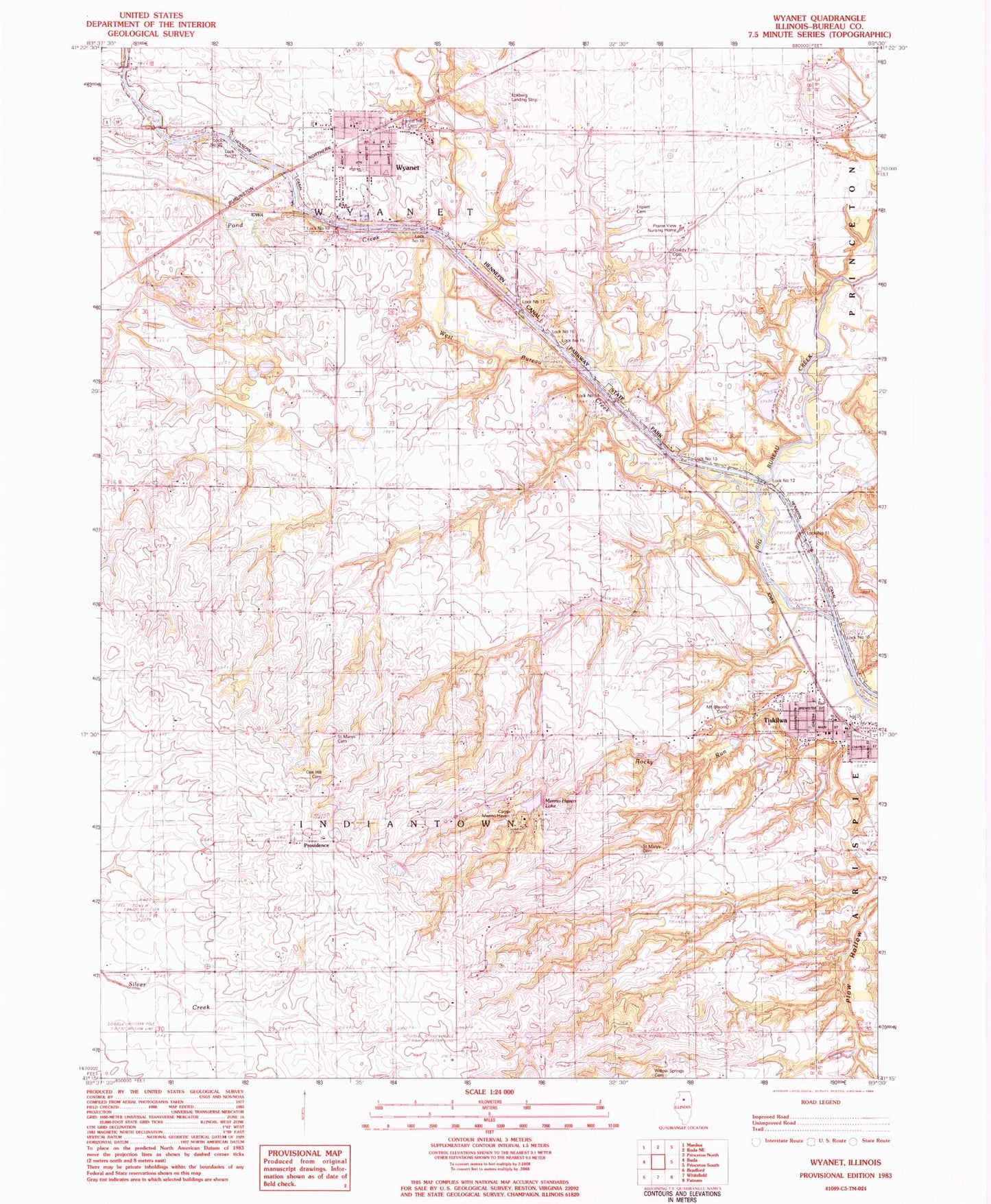
Classic USGS Wyanet Illinois 7.5'x7.5' Topo Map
Couldn't load pickup availability
Historical USGS topographic quad map of Wyanet in the state of Illinois. Map scale may vary for some years, but is generally around 1:24,000. Print size is approximately 24" x 27"
This quadrangle is in the following counties: Bureau.
The map contains contour lines, roads, rivers, towns, and lakes. Printed on high-quality waterproof paper with UV fade-resistant inks, and shipped rolled.
Contains the following named places: Bolton Lakes, Bolton Lakes Dam, Bureau County Home Cemetery, Bureau Valley South School, Camp Menno-Haven, Catholic Cemetery, Cedar Bluff, Center Grove School, Congregational Bible Church, Eckberg Airport, Forest Hill Cemetery, Fox Bend School, Harmon Pond, Harmon Pond Dam, Kitterman School, Lock Number 10, Lock Number 11, Lock Number 12, Lock Number 13, Lock Number 14, Lock Number 15, Lock Number 16, Lock Number 17, Lock Number 18, Lock Number 19, Lock Number 20, Lock Number 21, Menno-Haven Lake, Mount Bloom Cemetery, Oak Hill Cemetery, Pond Creek, Prairie View Nursing Home, Providence, Raymond A Sapp Memorial Library, Rocky Run, Saint Marys Cemetery, Sister School, Soverhill School, Sunny Knoll School, Tiskilwa, Tiskilwa Elementary School, Tiskilwa High School, Tiskilwa Post Office, Tiskilwa Rural Fire Protection District Station 1 and Ambulance Service, Tiskilwa Watershed Structure Number 1 Dam, Tiskilwa Watershed Structure Number 2 Dam, Tiskilwa Watershed Structure Number 4 Dam, Tiskilwa Watershed Structure Number 5 Dam, Township of Indiantown, Township of Wyanet, Triplett Cemetery, Twin Faun Lake, Union School, United Methodist Church of Wyanet, Village of Tiskilwa, Village of Wyanet, West Bureau Creek, Wyanet, Wyanet Fire Protection District, Wyanet Post Office, Wyanet Rescue Squad, ZIP Code: 61368