MyTopo
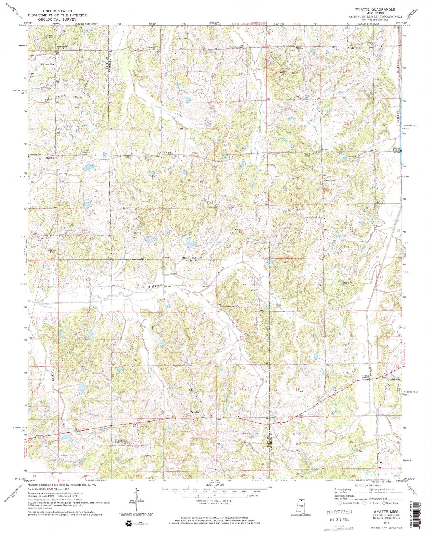
Classic USGS Wyatte Mississippi 7.5'x7.5' Topo Map
Couldn't load pickup availability
Historical USGS topographic quad map of Wyatte in the state of Mississippi. Map scale may vary for some years, but is generally around 1:24,000. Print size is approximately 24" x 27"
This quadrangle is in the following counties: Marshall, Tate.
The map contains contour lines, roads, rivers, towns, and lakes. Printed on high-quality waterproof paper with UV fade-resistant inks, and shipped rolled.
Contains the following named places: Aiken, Bowen Lake Dam, Brooks Cemetery, Callis Lake Dam, Carter Sunset Memorial Gardens, Cathey Cemetery, Chulahoma, Chulahoma Cemetery, Chulahoma Church, Church of Christ, Dry Fork Creek, Ellis Chapel School, Grubb Hill Cemetery, Grubb Hill Church, Harmon Cemetery, Hickahala Creek Watershed Y-6-11 Dam, Hickahala Creek Watershed Y-6-15 Dam, Hickahala Creek Watershed Y-6-16 Dam, Hickahala Creek Watershed Y-6-3 Dam, Hickahala Creek Watershed Y-6-4 Dam, Hickahala Creek Watershed Y-6-5 Dam, Hickahala Creek Watershed Y-6-6 Dam, Jamieson Chapel, Jones Cemetery, Lee School, Mount Olive Church, Mount Zion Cemetery, Mount Zion Church, Mullins School, New Travel Church, Orion, Phillips School, Pigeon Roost Watershed Y-5-122 Dam, Roberts Chapel, Roberts Chapel Cemetery, Rockhill, Rockhill School, Saint Josephs Church, Saint Josephs School, Shady Grove Cemetery, Shady Grove Church, Shady Grove School, Stickland Chapel Cemetery, Strickland Chapel Cemetery, Strickland Chapel Church, Thyatira Church, Wakefield, Wallhill, Worrier School, Wyatte, Wyatte Baptist Church, Wyatte School