MyTopo
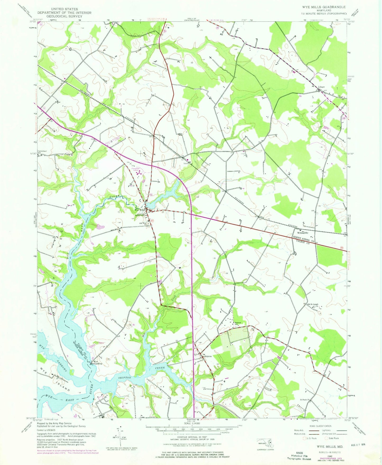
Classic USGS Wye Mills Maryland 7.5'x7.5' Topo Map
Couldn't load pickup availability
Historical USGS topographic quad map of Wye Mills in the state of Maryland. Map scale may vary for some years, but is generally around 1:24,000. Print size is approximately 24" x 27"
This quadrangle is in the following counties: Queen Anne's, Talbot.
The map contains contour lines, roads, rivers, towns, and lakes. Printed on high-quality waterproof paper with UV fade-resistant inks, and shipped rolled.
Contains the following named places: Bloomingdale, Boyd Farm Pond Dam, Carmichael School, Caroline College Center, Chesapeake College, Dolvin, Dorchester, Dorchester Building, Dorchester Sheriffs Office, Early Childhood Development Center, Eastern Shore Higher Education Center, Economic Development Center, Foreman Landing, Fox Meadow, Georgia Woods, Island Point, John Wesley Church Cemetery, Kent Humanities Building, Kent/Humanities, Long Point, Manufacturing Training Center, Mill Creek, Mill Creek Wildlife Sanctuary, Nathaniel Point, New Zion United Methodist Church, Newton School, Newtown, Newtown Square, Old Saint Joseph Catholic Cemetery, Old Saint Joseph Church, Old Wye Church, Powell Landing, Probasco Landing, Queen Anne's Technical Building, Queen Anne's/Technical, Queenstown Mobile Home Park, Richard Asbury United Methodist Church, Rufus M and Loraine Hall Todd Performing Arts Center, Saint Pauls Church, Saint Pauls Lutheran Cemetery, Saulsbury, Scottown, Skipton, Skipton Creek, Skipton Landing, Starr, Talbot/Science, The Aspen Institute Heliport, Todd Performing Arts Center, Wesley United Methodist Church, Willoughby, Wye Heights, Wye Landing, Wye Mill, Wye Mills, Wye Mills Cemetery, Wye Mills Community Lake, Wye Mills Dam, Wye Mills Post Office, Wye Mills Railroad Station, Wye Mills United Methodist Church, Wye Oak State Park, Yorke, ZIP Code: 21679


