MyTopo
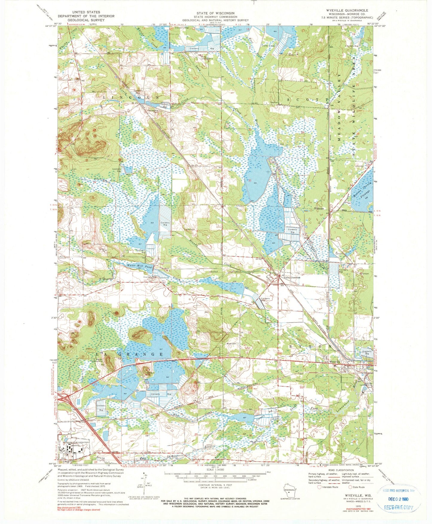
Classic USGS Wyeville Wisconsin 7.5'x7.5' Topo Map
Couldn't load pickup availability
Historical USGS topographic quad map of Wyeville in the state of Wisconsin. Map scale may vary for some years, but is generally around 1:24,000. Print size is approximately 24" x 27"
This quadrangle is in the following counties: Monroe.
The map contains contour lines, roads, rivers, towns, and lakes. Printed on high-quality waterproof paper with UV fade-resistant inks, and shipped rolled.
Contains the following named places: 136 Reservoir, Benjaminville School, Brandy Creek, Dandy Creek 11 2WP197 Dam, Dannavang Cemetery, Dannavang Church, Dead Creek, Jay Creek, Johnson C 12033 Dam, Kreyer Creek, Lake 18 13 22, Lake 26 2 and Lake 23 12d 13, Lake 32 11 57, Lake 5 7 58, Lowry Creek, Mill Creek, Mud Creek, North Tomah Cranberry Company 3WR483 Dam, Prehn Cranberry Company Airport, Salzwedel Cranberry Marsh, Sand Creek, Tomah Veterans Affairs Medical Center, Town of La Grange, Town of Lincoln, Valley Corporation Dam, Valley Junction, Valley View School, Veterans Affairs Fire Department, Village of Wyeville, Water Mill Dam, Water Mill Pond, Water Mill School, Wetherby Dam, Whisky Creek, Wood Cemetery, Wyeville, Wyeville Elementary School