MyTopo
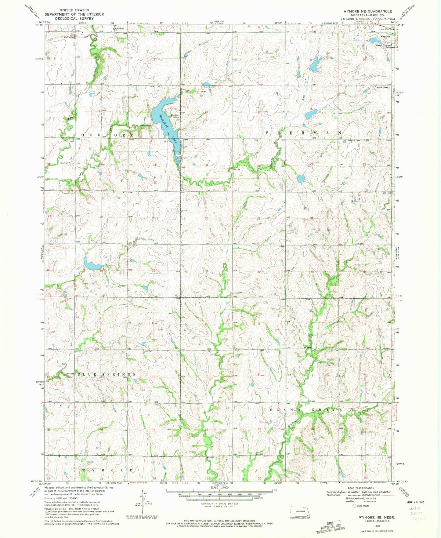
Classic USGS Wymore NE Nebraska 7.5'x7.5' Topo Map
Couldn't load pickup availability
Historical USGS topographic quad map of Wymore NE in the state of Nebraska. Map scale may vary for some years, but is generally around 1:24,000. Print size is approximately 24" x 27"
This quadrangle is in the following counties: Gage.
The map contains contour lines, roads, rivers, towns, and lakes. Printed on high-quality waterproof paper with UV fade-resistant inks, and shipped rolled.
Contains the following named places: Kuhns Dam, Kuhns Reservoir, Mud Creek Dam 3-A, Mud Creek Dam 4-4, Mud Creek Dam 4-5, Mud Creek Dam 4-8, Mud Creek Dam 4-C, Mud Creek Dam 4-D, Mud Creek Dam 4-E, Mud Creek Dam 4-J, Mud Creek Reservoir 3-A, Mud Creek Reservoir 4-4, Mud Creek Reservoir 4-5, Mud Creek Reservoir 4-8, Mud Creek Reservoir 4-C, Mud Creek Reservoir 4-D Dam, Mud Creek Reservoir 4-E, Mud Creek Reservoir 4-J, Rockford Lake, Rockford Lake State Recreation Area, Rockford Trail, Stark Cemetery, Township of Island Grove, Township of Sherman, Virginia Cemetery, ZIP Code: 68458