MyTopo
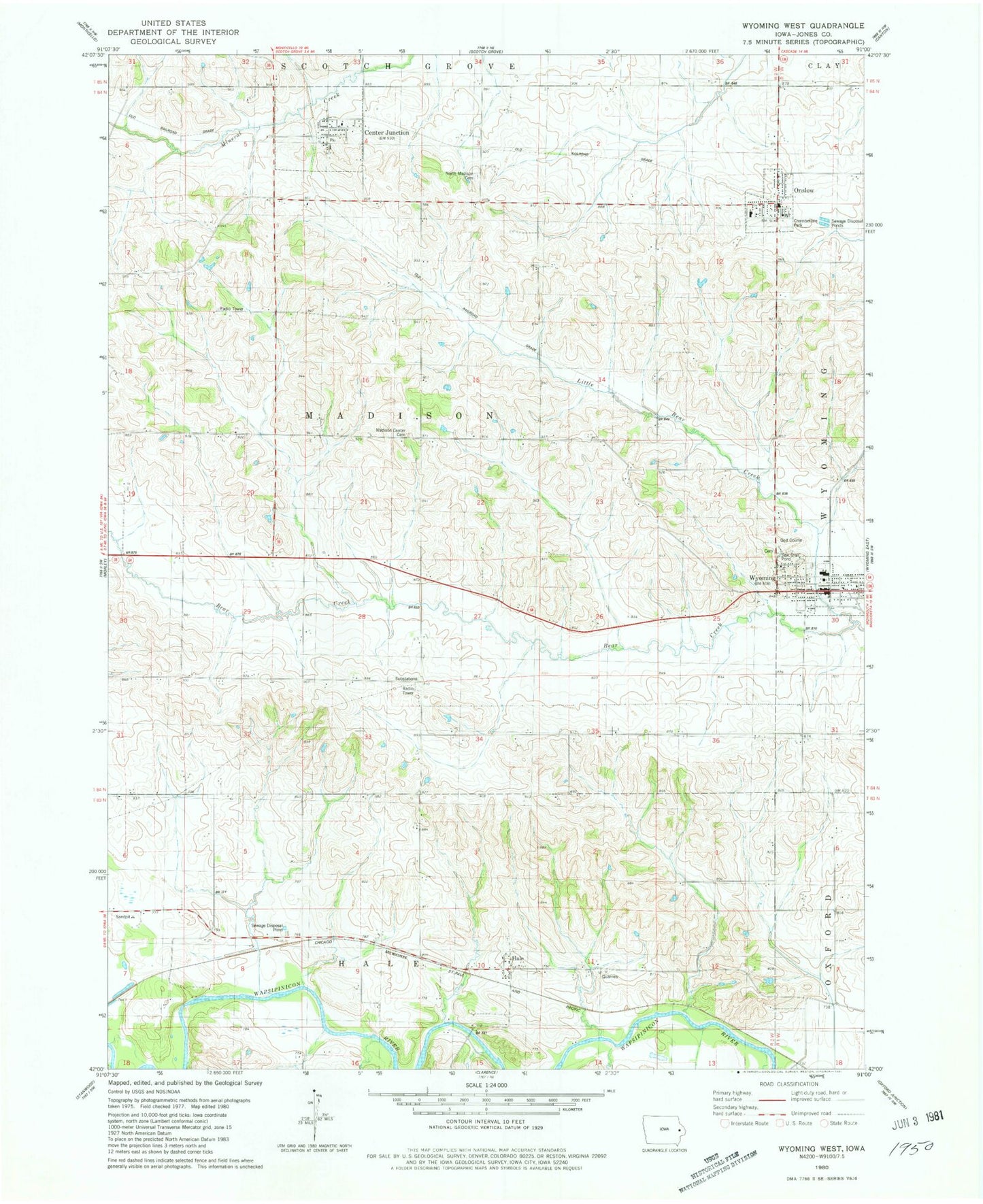
Classic USGS Wyoming West Iowa 7.5'x7.5' Topo Map
Couldn't load pickup availability
Historical USGS topographic quad map of Wyoming West in the state of Iowa. Map scale may vary for some years, but is generally around 1:24,000. Print size is approximately 24" x 27"
This quadrangle is in the following counties: Jones.
The map contains contour lines, roads, rivers, towns, and lakes. Printed on high-quality waterproof paper with UV fade-resistant inks, and shipped rolled.
Contains the following named places: Calvary Baptist Church, Center Junction, Center Junction Census Designated Place, Center Junction Community Building, Center Junction Fire Department, Center Junction Post Office, Chamberlain Park, City of Center Junction, City of Onslow, City of Wyoming, Hale, Hale Bridge, Hale Cemetery, Hale Post Office, Little Bear Country Club, Little Bear Creek, Lutheran Church, Madison, Madison Center Cemetery, Madison Post Office, Madison Village Cemetery, Maquoketa Medical Associates Center, Methodist Church, Midland Community Ambulance, Midland Middle / High School, North Madison Pioneers Cemetery, Onslow, Onslow Ball Park, Onslow Elementary School, Onslow Fire Department and First Responders, Onslow Post Office, Presbyterian Church, Township of Madison, Wyoming, Wyoming Cemetery, Wyoming City Hall, Wyoming Historical Museum, Wyoming Library, Wyoming Post Office, ZIP Code: 52212