MyTopo
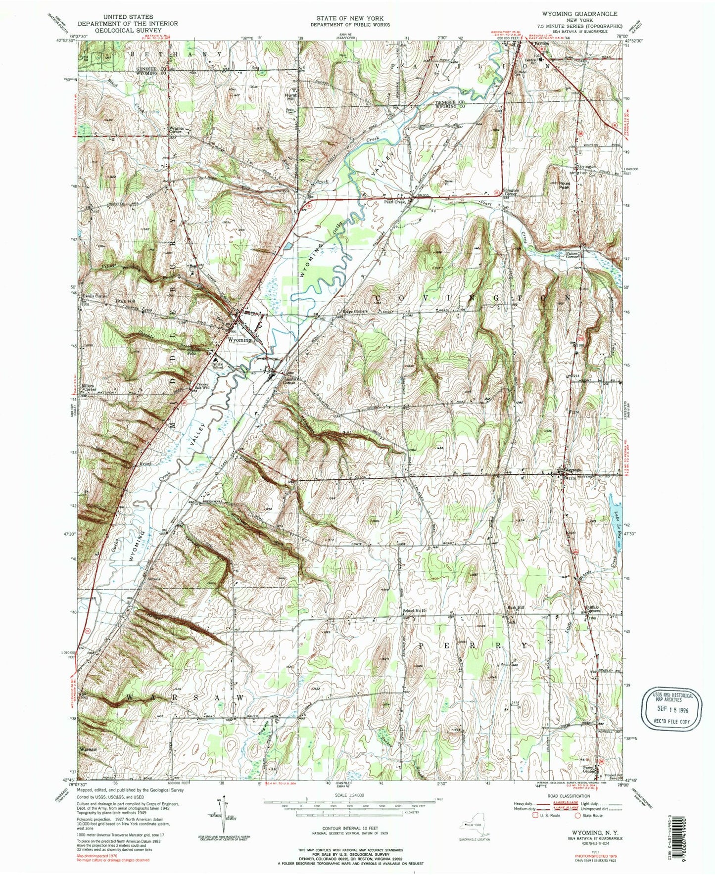
Classic USGS Wyoming New York 7.5'x7.5' Topo Map
Couldn't load pickup availability
Historical USGS topographic quad map of Wyoming in the state of New York. Map scale may vary for some years, but is generally around 1:24,000. Print size is approximately 24" x 27"
This quadrangle is in the following counties: Genesee, Wyoming.
The map contains contour lines, roads, rivers, towns, and lakes. Printed on high-quality waterproof paper with UV fade-resistant inks, and shipped rolled.
Contains the following named places: Bow Hill Farms, Buffalo Corners, Burk Hill, Canaway Gulf, Cascade Brook, Cascade Falls, Covington, Covington Pioneer Cemetery, Dillon Gulf, Ewells Corner, First Baptist Church, First Presbyterian Church, Frog Hollow, Handyside Gulf, Hillsides, Hilltop Acres Mobile Home Park, Holihan Gulf, Holstead Gulf, Hurst Hill, Kelly Brook, Lagrange, Lagrange Cemetery, Lake Le Roy, Lambs Corner, Middlebury Academy, Millers Corner, Paines Corner, Pavilion Fire Department, Pavilion Junior - Senior High School, Pearl Creek, Pierson Farms, Pikes Peak, Pioneer Salt Well, Red Brook, Ridge Corners, Saint Marys Cemetery, Saltvale, School Number 1, School Number 10, Spragues Corner, Titus Hill, Town of Covington, Town of Perry, Village Brook, Village of Wyoming, Woodvale Farms, Wrights Corner, WYDM-TV (Batavia), Wyoming, Wyoming Cemetery, Wyoming Central School, Wyoming Free Library, Wyoming Gulf, Wyoming Hook and Ladder Volunteer Fire Company Station 1, Wyoming Post Office, Wyoming United Methodist Church, Wyoming Valley, Wyoming Village Hall, Wyoming Village Historic District, ZIP Code: 14591