MyTopo
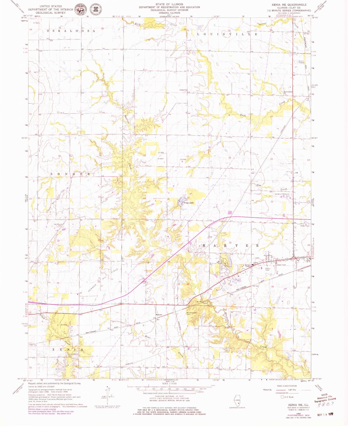
Classic USGS Xenia NE Illinois 7.5'x7.5' Topo Map
Couldn't load pickup availability
Historical USGS topographic quad map of Xenia NE in the state of Illinois. Map scale may vary for some years, but is generally around 1:24,000. Print size is approximately 24" x 27"
This quadrangle is in the following counties: Clay.
The map contains contour lines, roads, rivers, towns, and lakes. Printed on high-quality waterproof paper with UV fade-resistant inks, and shipped rolled.
Contains the following named places: Camp Ground Cemetery, Charley Brown Park, Charley Brown Park Lake, Charley Brown Park Lake Dam, Dayton School, Garden of Memories Cemetery, Golden Cemetery, Golden Church, Golden School, Kenner, Kenner Oil Field, Kenner West Oil Field, Lincoln School, Logan Family Cemetery, Martin T Snyder Memorial Nature Preserve, McCabe Chapel, Meisenheimer Cemetery, North Harter Church, North Kenner Oil Field, Oak Mound Cemetery, Oak Mound Church, Oak Mound School, Petwyler School, Shiloh School, South Kenner Oil Field, Township of Harter, Trago Lake, Trago Lake Dam, ZIP Code: 62839