MyTopo
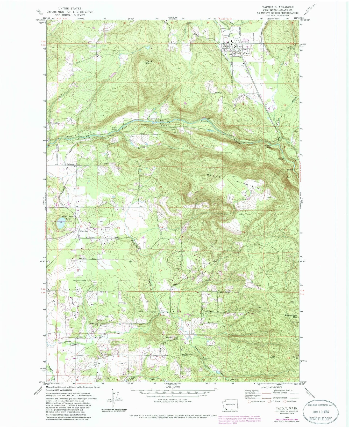
Classic USGS Yacolt Washington 7.5'x7.5' Topo Map
Couldn't load pickup availability
Historical USGS topographic quad map of Yacolt in the state of Washington. Typical map scale is 1:24,000, but may vary for certain years, if available. Print size: 24" x 27"
This quadrangle is in the following counties: Clark.
The map contains contour lines, roads, rivers, towns, and lakes. Printed on high-quality waterproof paper with UV fade-resistant inks, and shipped rolled.
Contains the following named places: Basket Creek, Battle Ground Lake, Bells Mountain, Big Tree Creek, Crawford, Finn Hill Cemetery, Gravel Point, Gravel Point Cemetery, Heisson, Lucia, Lucia Falls, Moulton Falls, Rock Creek, Salmon Falls, Spotted Deer Mountain, Venersborg, Yacolt, Yacolt Creek, Yacolt Mountain, Battle Ground State Park, Moulton Falls Park, Alpine, Moulton, Yacolt Primary School, Clark County, Homola Dam, Roosevelt Elementary School, Little Salmon Creek, Battle Ground Division, Venersborg Census Designated Place, Town of Yacolt, Multon Falls Tunnel, Yacolt Fire Department, North Country Emergency Medical Services Station 1, Clark County Fire District 3 Station 33, Clark County Fire District 3 Station 32, Heisson Post Office, Yacolt Post Office