
MyTopo
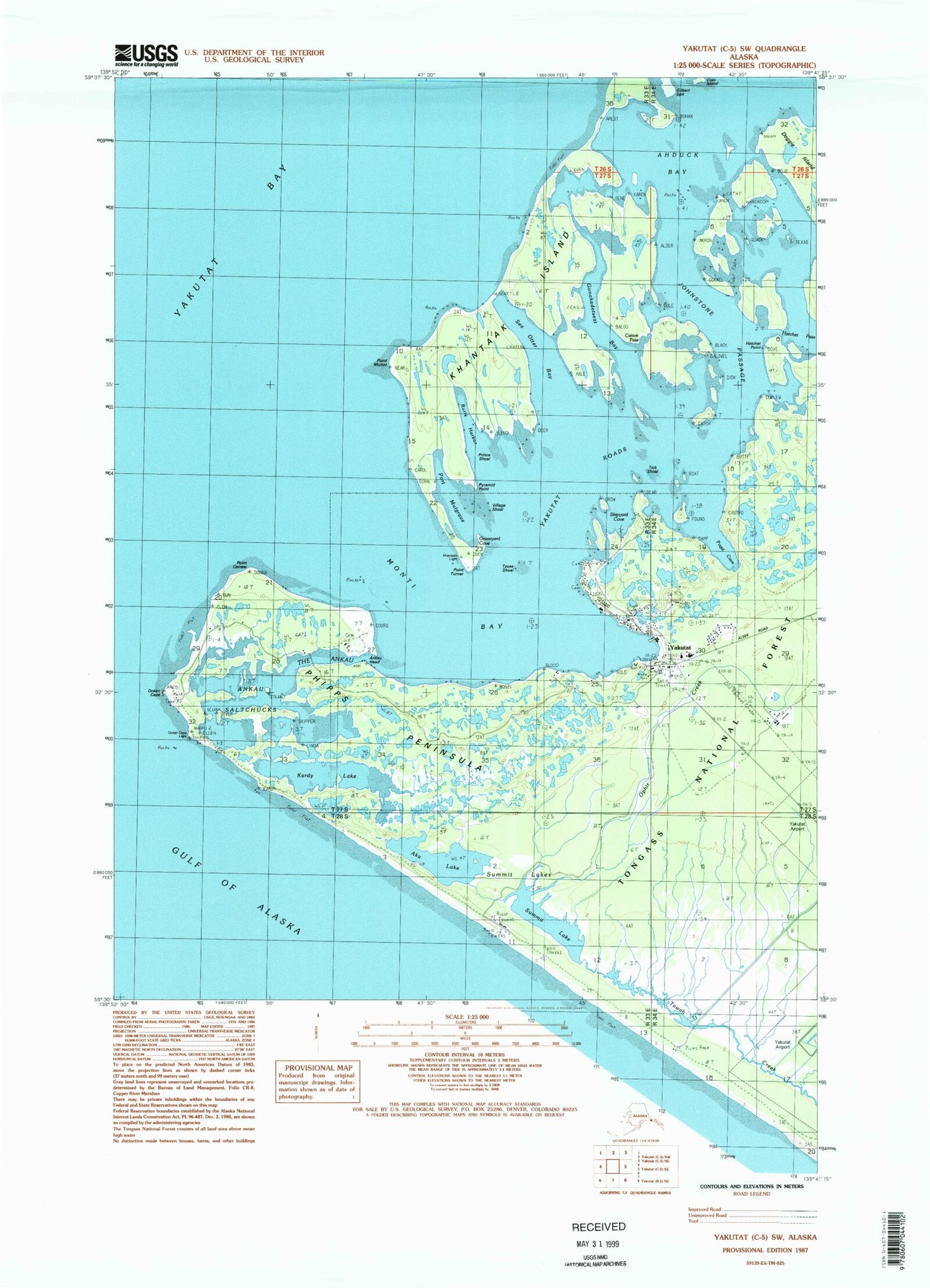
Classic USGS Yakutat C-5 SW Alaska 7.5'x7.5' Topo Map
Couldn't load pickup availability
Historical USGS topographic quad map of Yakutat C-5 SW in the state of Alaska. Map scale may vary for some years, but is generally around 1:24,000. Print size is approximately 24" x 27"
This quadrangle is in the following counties: Yakutat.
The map contains contour lines, roads, rivers, towns, and lakes. Printed on high-quality waterproof paper with UV fade-resistant inks, and shipped rolled.
Contains the following named places: Ahduck Bay, Aka Lake, Ankau Head, Ankau Saltchucks, Arrecifes Point, Canoe Island, Canoe Pass, Glory of Russia, Gonakadetseat Bay, Graveyard Cove, Hatchet Point, Johnstone Passage, Kardy Lake, Khantaak Beach, Khantaak Island, Khantaak Light, KJFP-FM (Yakutat), Laguna de la Frezas, Monti Bay, Ocean Cape, Ocean Cape Light, Ophir Creek, Phipps Cape, Phipps Peninsula, Placer de las Barada, Point Carrew, Point Munoz, Point Turner, Port Mulgrave, Prince Shoal, Puget Cove, Pyramid Point, Rocky Lake, Rurik Harbor, Sea Otter Bay, Shipyard Cove, Southeast Alaska Regional Health Consortium Yakutat Community Health Center, Summit Lake, Summit Lakes, T'awat Creek, The Ankau, The Lagoon, Tick Shoal, Tzuse Shoal, Village Shoal, Yakutat, Yakutat Post Office, Yakutat Public Safety, Yakutat Roads, Yakutat Seaplane Base, Yakutat Volunteer Emergency Medical Services and Rescue, Yakutat Volunteer Fire Department


