MyTopo
Classic USGS Yale Dam Washington 7.5'x7.5' Topo Map
Couldn't load pickup availability
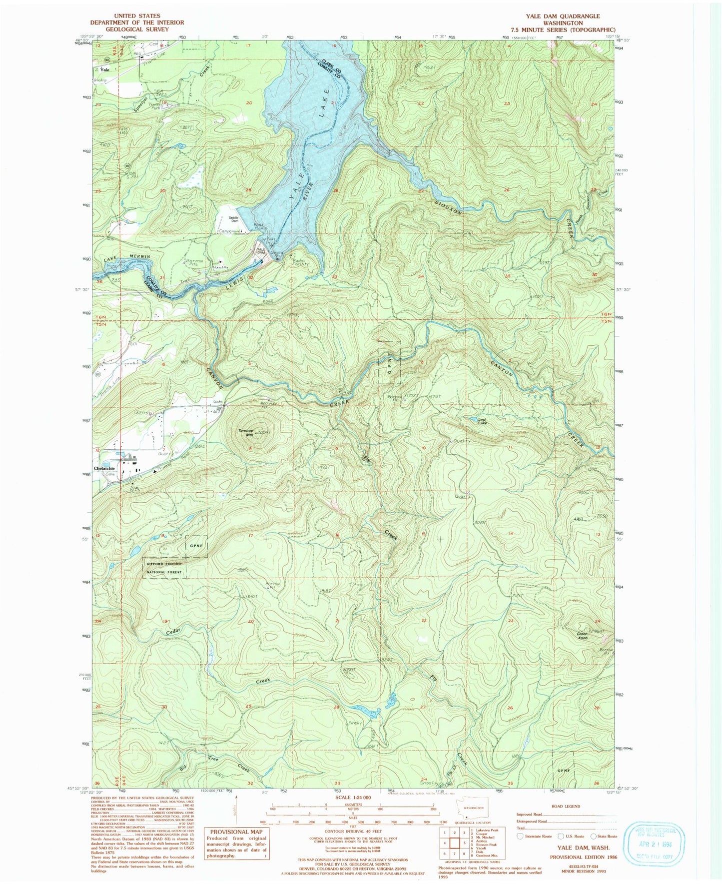
Historical USGS topographic quad map of Yale Dam in the state of Washington. Typical map scale is 1:24,000, but may vary for certain years, if available. Print size: 24" x 27"
This quadrangle is in the following counties: Clark, Cowlitz.
The map contains contour lines, roads, rivers, towns, and lakes. Printed on high-quality waterproof paper with UV fade-resistant inks, and shipped rolled.
Contains the following named places: Canyon Creek, Fly Creek, Green Knob, Little Fly Creek, Lost Lake, North Siouxon Creek, Siouxon Creek, Tumtum Mountain, Yale Dam, Saddle Dam, Saddle Dam Campground, Speelyai Hill Viewpoint, Chelatchie Prarie Mill Pond Dam, Chelatchie Prarie Mill Pond, Yacolt Division, North Country Emergency Medical Services Cresap Bay Station, Cowlitz - Skamania Fire District 7 Station 74