MyTopo
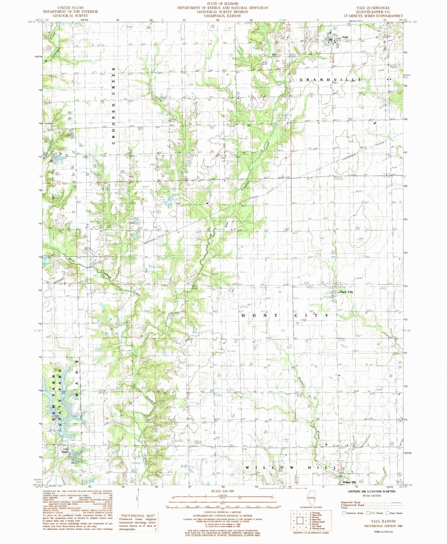
Classic USGS Yale Illinois 7.5'x7.5' Topo Map
Couldn't load pickup availability
Historical USGS topographic quad map of Yale in the state of Illinois. Map scale may vary for some years, but is generally around 1:24,000. Print size is approximately 24" x 27"
This quadrangle is in the following counties: Jasper.
The map contains contour lines, roads, rivers, towns, and lakes. Printed on high-quality waterproof paper with UV fade-resistant inks, and shipped rolled.
Contains the following named places: Andrews Cemetery, Aten Cemetery, Bethel Cemetery, Bethel Church, Brockville Cemetery, Brockville School, Brooks Cemetery, Brookville, Brown Cemetery, Byrd School, Chriss School, Clark School, Collins School, Compromise School, Cummins School, Deans Farm, Dogwood Picnic Area, East Crooked Creek, Fairview Drive-In, Fairview School, Fizzle Flat Farm, Frichtl Farms, Harris Farms, Howards Farm, Hunt City, Hunts Branch, Jones School, Kilgore Cemetery, Lake Jasper, Lake Jasper Dam, Lake Sandpoint Dam, Lake Side Foot Trail, Little Range School, Manges Farms, Matson Farms, Matteson Cemetery, McClure Farms, New Saint Peter Cemetery, Old Saint Peter Cemetery, Persimmon Point Camping Area, Premium School, Red Bud Picnic Area, Reisner School, Saint Peters School, Sam Parr Lake, Sam Parr Lake Dam, Sam Parr State Park, Todd Cemetery, Township of Hunt City, Universalist Church, Village of Yale, Water Oak School, West Crooked Creek, Whitaker School, White Oak Picnic Area, Wilson Farm, Yale, Yale Cemetery, Yale Elementary School, Yale Post Office, Yale Volunteer Fire Department