MyTopo
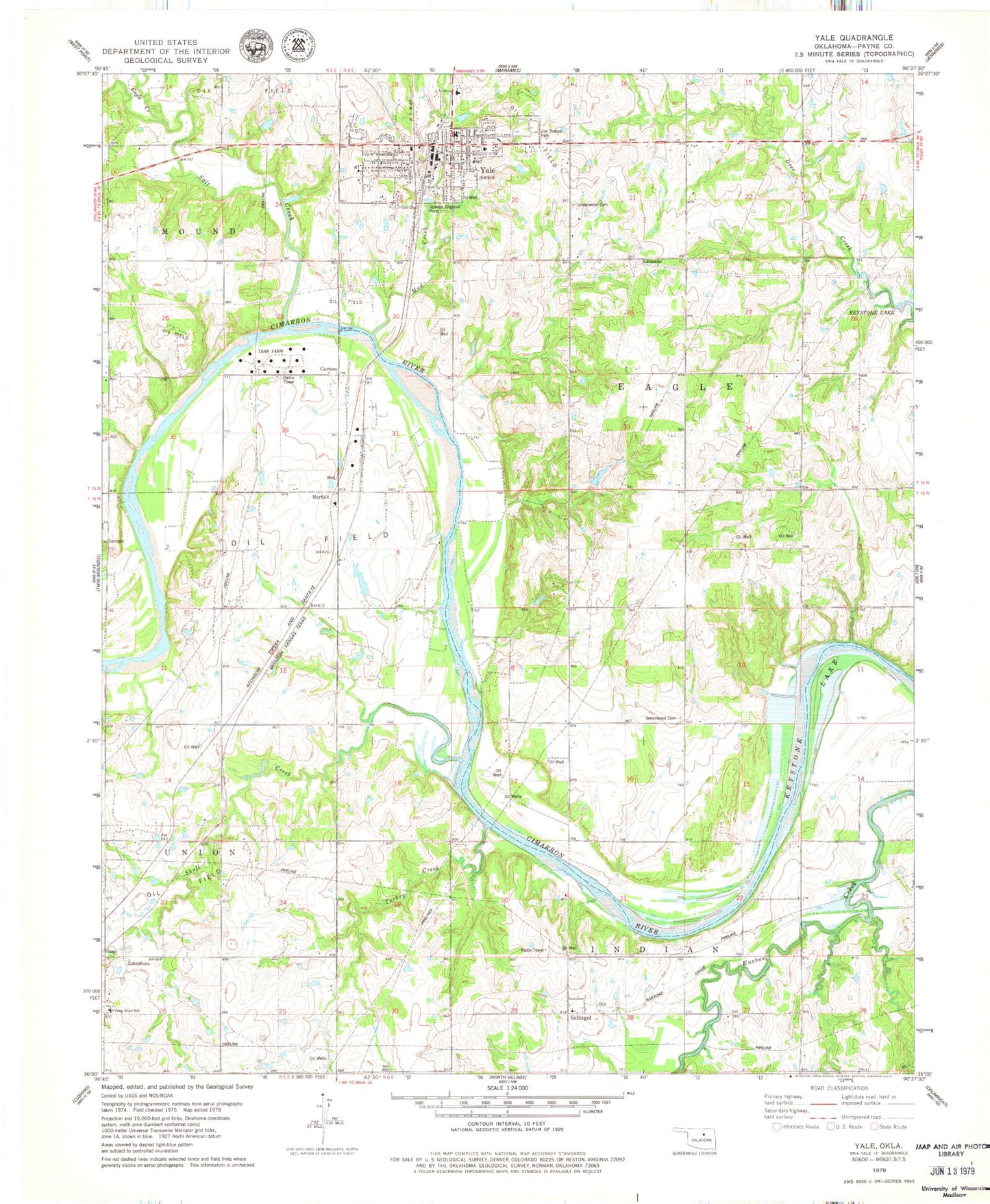
Classic USGS Yale Oklahoma 7.5'x7.5' Topo Map
Couldn't load pickup availability
Historical USGS topographic quad map of Yale in the state of Oklahoma. Map scale may vary for some years, but is generally around 1:24,000. Print size is approximately 24" x 27"
This quadrangle is in the following counties: Payne.
The map contains contour lines, roads, rivers, towns, and lakes. Printed on high-quality waterproof paper with UV fade-resistant inks, and shipped rolled.
Contains the following named places: Baptist Church, Cartoco, Church of Christ, City of Yale, Deep Rock Elementary School, Eagle Creek, Greenwood Cemetery, Jim Thorpe Park, Mud Creek, Oknoname 11905 Dam, Oknoname 11905 Reservoir, Salt Creek, Schlegel, Skull Creek, Township of Eagle, Turkey Creek, Underwood Cemetery, Yale, Yale Division, Yale Elementary School, Yale Fire Department, Yale High School, Yale Police Department, Yale Post Office, ZIP Code: 74085