MyTopo
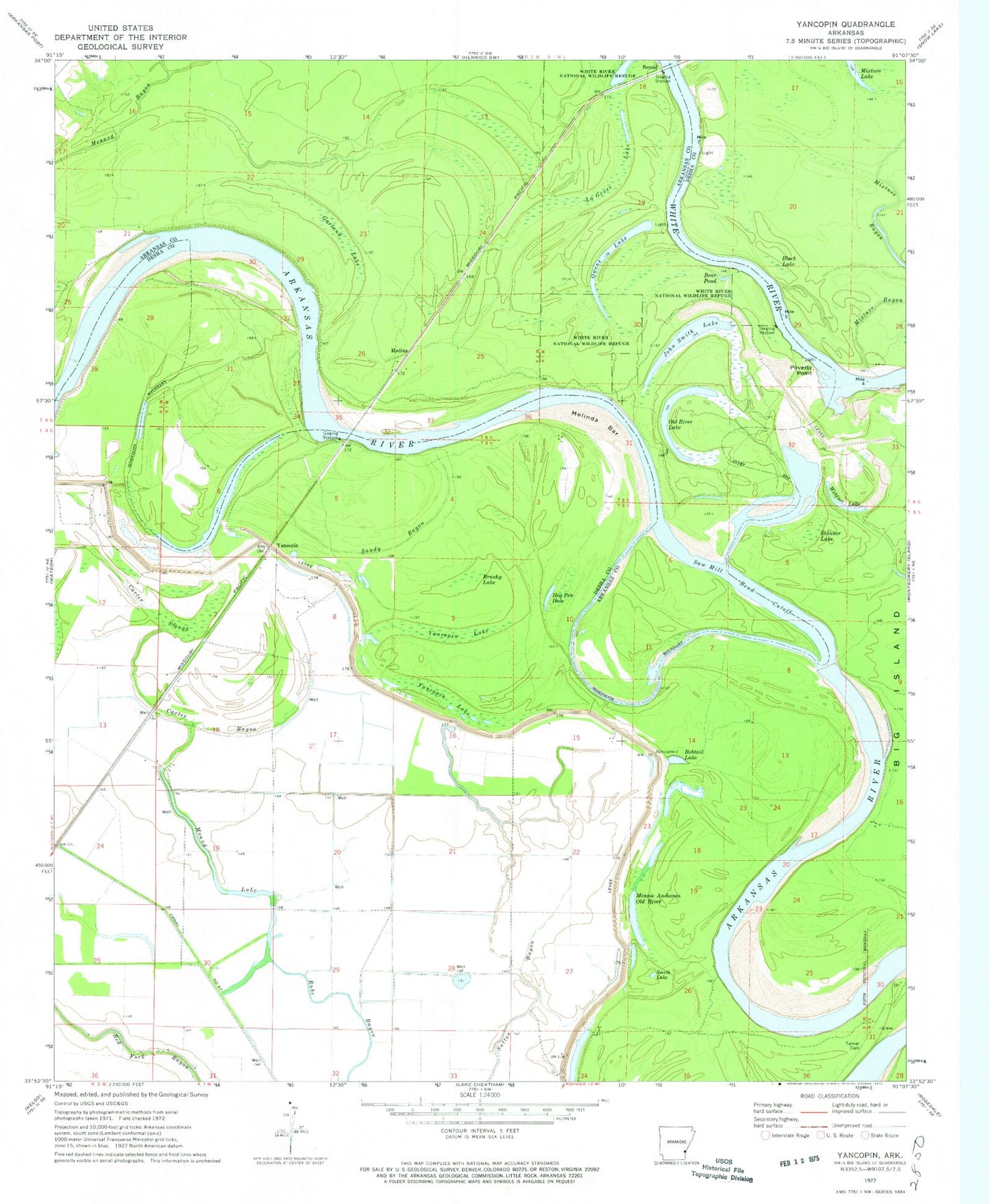
Classic USGS Yancopin Arkansas 7.5'x7.5' Topo Map
Couldn't load pickup availability
Historical USGS topographic quad map of Yancopin in the state of Arkansas. Map scale may vary for some years, but is generally around 1:24,000. Print size is approximately 24" x 27"
This quadrangle is in the following counties: Arkansas, Desha.
The map contains contour lines, roads, rivers, towns, and lakes. Printed on high-quality waterproof paper with UV fade-resistant inks, and shipped rolled.
Contains the following named places: Bear Pond, Benzal, Black Lake, Bobtail Lake, Brushy Lake, Canal Number 67, Carter Bayou, Carter Slough, Como Reach, Garland Lake, Hog Pen Hole, Hopedale Landing, House Bend, Jefferson Bend, John Smith Lake, La Grues Lake, Lacy, Medina, Melinda Bar, Menard Bend, Menard-Hodges Site, Minnie Anderson Old River, Mixture Bayou, Mixture Lake, Mound Lake, Old River Lake, Owens Lake, Poverty Point, Rosemary Lake, Rosemary Landing, Sandy Bayou, Saw Mill Bend Cutoff, Skinner Lake, Smith Lake, Trusten Holder State Wildlife Management Area, Turner Cemetery, Webfoot Lake, Yancopin, Yancopin Airport, Yancopin Lake