MyTopo
Classic USGS Yankee New Mexico 7.5'x7.5' Topo Map
Couldn't load pickup availability
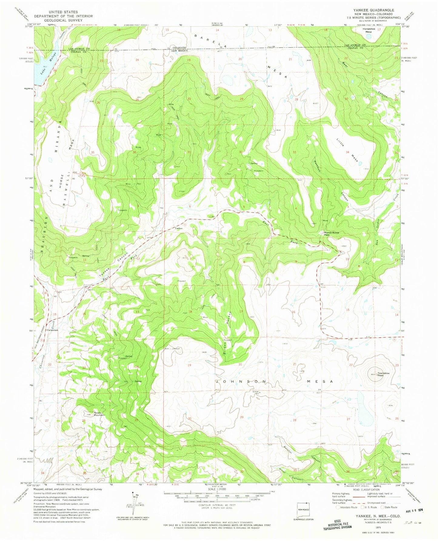
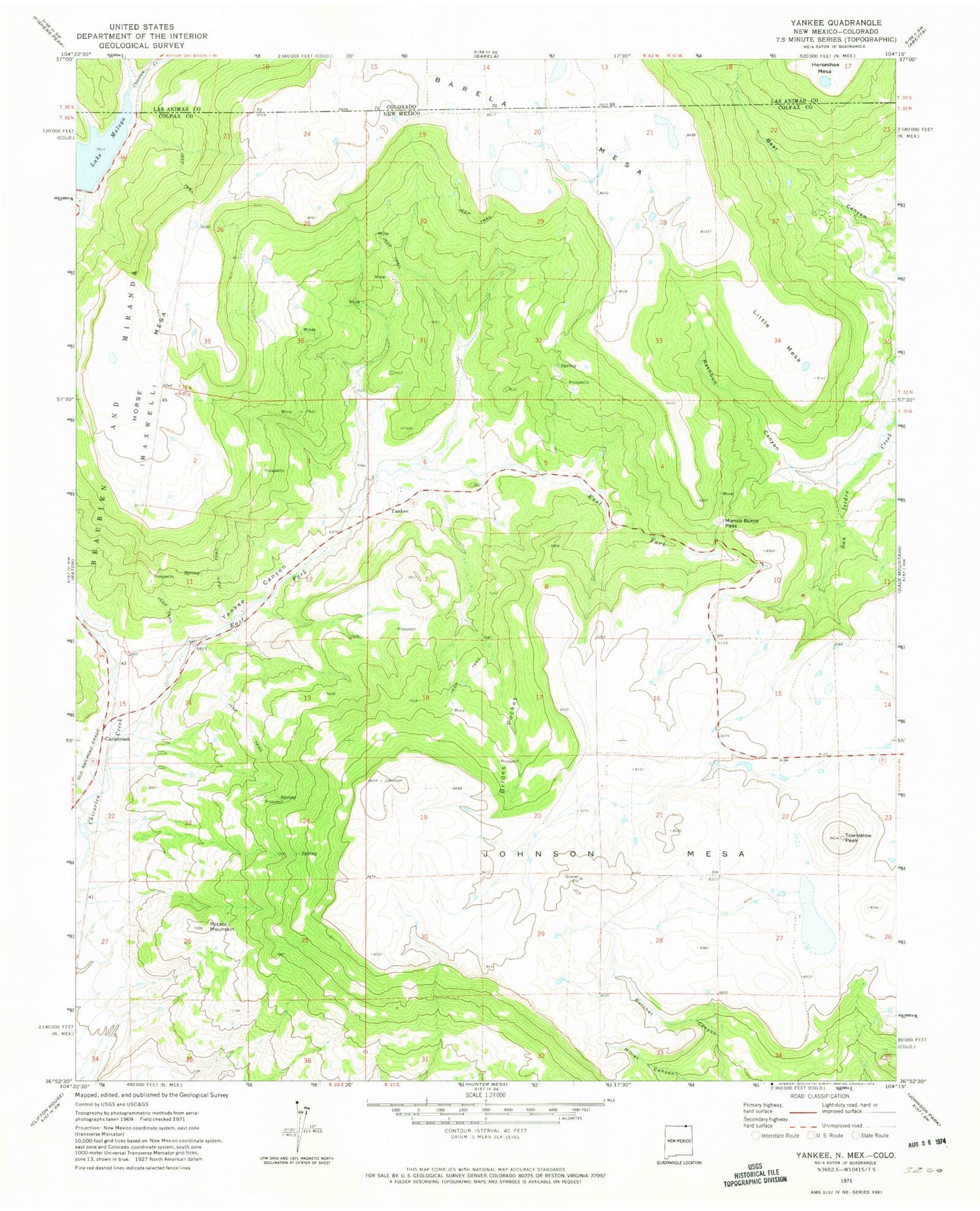
Historical USGS topographic quad map of Yankee in the states of New Mexico, Colorado. Map scale may vary for some years, but is generally around 1:24,000. Print size is approximately 24" x 27"
This quadrangle is in the following counties: Colfax, Las Animas.
The map contains contour lines, roads, rivers, towns, and lakes. Printed on high-quality waterproof paper with UV fade-resistant inks, and shipped rolled.
Contains the following named places: Barela Mesa, Block Coal Mine Number Two, Brides Pocket, Carisbrook, Carisbrook Post Office, Davis Mine, Denton, Denton Mine, East Fork Chicorica Creek, Evans, Franks Mine, Guerra, Hartzel Mine, Harvey-Genta Mine, Hobbs Mine, Horse Coal Mine, Horse Mesa, Horse Shoe Mesa, Johnson Mesa, Klantchnik Mine, Lake Maloya, Lake Maloya Dam, Little Mesa, Llewellyn Mine, M and M Mine, Manco Burro Pass, McClafferty Mine, Mendelsohn Mine, New Yankee Number 4 Claim, Newton Mine, Newton-Talbott Mine, Old Honeyfield Mine, Old Latimore Mine, Potato Mountain, Rathbun Canyon, Reynolds Mine, Schwachheim Creek, Scoop Prospect, Sperry Mine, Sugarite Canyon, Sugarite Mine, Sunset Coal Mine, Sunshine Mine, Tondrow Peak Mine, Towndrow, Towndrow Peak, Turner, Turner Mine, Turner Mine Number Two, Yankee, Yankee Canyon, Yankee Number Five Mine, Yankee Number Four Mine, Yankee Number One Mine, Yankee Number Three Mine, Yankee Number Two Mine, Yankee Post Office, Yankee-Reynolds Prospect