MyTopo
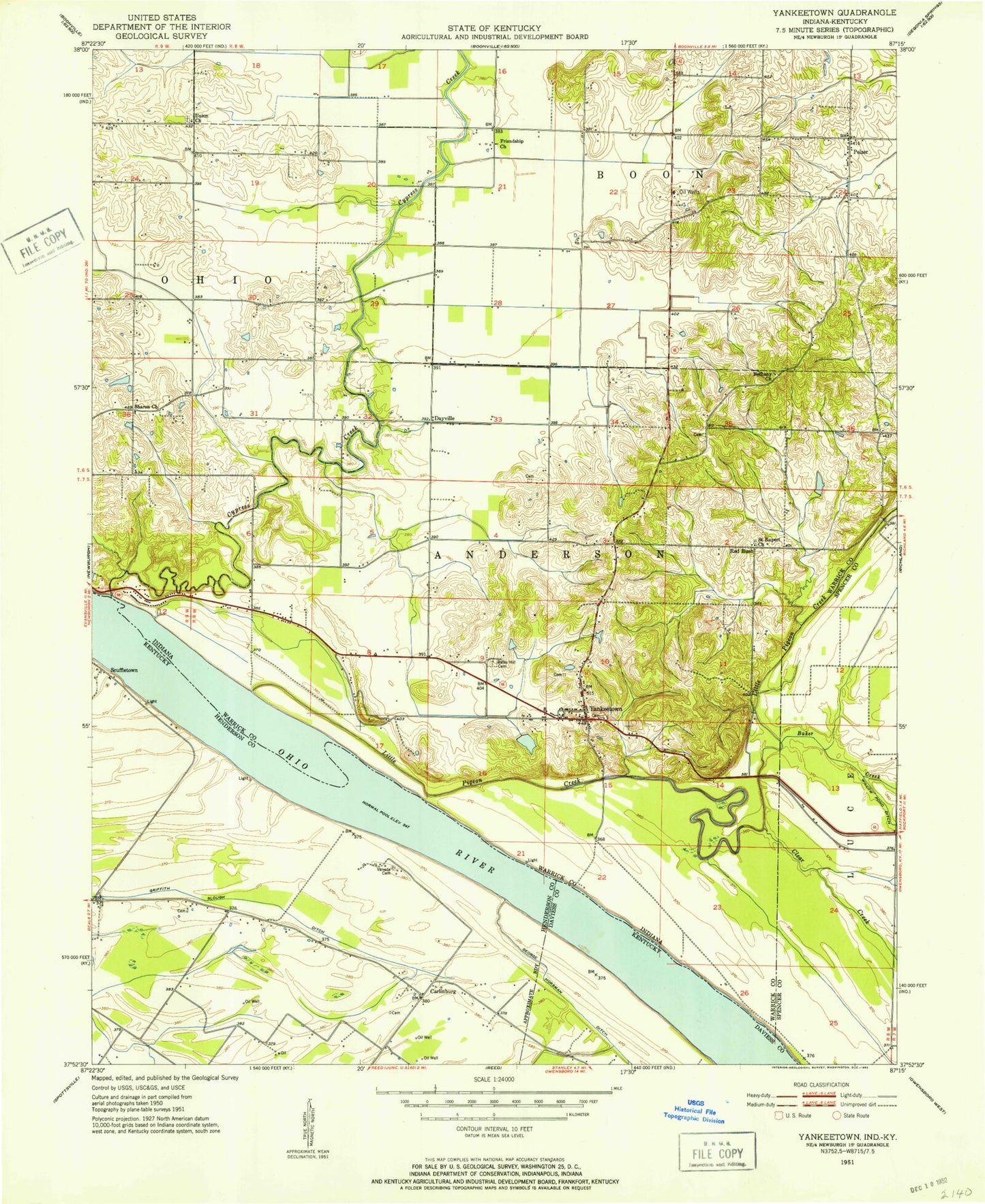
Classic USGS Yankeetown Indiana 7.5'x7.5' Topo Map
Couldn't load pickup availability
Historical USGS topographic quad map of Yankeetown in the states of Indiana, Kentucky. Map scale may vary for some years, but is generally around 1:24,000. Print size is approximately 24" x 27"
This quadrangle is in the following counties: Daviess, Henderson, Spencer, Warrick.
The map contains contour lines, roads, rivers, towns, and lakes. Printed on high-quality waterproof paper with UV fade-resistant inks, and shipped rolled.
Contains the following named places: Aluminum Company of America Fire Department and Emergency Medical Services, Baker Creek, Bates Hill Cemetery, Bethany Church, Bullock Cemetery, Carlinburg, Chase Lake, Clear Creek, Collins Lake, Cornell Airport, Cypress Creek, Dayville, Friendship Church, Griffith Slough Ditch, Horsman Ditch, Kaiser Ditch, Koehler Ditch, Laketown, McCool Ditch, Mitchem Ditch, Pelzer, Pleasant Chapel, Pyeattville, Red Bush, Robert Richard Drain, Rustic Hills, Saint Ruperts Church, Scuffletown, Sharon Church, Summer Pecka Ditch, Taylor Ditch, Township of Anderson, U S Dam Number Four, Union Church, Vanada, Vanada Cemetery, Vanada Landing, Yankeetown, Yankeetown Elementary School, Yankeetown Volunteer Fire Department, ZIP Code: 47630