MyTopo
Classic USGS Yantley Alabama 7.5'x7.5' Topo Map
Couldn't load pickup availability
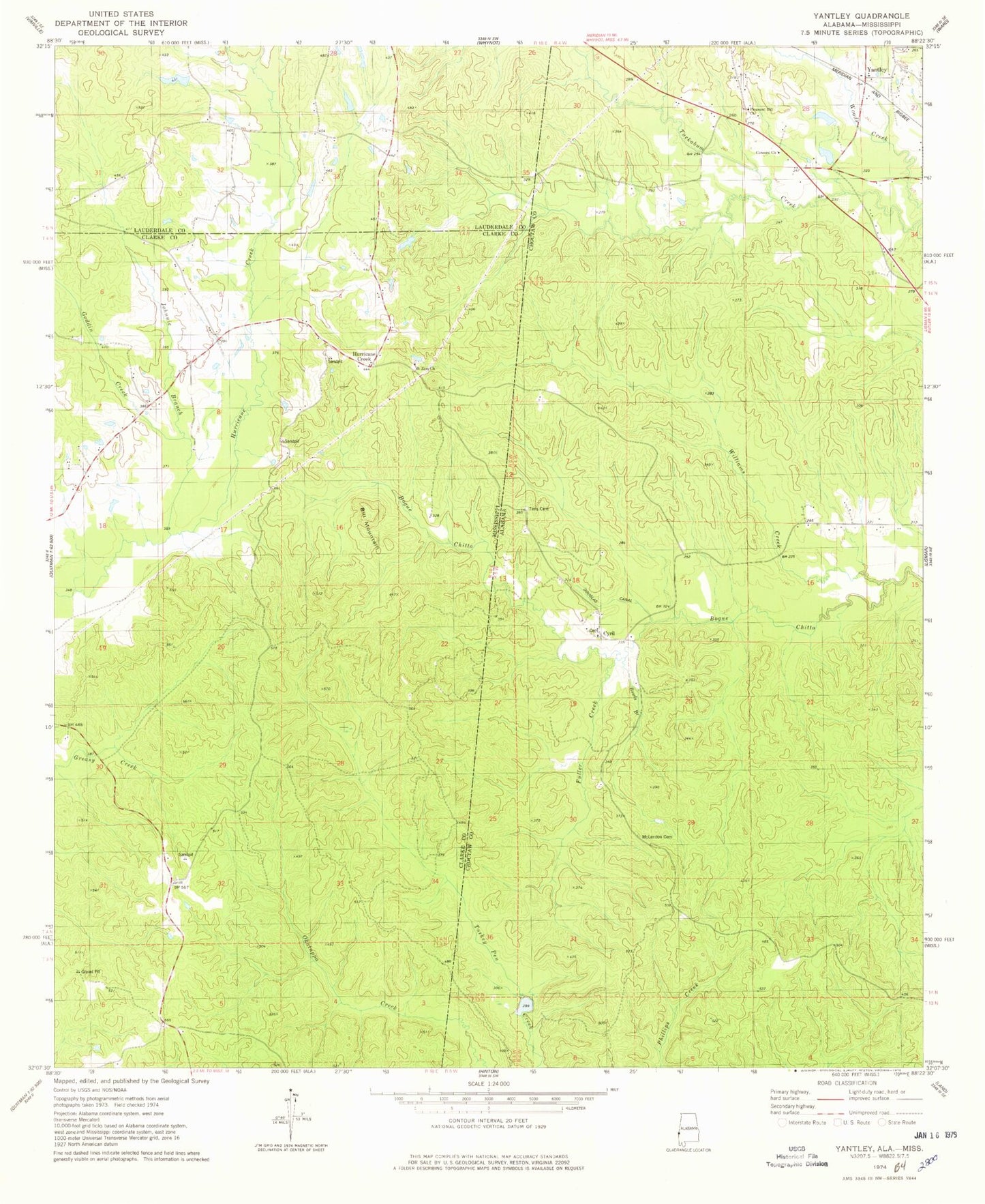
Historical USGS topographic quad map of Yantley in the states of Alabama, Mississippi. Map scale may vary for some years, but is generally around 1:24,000. Print size is approximately 24" x 27"
This quadrangle is in the following counties: Choctaw, Clarke, Lauderdale.
The map contains contour lines, roads, rivers, towns, and lakes. Printed on high-quality waterproof paper with UV fade-resistant inks, and shipped rolled.
Contains the following named places: Bethel United Methodist Church, Bill Mountain, Bowls Branch, Concord Baptist Church, Cyril, Davidson, Douglas Canal, Fuller Creek, Goddin Creek, Hog Wallow Ridge, Hurricane Creek, Johnnie Branch, McLendon Cemetery, Mount Zion Baptist Church, Mount Zion Cemetery, Mount Zion School, Page Branch, Pleasant Grove Church, Pleasant Hill Baptist Church, Reynolds School, Reynolds Store, Rock Gap, Tims Cemetery, Turkey Pen Ridge, Williams Creek, Yantley