MyTopo
Classic USGS Yanush Oklahoma 7.5'x7.5' Topo Map
Couldn't load pickup availability
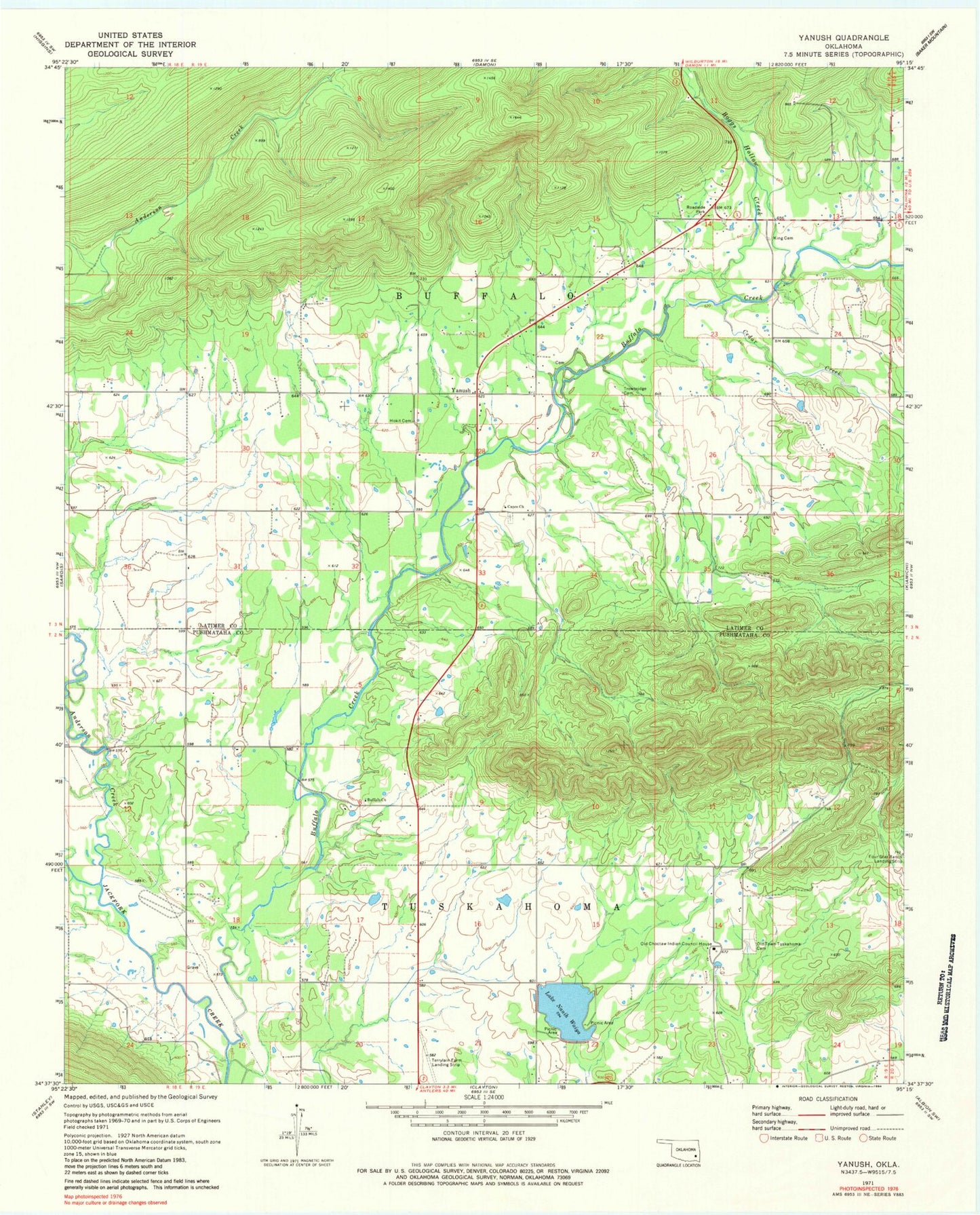
Historical USGS topographic quad map of Yanush in the state of Oklahoma. Map scale may vary for some years, but is generally around 1:24,000. Print size is approximately 24" x 27"
This quadrangle is in the following counties: Latimer, Pushmataha.
The map contains contour lines, roads, rivers, towns, and lakes. Printed on high-quality waterproof paper with UV fade-resistant inks, and shipped rolled.
Contains the following named places: Anderson Creek, Boggs Hollow Creek, Buffalo Church, Buffalo Creek, Cedar Creek, Clayton Lake, Clayton Lake Dam, Cupco Cemetery, Cupco Church, Hokit Cemetery, King Cemetery, Lake Nanih Waiya, Nanih Waiya Lake Dam, Oknoname 077008 Dam, Oknoname 077008 Reservoir, Oknoname 127005 Dam, Oknoname 127005 Reservoir, Old Choctaw Indian Council House, Township of Buffalo, Trowbridge Cemetery, Tuskahoma Census Designated Place, Tuskahoma Choctaw Veterans Cemetery, Yanush, ZIP Code: 74574