MyTopo
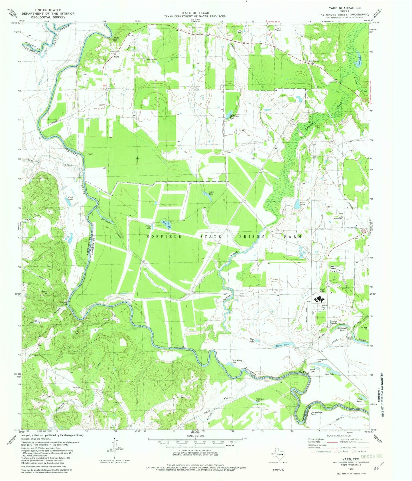
Classic USGS Yard Texas 7.5'x7.5' Topo Map
Couldn't load pickup availability
Historical USGS topographic quad map of Yard in the state of Texas. Map scale may vary for some years, but is generally around 1:24,000. Print size is approximately 24" x 27"
This quadrangle is in the following counties: Anderson, Freestone.
The map contains contour lines, roads, rivers, towns, and lakes. Printed on high-quality waterproof paper with UV fade-resistant inks, and shipped rolled.
Contains the following named places: Allen Lake, Alligator Slough, Bear Lake, Beaver Creek, Blue Lake, Brush Lake, Campbell Lake, Catfish Creek, Cold Springs Branch, Cook Lake, Edwards Cemetery, Edwards Creek, Flag Lake, Goose Pond, Greens Bluff, Indian Creek, Jackson Cemetery, Johnnycake Lake, McFarlen Lake, Mossy Lake, Mount Olive Church, New Hope Church, Patterson Lake, Peters Lake, Prairie Lake, Rocky Branch, Sand Lake, Spring Creek, Tehuacana Creek, Texas Department of Criminal Justice H H Coffield Unit, Texas Department of Criminal Justice Mark W Michael Unit, Trinity Chapel School, Tyler Ferry Lake, Tyus Cemetery, W J E Airport, Weed Lake, Yard, Yard School, ZIP Code: 75861