
MyTopo
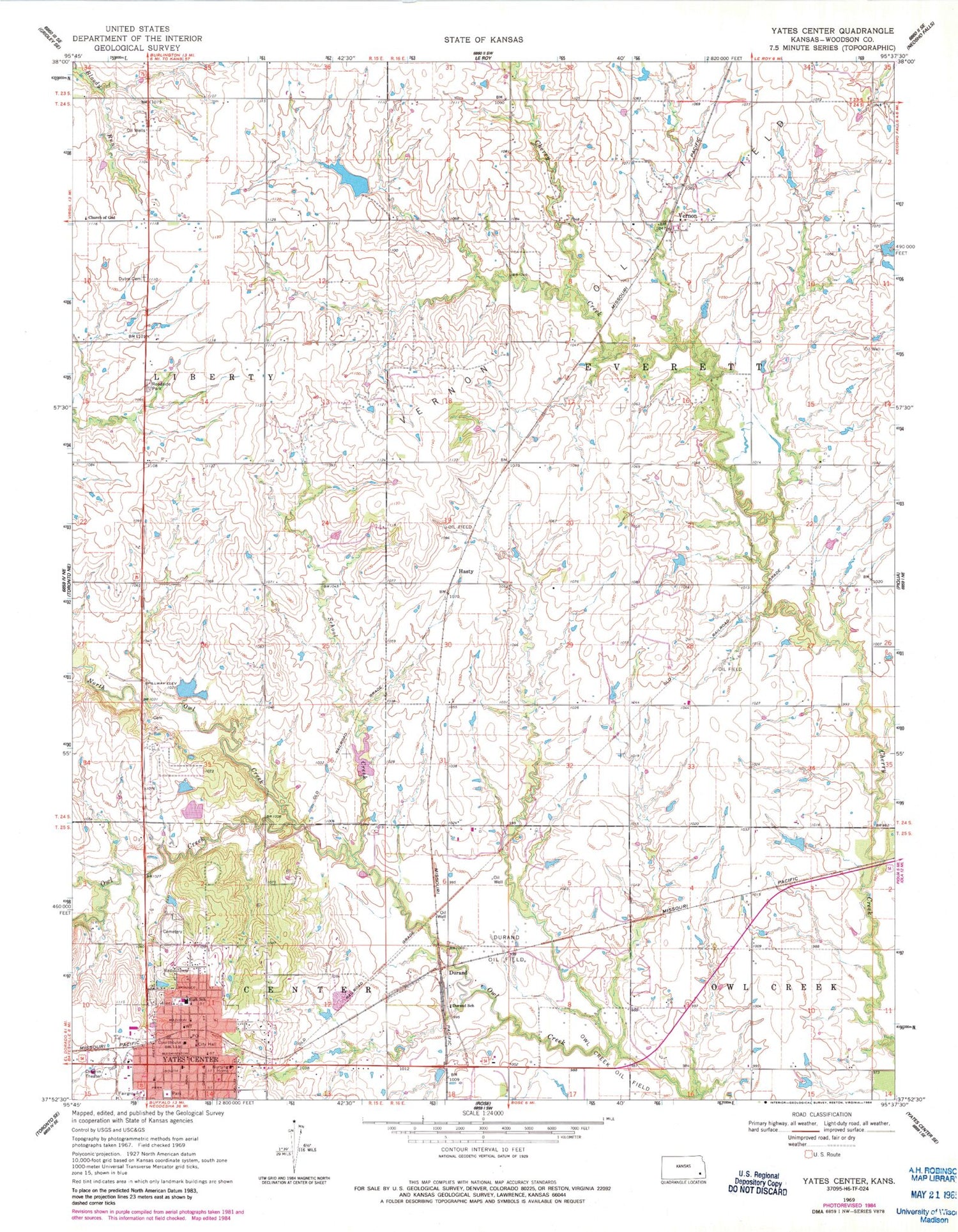
Classic USGS Yates Center Kansas 7.5'x7.5' Topo Map
Couldn't load pickup availability
Historical USGS topographic quad map of Yates Center in the state of Kansas. Map scale may vary for some years, but is generally around 1:24,000. Print size is approximately 24" x 27"
This quadrangle is in the following counties: Woodson.
The map contains contour lines, roads, rivers, towns, and lakes. Printed on high-quality waterproof paper with UV fade-resistant inks, and shipped rolled.
Contains the following named places: Calvary Episcopal Church, Church of God, Clear Springs School, Coloma, Defiance School, Durand, Durand Oil Field, Durand School, Dutro School, First Baptist Church, First Christian Church, Hasty, Liberty Dutro Cemetery, Lomando, Mount Pisgah School, New York Valley Church of God, North Maple School, North Owl Creek, Owl Creek Oil Field, Pleasant View School, Possum Trot School, Saint Joseph Catholic Church, School Creek, Southeast Kansas Multi - County Health Department Woodson County, Township of Everett, Township of Liberty, Vernon, Woodson County, Woodson County Ambulance Service, Woodson County Co - Operative Association Grain Elevator Number 1, Woodson County Courthouse, Woodson County Fairgrounds, Woodson County Historical Museum, Woodson County Jail, Woodson County Rural Fire Department, Woodson County Sheriff's Office, Yates Center, Yates Center City Hall, Yates Center Elevator Grain Elevator Number 1, Yates Center High School, Yates Center Police Department, Yates Center Post Office, Yates Center Presbyterian Church, Yates Center Public Library, Yates Center Senior Center, Yates Center United Methodist Church, Yates Center Volunteer Fire Department


