
MyTopo
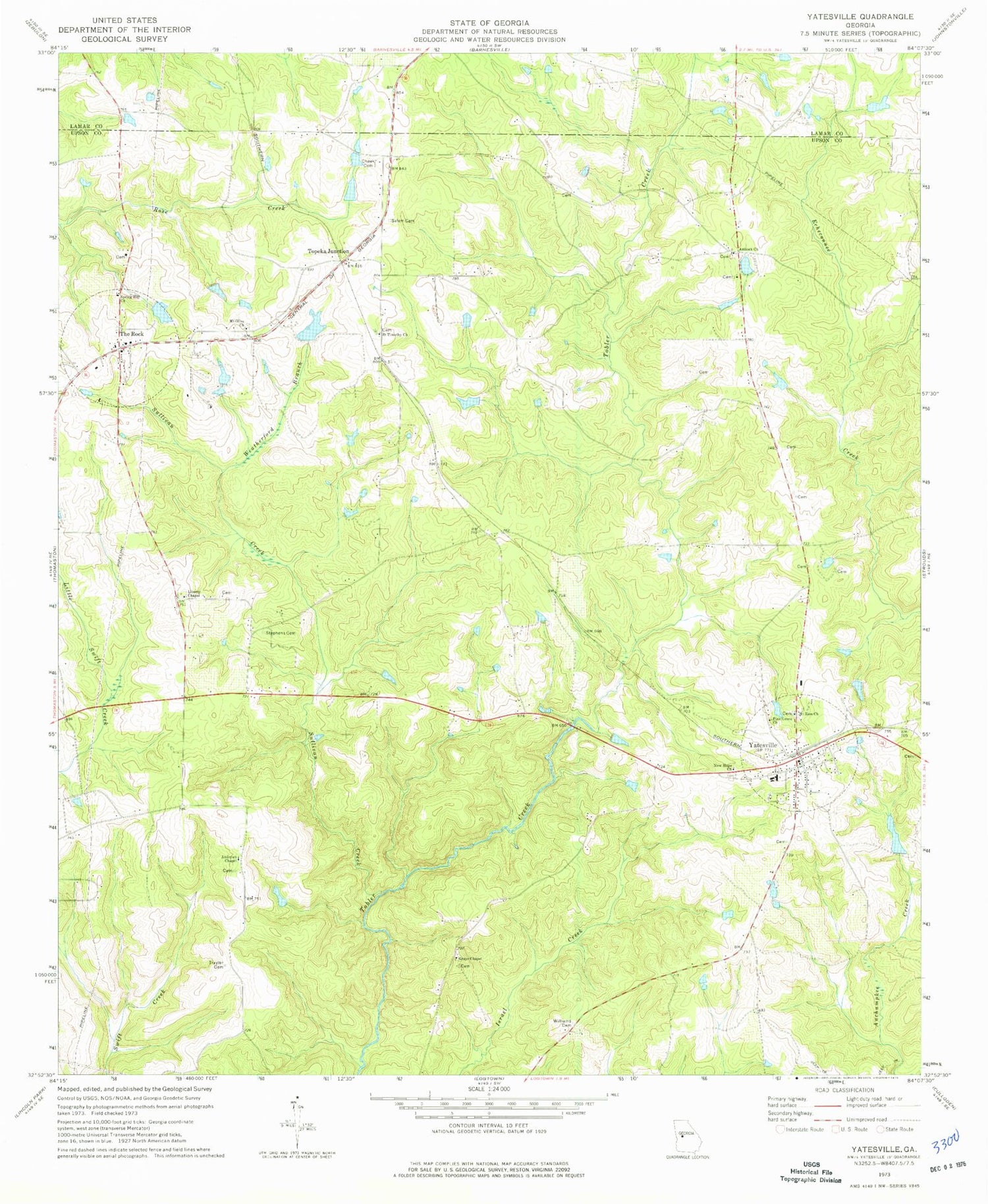
Classic USGS Yatesville Georgia 7.5'x7.5' Topo Map
Couldn't load pickup availability
Historical USGS topographic quad map of Yatesville in the state of Georgia. Typical map scale is 1:24,000, but may vary for certain years, if available. Print size: 24" x 27"
This quadrangle is in the following counties: Lamar, Upson.
The map contains contour lines, roads, rivers, towns, and lakes. Printed on high-quality waterproof paper with UV fade-resistant inks, and shipped rolled.
Contains the following named places: Andrews Chapel, Cheek Cemetery, Grays Chapel Cemetery, Liberty Chapel, Mount Olive Church, Mount Zion Church, New Hope Church, Pine Grove Church, Saint Timothy Church, Salem Cemetery, Spring Hill Church, Stephens Cemetery, Sullivan Creek, Trayler Cemetery, Weatherford Branch, Williams Cemetery, Yatesville, Topeka Junction, The Rock, Grays Chapel, Grays School (historical), Liberty School (historical), Union Hill School (historical), White Dam, White Lake, Turner Dam, Turner Lake, McGehee Lake Dam, McGehee Lake, Nash Dam, Nash Lake, Haygood Dam, Haygood Lake, Middlebrooks (historical), Andrews Chapel Cemetery, Antioch Cemetery, Bethlehem Temple, New Hope Church Cemetery, Rest Haven, The Rock United Methodist Church, Upson Camp Ground (historical), Yatesville Church Cemetery, Yatesville Methodist Church, Thistle Field (historical), Antioch Church, The Rock-Yatesville Division, Town of Yatesville, The Rock Cemetery, The Rock Census Designated Place, Yatesville Fire Department, The Rock Post Office, Yatesville Post Office, Mount Zion Baptist Cemetery


