MyTopo
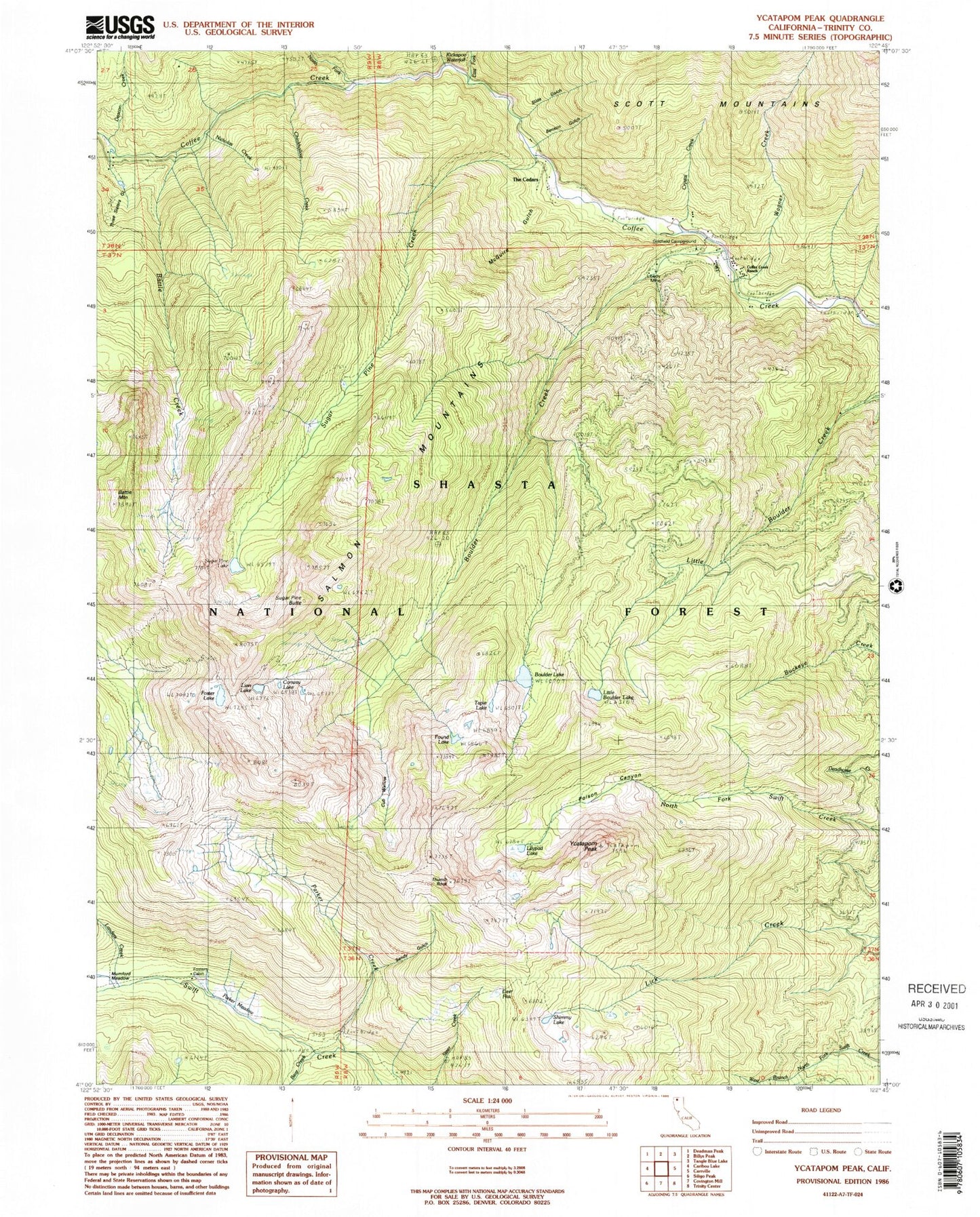
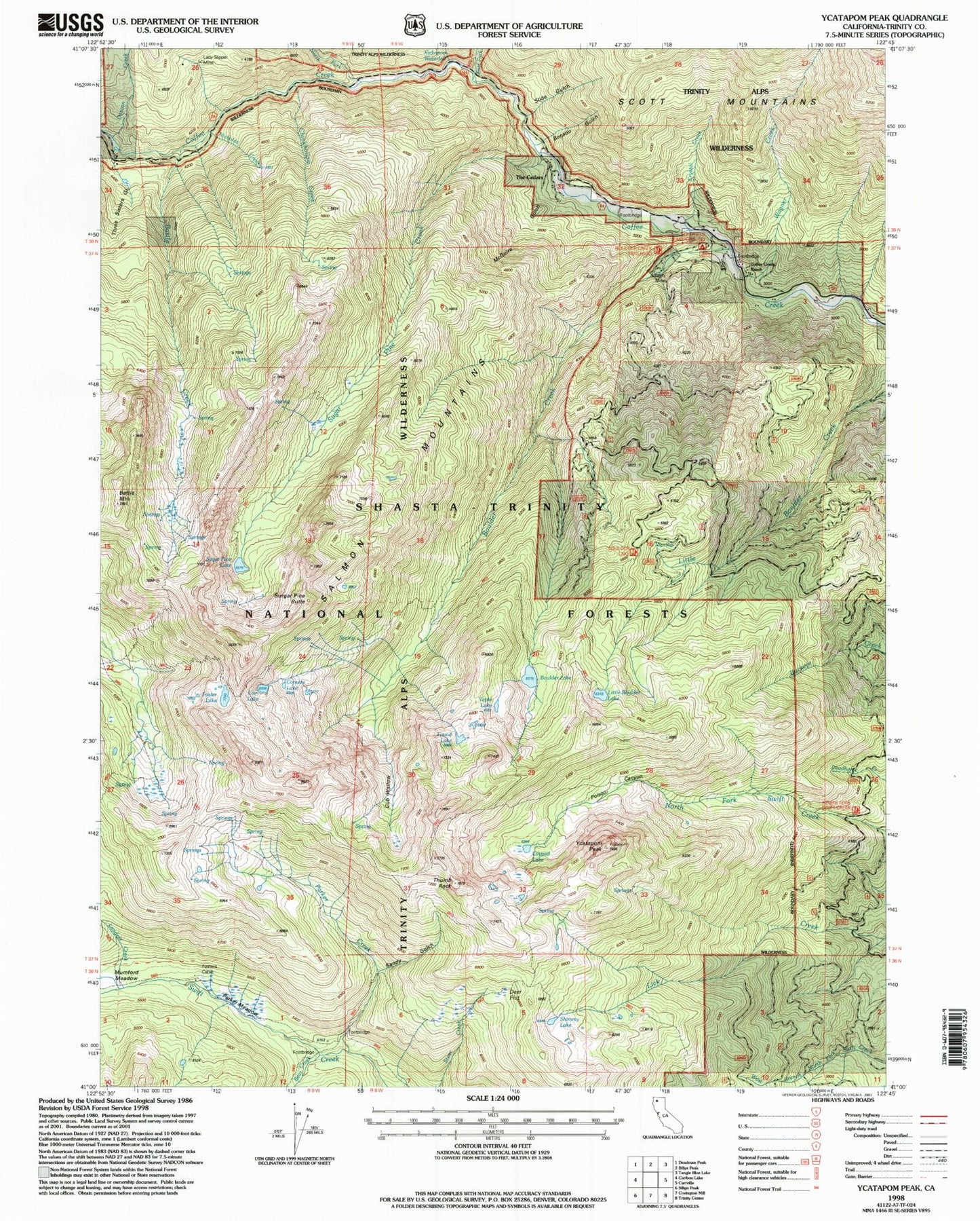
USGS Classic Ycatapom Peak California 7.5'x7.5' Topo Map
Couldn't load pickup availability
Historical USGS topographic quad map of Ycatapom Peak in the state of California. Scale: 1:24000. Print size: 24" x 27"
This quadrangle is in the following counties: Trinity.
The map contains contour lines, roads, rivers, towns, lakes, and grids including latitude / longitude and UTM / MGRS. Printed on high-quality waterproof paper with UV fade-resistant inks.
Contains the following named places: Battle Creek, Battle Mountain, Bear Creek, Benson Gulch, Boulder Creek, Chinkhollow Creek, Coffee Creek Guard Station, Coffee Creek Ranch, Crystal Creek, Cub Wallow, Deacon Creek, Deer Flat, East Fork Coffee Creek, Foster Lake, Fosters Cabin, Found Lake, Goldfish Campground, Lady Slipper Mine, Liberty Mine, Lilypad Lake, Lion Lake, Little Boulder Lake, McGuire Gulch, Mumford Meadow, Nicholas Creek, North Fork Coffee Creek, Parker Creek, Parker Meadow, Poison Canyon, Shimmy Lake, Slide Gulch, Landers Creek, Sugar Pine Butte, Sugar Pine Creek, Sugar Pine Lake, The Cedars, Three Sisters Gulch, Wagner Creek, Ycatapom Peak, Tapie Lake, Boulder Lake, Conway Lake, Goldfield Campground, Lady Slipper Mine, Fosters Cabin, Sandy Gulch, Union Lakes, Coffee, Goldfield Ranger Station (historical), Kickapoo Waterfall