MyTopo
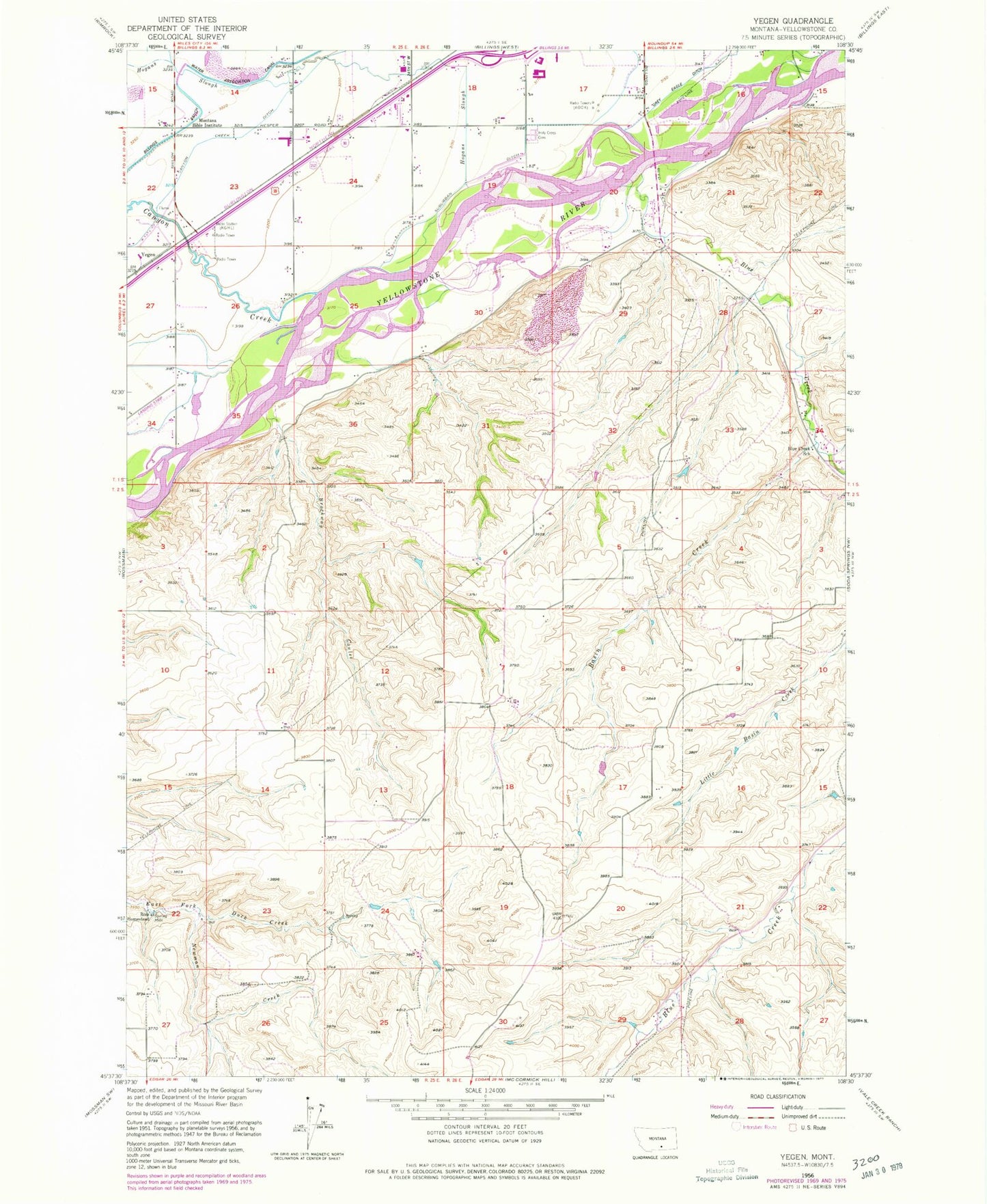
Classic USGS Yegen Montana 7.5'x7.5' Topo Map
Couldn't load pickup availability
Historical USGS topographic quad map of Yegen in the state of Montana. Typical map scale is 1:24,000, but may vary for certain years, if available. Print size: 24" x 27"
This quadrangle is in the following counties: Yellowstone.
The map contains contour lines, roads, rivers, towns, and lakes. Printed on high-quality waterproof paper with UV fade-resistant inks, and shipped rolled.
Contains the following named places: Basin Creek, Blue Creek, Blue Creek School, Brockway Coulee, Canyon Creek, Hogans Slough, Holy Cross Cemetery, Yellowstone Baptist College, Newman Creek, Ross Homestead, Suburban Ditch, Yegen, Airpark Oscars (historical), KGHL-AM (Billings), KCTR-AM (Billings), KEMC-FM (Billings), 02S26E10BDCA01 Well, 01S25E35BBBC01 Well, 01S25E26ADDB01 Well, 01S26E28ACAC01 Well, 01S26E28BACD01 Well, 01S25E26BBAA01 Well, 01S26E20DDDA01 Well, 01S26E19ADAB01 Well, 01S26E19BCBB01 Well, 01S25E23AAAC01 Well, 01S25E22AAAA01 Well, 01S26E17DCAB01 Well, 01S25E13DACC01 Well, 01S26E18ACCD01 Well, 01S26E16ADDA01 Well, South Hills Fishing Access Site, Blue Creek Volunteer Fire Department, Advanced Care Hospital of Montana, Billings Flying Service, Ostlunds Airport